TopoQuest Logo
Do you find TopoQuest useful?
Help keep TopoQuest running and adding new maps/features by donating!
Bitcoin:  19c7KJd3qBynnjoSw5npx9KScwjBe4ifkT
Litecoin:  LXs6TkuXGGXo1vDsWCkWVdjQX94eUKd6ui
Home View Maps Find Maps Find Places Resources & Links


Kiamichi, Oklahoma Topographic Map

USGS Map Title: Kiamichi, OK
USGS Map MRC: 34095F2
DRG (GeoTIFF) Download: o34095f2.tif


Neighboring USGS Topographic Map Quads:


  Damon, OK  
34095G3
 

  Baker Mountain, OK  
34095G2
 

  Talihina, OK  
34095G1
 

  Yanush, OK  
34095F3
 

  Kiamichi, OK  
34095F2
 

  Albion, OK  
34095F1
 

  Clayton, OK  
34095E3
 

  Albion SW, OK  
34095E2
 

  Albion SE, OK  
34095E1


Map MRC Location:

N35°
W96°
N35°
W95°
H8 H7 H6 H5 H4 H3 H2 H1
G8 G7 G6 G5 G4 G3 G2 G1
F8 F7 F6 F5 F4 F3 F2 F1
E8 E7 E6 E5 E4 E3 E2 E1
D8 D7 D6 D5 D4 D3 D2 D1
C8 C7 C6 C5 C4 C3 C2 C1
B8 B7 B6 B5 B4 B3 B2 B1
A8 A7 A6 A5 A4 A3 A2 A1
N34°
W96°
N34°
W95°

Kiamichi, OK USGS 1:24K Topographic Map Preview:
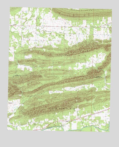
Kiamichi, OK USGS Topographic Map
Click on map above to begin viewing in our Map Viewer.

This topographic map contains these locations and features:
Feature Name Type Latitude Longitude GNIS ID View Map
Bryant BranchStreamN34.6293°W95.1566°1090593View Map
Buffalo Valley Elementary SchoolSchoolN34.7325°W95.2455°1090656View Map
Buffalo Valley High SchoolSchoolN34.7325°W95.2455°2712988View Map
Cole Spur CemeteryCemeteryN34.6316°W95.2178°1091571View Map
Falfa ChurchChurchN34.7345°W95.1308°1092750View Map
Friendship ChurchChurchN34.6329°W95.2216°1093057View Map
Hatton Ranch Airport (historical)AirportN34.7168°W95.1752°1102688View Map
KiamichiPopulated PlaceN34.6354°W95.1789°1100554View Map
Kiamichi Pioneer CemeteryCemeteryN34.6298°W95.1810°2708540View Map
Laura CemeteryCemeteryN34.7390°W95.2136°1094527View Map
Little Buffalo CreekStreamN34.7259°W95.2494°1094718View Map
North Fork Walnut CreekStreamN34.6690°W95.1294°1095960View Map
Oknoname 077007 DamDamN34.7451°W95.2302°1755583View Map
Oknoname 077007 ReservoirReservoirN34.7451°W95.2302°1755584View Map
Potato HillsRangeN34.7087°W95.1530°1096871View Map
Potts CemeteryCemeteryN34.7162°W95.2101°1096877View Map
South Fork Walnut CreekStreamN34.6693°W95.1294°1098246View Map

Note: Coordinates in the location and feature list above are referenced to NAD83 datum.


Copyright (C) 2008-2025 Ryan Niemi / Sunset Dynamics ... All Rights Reserved