TopoQuest Logo
Do you find TopoQuest useful?
Help keep TopoQuest running and adding new maps/features by donating!
Bitcoin:  19c7KJd3qBynnjoSw5npx9KScwjBe4ifkT
Litecoin:  LXs6TkuXGGXo1vDsWCkWVdjQX94eUKd6ui
Home View Maps Find Maps Find Places Resources & Links


Kiawah Island, South Carolina Topographic Map

USGS Map Title: Kiawah Island, SC
USGS Map MRC: 32080E1
DRG (GeoTIFF) Download: o32080e1.tif


Neighboring USGS Topographic Map Quads:


  Wadmalaw Island, SC  
32080F2
 

  Legareville, SC  
32080F1
 

  James Island, SC  
32079F8
 

  Rockville, SC  
32080E2
 

  Kiawah Island, SC  
32080E1


Map MRC Location:

N33°
W81°
N33°
W80°
H8 H7 H6 H5 H4 H3 H2 H1
G8 G7 G6 G5 G4 G3 G2 G1
F8 F7 F6 F5 F4 F3 F2 F1
E8 E7 E6 E5 E4 E3 E2 E1
D8 D7 D6 D5 D4 D3 D2 D1
C8 C7 C6 C5 C4 C3 C2 C1
B8 B7 B6 B5 B4 B3 B2 B1
A8 A7 A6 A5 A4 A3 A2 A1
N32°
W81°
N32°
W80°

Kiawah Island, SC USGS 1:24K Topographic Map Preview:
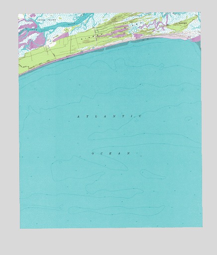
Kiawah Island, SC USGS Topographic Map
Click on map above to begin viewing in our Map Viewer.

This topographic map contains these locations and features:
Feature Name Type Latitude Longitude GNIS ID View Map
Bryans CreekStreamN32.6238°W80.0801°1221052View Map
Cinder PointCapeN32.6246°W80.0523°1221599View Map
Eagle PointCapeN32.6196°W80.0495°1222175View Map
Haulover CreekStreamN32.6160°W80.1179°1223084View Map
Kiawah IslandIslandN32.6085°W80.0818°1223726View Map
Kiawah IslandPopulated PlaceN32.6082°W80.0848°1253569View Map
Kiawah Island Bass Pond D-3047 DamDamN32.6118°W80.0982°1239694View Map
Kiawah Island-Seabrook Island DivisionCensusN32.5724°W80.0889°2584538View Map
Ocean Course Golf CourseLocaleN32.6119°W80.0218°2490033View Map
Saint Johns Fire Department Station 4BuildingN32.6020°W80.1054°2368135View Map
Saint Johns Fire Department Station 6BuildingN32.6120°W80.0497°2368476View Map
Sandy PointCapeN32.6188°W80.0068°1226373View Map
Shullbred PointCapeN32.6135°W80.0948°1226603View Map
Town of Kiawah IslandCivilN32.6160°W80.0604°2405943View Map

Note: Coordinates in the location and feature list above are referenced to NAD83 datum.


Copyright (C) 2008-2025 Ryan Niemi / Sunset Dynamics ... All Rights Reserved