TopoQuest Logo
Do you find TopoQuest useful?
Help keep TopoQuest running and adding new maps/features by donating!
Bitcoin:  19c7KJd3qBynnjoSw5npx9KScwjBe4ifkT
Litecoin:  LXs6TkuXGGXo1vDsWCkWVdjQX94eUKd6ui
Home View Maps Find Maps Find Places Resources & Links


Killduff, Iowa Topographic Map

USGS Map Title: Killduff, IA
USGS Map MRC: 41092E8
DRG (GeoTIFF) Download: o41092e8.tif


Neighboring USGS Topographic Map Quads:


  Newton, IA  
41093F1
 

  Kellogg, IA  
41092F8
 

  Oakland Acres, IA  
41092F7
 

  Monroe, IA  
41093E1
 

  Killduff, IA  
41092E8
 

  Sully, IA  
41092E7
 

  Otley, IA  
41093D1
 

  Pella, IA  
41092D8
 

  Peoria, IA  
41092D7


Map MRC Location:

N42°
W93°
N42°
W92°
H8 H7 H6 H5 H4 H3 H2 H1
G8 G7 G6 G5 G4 G3 G2 G1
F8 F7 F6 F5 F4 F3 F2 F1
E8 E7 E6 E5 E4 E3 E2 E1
D8 D7 D6 D5 D4 D3 D2 D1
C8 C7 C6 C5 C4 C3 C2 C1
B8 B7 B6 B5 B4 B3 B2 B1
A8 A7 A6 A5 A4 A3 A2 A1
N41°
W93°
N41°
W92°

Killduff, IA USGS 1:24K Topographic Map Preview:
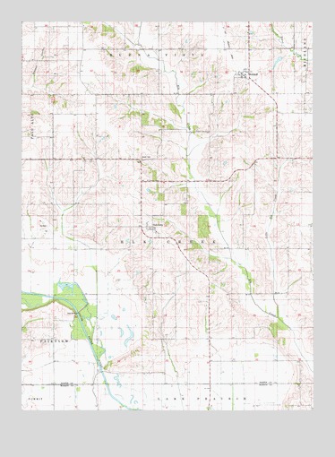
Killduff, IA USGS Topographic Map
Click on map above to begin viewing in our Map Viewer.

This topographic map contains these locations and features:
Feature Name Type Latitude Longitude GNIS ID View Map
Dairy Grove Post Office (historical)Post OfficeN41.5422°W92.8758°1999693View Map
Dearinger CemeteryCemeteryN41.5334°W92.9184°1999704View Map
Elk Creek Post Office (historical)Post OfficeN41.5917°W92.9480°1999565View Map
GalesburgPopulated PlaceN41.5589°W92.9463°456811View Map
Galesburg Post Office (historical)Post OfficeN41.5589°W92.9463°1999566View Map
Hewitt CemeteryCemeteryN41.5809°W92.9490°457412View Map
KillduffPopulated PlaceN41.6080°W92.9046°458072View Map
Killduff (historical)LocaleN41.6083°W92.9049°1999655View Map
Killduff Fire DepartmentBuildingN41.6080°W92.9046°1999658View Map
Killduff Post OfficePost OfficeN41.6080°W92.9046°1999656View Map
Killduff United Methodist ChurchChurchN41.6080°W92.9046°1999657View Map
Kleins CemeteryCemeteryN41.5028°W92.9974°1975942View Map
Little Elk CreekStreamN41.5300°W92.8899°458463View Map
Saint Andrews CemeteryCemeteryN41.5732°W92.9420°1999708View Map
Saint Andrews ChurchChurchN41.5739°W92.9419°460926View Map
South Skunk River Wildlife AreaParkN41.5333°W92.9808°1999528View Map
Township of Elk CreekCivilN41.5568°W92.9366°467778View Map
Van Zante CreekStreamN41.5008°W92.9563°462539View Map

Note: Coordinates in the location and feature list above are referenced to NAD83 datum.


Copyright (C) 2008-2024 Ryan Niemi / Sunset Dynamics ... All Rights Reserved