TopoQuest Logo
Do you find TopoQuest useful?
Help keep TopoQuest running and adding new maps/features by donating!
Bitcoin:  19c7KJd3qBynnjoSw5npx9KScwjBe4ifkT
Litecoin:  LXs6TkuXGGXo1vDsWCkWVdjQX94eUKd6ui
Home View Maps Find Maps Find Places Resources & Links


Monroe, Iowa Topographic Map

USGS Map Title: Monroe, IA
USGS Map MRC: 41093E1
DRG (GeoTIFF) Download: o41093e1.tif


Neighboring USGS Topographic Map Quads:


  Colfax, IA  
41093F2
 

  Newton, IA  
41093F1
 

  Kellogg, IA  
41092F8
 

  Prairie City, IA  
41093E2
 

  Monroe, IA  
41093E1
 

  Killduff, IA  
41092E8
 

  Knoxville NW, IA  
41093D2
 

  Otley, IA  
41093D1
 

  Pella, IA  
41092D8


Map MRC Location:

N42°
W94°
N42°
W93°
H8 H7 H6 H5 H4 H3 H2 H1
G8 G7 G6 G5 G4 G3 G2 G1
F8 F7 F6 F5 F4 F3 F2 F1
E8 E7 E6 E5 E4 E3 E2 E1
D8 D7 D6 D5 D4 D3 D2 D1
C8 C7 C6 C5 C4 C3 C2 C1
B8 B7 B6 B5 B4 B3 B2 B1
A8 A7 A6 A5 A4 A3 A2 A1
N41°
W94°
N41°
W93°

Monroe, IA USGS 1:24K Topographic Map Preview:
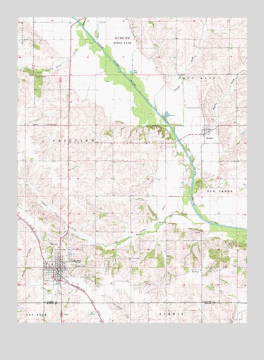
Monroe, IA USGS Topographic Map
Click on map above to begin viewing in our Map Viewer.

This topographic map contains these locations and features:
Feature Name Type Latitude Longitude GNIS ID View Map
Buck CreekStreamN41.5442°W93.0271°454926View Map
Cardinal CreekStreamN41.6147°W93.0819°461515View Map
Carson CreekStreamN41.5872°W93.0496°455188View Map
Cherry CreekStreamN41.6208°W93.0894°455373View Map
City of MonroeCivilN41.5189°W93.1037°2395375View Map
City of ReasnorCivilN41.5789°W93.0229°2396333View Map
Draper Post Office (historical)Post OfficeN41.5194°W93.0391°1999546View Map
Fairview CemeteryCemeteryN41.5231°W93.0059°456483View Map
Fairview Wildlife AreaParkN41.5833°W93.0808°1999536View Map
First Baptist ChurchChurchN41.5153°W93.1030°1999628View Map
FranklinLocaleN41.5425°W93.0455°466107View Map
Gateway Recreation Golf CourseLocaleN41.5208°W93.1127°1999621View Map
Gifford CemeteryCemeteryN41.5189°W93.0883°456898View Map
Kish-Ke-Kosh Prairie State PreserveParkN41.5694°W93.0196°1999535View Map
MonroePopulated PlaceN41.5222°W93.1019°459177View Map
MonroeLocaleN41.5208°W93.1038°1999622View Map
Monroe CemeteryCemeteryN41.5128°W93.1083°459179View Map
Monroe City HallBuildingN41.5167°W93.1038°1999618View Map
Monroe Elementary SchoolSchoolN41.5240°W93.1061°1999625View Map
Monroe Family Health CenterHospitalN41.5169°W93.1008°1999623View Map
Monroe Fire DepartmentBuildingN41.5221°W93.1015°2577365View Map
Monroe Library and Community BuildingBuildingN41.5228°W93.1027°1999619View Map
Monroe Post OfficePost OfficeN41.5214°W93.1027°1999620View Map
Monroe Presbyterian ChurchChurchN41.5208°W93.1008°1999627View Map
PCM High SchoolSchoolN41.5151°W93.0985°1999624View Map
ReasnorPopulated PlaceN41.5783°W93.0233°460545View Map
Reasnor (historical)LocaleN41.5769°W93.0238°1999617View Map
Reasnor City HallBuildingN41.5783°W93.0233°1999616View Map
Reasnor CreekStreamN41.5778°W93.0394°460546View Map
Reasnor Fire and Ambulance ServiceBuildingN41.5793°W93.0230°2577399View Map
Reasnor Post OfficePost OfficeN41.5783°W93.0233°1999615View Map
Red BridgeBridgeN41.5414°W93.0210°1999717View Map
Riverview Honor FarmLocaleN41.6205°W93.0635°465892View Map
Seay CemeteryCemeteryN41.5321°W93.1071°461497View Map
Tools ChapelChurchN41.5217°W93.0299°462279View Map
Township of FairviewCivilN41.5531°W93.0951°467816View Map
United Methodist ChurchChurchN41.5247°W93.1016°1999626View Map
Warren Grove CreekStreamN41.6155°W93.0838°462681View Map
Warren Grove Post Office (historical)Post OfficeN41.5805°W93.1002°1999558View Map
Warren Grove SchoolSchoolN41.6008°W93.1158°462682View Map
Wire LakeLakeN41.6025°W93.0631°463142View Map

Note: Coordinates in the location and feature list above are referenced to NAD83 datum.


Copyright (C) 2008-2025 Ryan Niemi / Sunset Dynamics ... All Rights Reserved