TopoQuest Logo
Do you find TopoQuest useful?
Help keep TopoQuest running and adding new maps/features by donating!
Bitcoin:  19c7KJd3qBynnjoSw5npx9KScwjBe4ifkT
Litecoin:  LXs6TkuXGGXo1vDsWCkWVdjQX94eUKd6ui
Home View Maps Find Maps Find Places Resources & Links


King Arthur Castle, Arizona Topographic Map

USGS Map Title: King Arthur Castle, AZ
USGS Map MRC: 36112C3
DRG (GeoTIFF) Download: o36112c3.tif


Neighboring USGS Topographic Map Quads:


  Tapeats Amphitheater, AZ  
36112D4
 

  Timp Point, AZ  
36112D3
 

  De Motte Park, AZ  
36112D2
 

  Powell Plateau, AZ  
36112C4
 

  King Arthur Castle, AZ  
36112C3
 

  Kanabownits Spring, AZ  
36112C2
 

  Explorers Monument, AZ  
36112B4
 

  Havasupai Point, AZ  
36112B3
 

  Shiva Temple, AZ  
36112B2


Map MRC Location:

N37°
W113°
N37°
W112°
H8 H7 H6 H5 H4 H3 H2 H1
G8 G7 G6 G5 G4 G3 G2 G1
F8 F7 F6 F5 F4 F3 F2 F1
E8 E7 E6 E5 E4 E3 E2 E1
D8 D7 D6 D5 D4 D3 D2 D1
C8 C7 C6 C5 C4 C3 C2 C1
B8 B7 B6 B5 B4 B3 B2 B1
A8 A7 A6 A5 A4 A3 A2 A1
N36°
W113°
N36°
W112°

King Arthur Castle, AZ USGS 1:24K Topographic Map Preview:
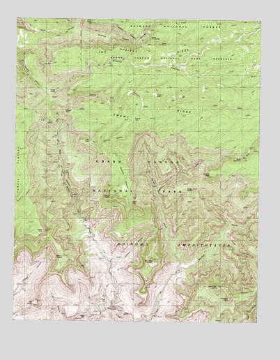
King Arthur Castle, AZ USGS Topographic Map
Click on map above to begin viewing in our Map Viewer.

This topographic map contains these locations and features:
Feature Name Type Latitude Longitude GNIS ID View Map
Bass TrailTrailN36.2805°W112.3318°1059View Map
Beaman PointCapeN36.3256°W112.3010°2558100View Map
Big Spring CanyonValleyN36.3180°W112.2606°1376View Map
Castle CanyonValleyN36.3416°W112.3575°2523View Map
Castle LakeLakeN36.3432°W112.3037°2535View Map
Dutton PointCliffN36.2872°W112.3616°4218View Map
Elaine CastleSummitN36.3046°W112.2847°4389View Map
Emerald PointCliffN36.3022°W112.3268°4429View Map
ExcaliburSummitN36.2626°W112.2552°4525View Map
Fan IslandSummitN36.2575°W112.3643°4546View Map
Fire PointCliffN36.3558°W112.3616°4609View Map
Galahad PointCliffN36.2733°W112.2502°4905View Map
Grass CanyonValleyN36.3451°W112.3595°5295View Map
Guinevere CastleSummitN36.2598°W112.2658°5420View Map
Holy Grail TempleSummitN36.2751°W112.3046°5895View Map
Ikes SpringSpringN36.3483°W112.2721°6179View Map
Kanab CanyonValleyN36.2850°W112.2687°6596View Map
King Arthur CastleSummitN36.2645°W112.2714°6695View Map
Lancelot PointCliffN36.3122°W112.2730°6861View Map
Lower Two SpringSpringN36.3669°W112.3070°7516View Map
Masonic TempleSummitN36.2765°W112.3507°7767View Map
Merlin AbyssValleyN36.2730°W112.2912°7884View Map
Modred AbyssValleyN36.2727°W112.2911°8156View Map
Muav CanyonValleyN36.2747°W112.3263°8344View Map
Muav SaddleGapN36.3322°W112.3574°8346View Map
Natural BridgeArchN36.3122°W112.3511°2647698View Map
Powell SpringSpringN36.3457°W112.3583°9723View Map
Quaking Aspen CanyonValleyN36.3695°W112.3460°9855View Map
Rainbow PlateauPlainN36.3111°W112.3191°9921View Map
Redwall CanyonValleyN36.2720°W112.3260°10190View Map
Rose PointCliffN36.3244°W112.3399°10500View Map
Saffron ValleyValleyN36.3256°W112.3360°10662View Map
Shinumo CampLocaleN36.2508°W112.3396°43542View Map
South Big SpringSpringN36.3183°W112.2610°11572View Map
Stina PointCliffN36.3722°W112.3416°11840View Map
Swamp LakeLakeN36.3333°W112.3151°12030View Map
Swamp PointCliffN36.3353°W112.3543°12031View Map
Upper Two SpringSpringN36.3651°W112.2988°13130View Map
Violet PointCliffN36.2989°W112.3163°13231View Map
White CreekStreamN36.2561°W112.3260°13614View Map

Note: Coordinates in the location and feature list above are referenced to NAD83 datum.


Copyright (C) 2008-2024 Ryan Niemi / Sunset Dynamics ... All Rights Reserved