TopoQuest Logo
Do you find TopoQuest useful?
Help keep TopoQuest running and adding new maps/features by donating!
Bitcoin:  19c7KJd3qBynnjoSw5npx9KScwjBe4ifkT
Litecoin:  LXs6TkuXGGXo1vDsWCkWVdjQX94eUKd6ui
Home View Maps Find Maps Find Places Resources & Links


Kingfisher, Oklahoma Topographic Map

USGS Map Title: Kingfisher, OK
USGS Map MRC: 35097G8
DRG (GeoTIFF) Download: o35097g8.tif


Neighboring USGS Topographic Map Quads:


  Loyal, OK  
35098H1
 

  Dover, OK  
35097H8
 

  Kingfisher NE, OK  
35097H7
 

  Loyal SE, OK  
35098G1
 

  Kingfisher, OK  
35097G8
 

  Kingfisher SE, OK  
35097G7
 

  Fort Reno NE, OK  
35098F1
 

  Okarche, OK  
35097F8
 

  El Reno NE, OK  
35097F7


Map MRC Location:

N36°
W98°
N36°
W97°
H8 H7 H6 H5 H4 H3 H2 H1
G8 G7 G6 G5 G4 G3 G2 G1
F8 F7 F6 F5 F4 F3 F2 F1
E8 E7 E6 E5 E4 E3 E2 E1
D8 D7 D6 D5 D4 D3 D2 D1
C8 C7 C6 C5 C4 C3 C2 C1
B8 B7 B6 B5 B4 B3 B2 B1
A8 A7 A6 A5 A4 A3 A2 A1
N35°
W98°
N35°
W97°

Kingfisher, OK USGS 1:24K Topographic Map Preview:
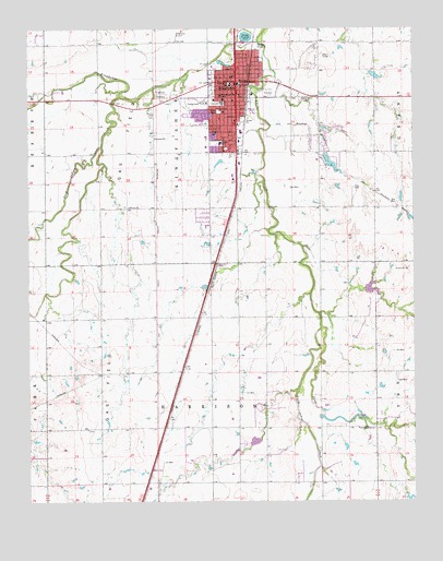
Kingfisher, OK USGS Topographic Map
Click on map above to begin viewing in our Map Viewer.

This topographic map contains these locations and features:
Feature Name Type Latitude Longitude GNIS ID View Map
Church of the NazareneChurchN35.8467°W97.9359°1798415View Map
City of KingfisherCivilN35.8439°W97.9380°2411546View Map
Clear CreekStreamN35.7962°W97.9051°1091425View Map
Emmanuel Lutheran ChurchChurchN35.8506°W97.9334°1798416View Map
First Baptist ChurchChurchN35.8464°W97.9414°1798418View Map
First Baptist ChurchChurchN35.8639°W97.9309°1798417View Map
First Christian ChurchChurchN35.8609°W97.9342°1798419View Map
First United Methodist ChurchChurchN35.8606°W97.9331°1798420View Map
Gilmour Elementary SchoolSchoolN35.8450°W97.9378°1093189View Map
KingfisherPopulated PlaceN35.8614°W97.9317°1094390View Map
Kingfisher AirportAirportN35.8719°W97.9541°1102523View Map
Kingfisher CemeteryCemeteryN35.8568°W97.9569°1094391View Map
Kingfisher County JailBuildingN35.8601°W97.9322°2757837View Map
Kingfisher County Sheriff DeptBuildingN35.8606°W97.9326°2757539View Map
Kingfisher Fire Department and Emergency Medical ServicesBuildingN35.8574°W97.9323°2658462View Map
Kingfisher High SchoolSchoolN35.8553°W97.9374°1793741View Map
Kingfisher Middle SchoolSchoolN35.8447°W97.9425°1793742View Map
Kingfisher Police DeptBuildingN35.8619°W97.9329°2757703View Map
Kingfisher Regional HospitalHospitalN35.8564°W97.9370°2695729View Map
Kingfisher Sewage Disposal DamDamN35.8717°W97.9270°1752797View Map
Kingfisher Sewage Disposal PondReservoirN35.8728°W97.9293°1752798View Map
Lighthouse Praise and Worship ChurchChurchN35.8562°W97.9342°1798421View Map
Oak Street Baptist ChurchChurchN35.8439°W97.9376°1798422View Map
Okarche-Cashion DivisionCivilN35.7747°W97.9037°1937813View Map
Oknoname 07309 DamDamN35.8634°W97.8887°1752799View Map
Oknoname 07309 ReservoirReservoirN35.8626°W97.8868°1752800View Map
Oknoname 07311 DamDamN35.8034°W97.8753°1752803View Map
Pilgrim Rest Baptist ChurchChurchN35.8675°W97.9306°1798423View Map
Reherman Airport (historical)AirportN35.8042°W97.9339°1102525View Map
Saints Peter and Paul SchoolSchoolN35.8585°W97.9323°1097646View Map
Shaw ParkParkN35.8534°W97.9376°1097963View Map
Township of HarrisonCivilN35.7723°W97.9392°1825578View Map
Township of KingfisherCivilN35.8473°W97.9531°1825570View Map
Uncle John Creek Site 14 DamDamN35.8067°W97.8903°1750847View Map
Uncle John Creek Site 14 ReservoirReservoirN35.8062°W97.8888°1750848View Map
Uncle John Creek Site 2 DamDamN35.7684°W97.9253°1751886View Map
Uncle John Creek Site 2 ReservoirReservoirN35.7684°W97.9253°1751887View Map
Uncle Johns CreekStreamN35.8720°W97.9245°1099144View Map
Union Hall CemeteryCemeteryN35.7983°W97.9594°2705446View Map
Victory Baptist ChurchChurchN35.8634°W97.9398°1798424View Map
Washington SchoolSchoolN35.8600°W97.9337°1099401View Map
Winter Camp CreekStreamN35.8570°W97.9701°1091966View Map

Note: Coordinates in the location and feature list above are referenced to NAD83 datum.


Copyright (C) 2008-2025 Ryan Niemi / Sunset Dynamics ... All Rights Reserved