TopoQuest Logo
Do you find TopoQuest useful?
Help keep TopoQuest running and adding new maps/features by donating!
Bitcoin:  19c7KJd3qBynnjoSw5npx9KScwjBe4ifkT
Litecoin:  LXs6TkuXGGXo1vDsWCkWVdjQX94eUKd6ui
Home View Maps Find Maps Find Places Resources & Links


Kingsley, Florida Topographic Map

USGS Map Title: Kingsley, FL
USGS Map MRC: 29081H8
DRG (GeoTIFF) Download: o29081h8.tif


Neighboring USGS Topographic Map Quads:


  Lawtey, FL  
30082A1
 

  Middleburg SW, FL  
30081A8
 

  Middleburg, FL  
30081A7
 

  Starke, FL  
29082H1
 

  Kingsley, FL  
29081H8
 

  Penney Farms, FL  
29081H7
 

  Keystone Heights, FL  
29082G1
 

  Gold Head Branch, FL  
29081G8
 

  Rice Creek, FL  
29081G7


Map MRC Location:

N30°
W82°
N30°
W81°
H8 H7 H6 H5 H4 H3 H2 H1
G8 G7 G6 G5 G4 G3 G2 G1
F8 F7 F6 F5 F4 F3 F2 F1
E8 E7 E6 E5 E4 E3 E2 E1
D8 D7 D6 D5 D4 D3 D2 D1
C8 C7 C6 C5 C4 C3 C2 C1
B8 B7 B6 B5 B4 B3 B2 B1
A8 A7 A6 A5 A4 A3 A2 A1
N29°
W82°
N29°
W81°

Kingsley, FL USGS 1:24K Topographic Map Preview:
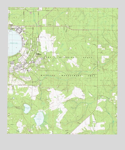
Kingsley, FL USGS Topographic Map
Click on map above to begin viewing in our Map Viewer.

This topographic map contains these locations and features:
Feature Name Type Latitude Longitude GNIS ID View Map
BelmorePopulated PlaceN29.8866°W81.8987°295126View Map
Beulah CemeteryCemeteryN29.9425°W81.9184°278584View Map
Beulah Missionary ChurchChurchN29.9383°W81.8982°304950View Map
Camp BlandingMilitaryN29.9469°W81.9732°2512399View Map
Camp Blanding Army Airfield/National Guard AirportAirportN29.9527°W81.9815°2676647View Map
Camp Blanding State Wildlife Management AreaParkN29.9394°W81.9368°307127View Map
Clay County Fire Rescue Camp Blanding Station 25BuildingN29.9814°W81.9846°2644360View Map
Florida National Guard Military AcademySchoolN29.9780°W81.9887°304951View Map
Kennedy C Ballard Post HeadquartersBuildingN29.9633°W81.9812°304955View Map
Keystone Heights DivisionCivilN29.9001°W81.9440°1935817View Map
KingsleyPopulated PlaceN29.9819°W81.9959°285128View Map
Kingsley BeachPopulated PlaceN29.9791°W81.9957°285129View Map
Kingsley LakeLakeN29.9650°W81.9990°285131View Map
Old Conway CemeteryCemeteryN29.9830°W81.9498°304953View Map
Penney Farms TowerTowerN29.9808°W81.9309°304954View Map
Reynolds ChapelChurchN29.9786°W81.9851°304952View Map
Varnes LakeLakeN29.8904°W81.9634°292739View Map
Whitmore LakeLakeN29.9002°W81.9776°293256View Map

Note: Coordinates in the location and feature list above are referenced to NAD83 datum.


Copyright (C) 2008-2024 Ryan Niemi / Sunset Dynamics ... All Rights Reserved