TopoQuest Logo
Do you find TopoQuest useful?
Help keep TopoQuest running and adding new maps/features by donating!
Bitcoin:  19c7KJd3qBynnjoSw5npx9KScwjBe4ifkT
Litecoin:  LXs6TkuXGGXo1vDsWCkWVdjQX94eUKd6ui
Home View Maps Find Maps Find Places Resources & Links


Kisatchie, Louisiana Topographic Map

USGS Map Title: Kisatchie, LA
USGS Map MRC: 31093D2
DRG (GeoTIFF) Download: o31093d2.tif


Neighboring USGS Topographic Map Quads:


  Vowells Mill, LA  
31093E3
 

  Bellwood, LA  
31093E2
 

  Flora, LA  
31093E1
 

  Peason, LA  
31093D3
 

  Kisatchie, LA  
31093D2
 

  Bayou Livrogne, LA  
31093D1
 

  Dowden Creek, LA  
31093C3
 

  Kurthwood, LA  
31093C2
 

  Simpson North, LA  
31093C1


Map MRC Location:

N32°
W94°
N32°
W93°
H8 H7 H6 H5 H4 H3 H2 H1
G8 G7 G6 G5 G4 G3 G2 G1
F8 F7 F6 F5 F4 F3 F2 F1
E8 E7 E6 E5 E4 E3 E2 E1
D8 D7 D6 D5 D4 D3 D2 D1
C8 C7 C6 C5 C4 C3 C2 C1
B8 B7 B6 B5 B4 B3 B2 B1
A8 A7 A6 A5 A4 A3 A2 A1
N31°
W94°
N31°
W93°

Kisatchie, LA USGS 1:24K Topographic Map Preview:
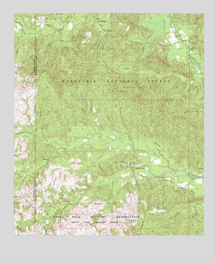
Kisatchie, LA USGS Topographic Map
Click on map above to begin viewing in our Map Viewer.

This topographic map contains these locations and features:
Feature Name Type Latitude Longitude GNIS ID View Map
Billy Dowden CemeteryCemeteryN31.3941°W93.2188°547089View Map
Booty CemeteryCemeteryN31.4082°W93.1554°547120View Map
Caney BranchStreamN31.4260°W93.1779°547184View Map
Dogwood CampgroundLocaleN31.4902°W93.1952°548192View Map
Double BranchStreamN31.4885°W93.1582°547304View Map
Dry CreekStreamN31.4316°W93.2329°554271View Map
Folly CemeteryCemeteryN31.3999°W93.1446°547367View Map
Hannah SpringSpringN31.4775°W93.1291°547434View Map
Hyatt BranchStreamN31.4260°W93.1729°547500View Map
Jackson OverlookLocaleN31.4746°W93.1579°548201View Map
Key BranchStreamN31.4202°W93.1529°547542View Map
KilePopulated PlaceN31.4057°W93.1474°549014View Map
Kile CemeteryCemeteryN31.4124°W93.1271°547544View Map
KisatchiePopulated PlaceN31.4157°W93.1743°554937View Map
Kisatchie FallFallsN31.4077°W93.1310°548199View Map
Kisatchie Guard StationLocaleN31.4905°W93.1924°554939View Map
Kisatchie Lookout TowerTowerN31.4557°W93.1810°558789View Map
Kisatchie Post OfficePost OfficeN31.4141°W93.1743°1630938View Map
Little Sandy CreekStreamN31.4121°W93.1452°555095View Map
Long BranchStreamN31.3849°W93.1977°546954View Map
LotusPopulated PlaceN31.4855°W93.1304°547631View Map
Lotus CampgroundLocaleN31.4860°W93.1329°548200View Map
Lyles CreekStreamN31.4257°W93.2141°547638View Map
Mike BranchStreamN31.4299°W93.1829°547692View Map
Mill CreekStreamN31.4910°W93.2446°547708View Map
New Kisatchie CemeteryCemeteryN31.4135°W93.1699°547771View Map
Odom CreekStreamN31.4071°W93.1827°547792View Map
Odum FallsFallsN31.3852°W93.1974°548890View Map
Old Bellwood CemeteryCemeteryN31.4952°W93.1927°547796View Map
Old Kisatchie CemeteryCemeteryN31.4291°W93.2052°547797View Map
Pate CreekStreamN31.4360°W93.2399°555603View Map
Reaugaulle CreekStreamN31.3849°W93.2254°547887View Map
Red Bluff CampgroundLocaleN31.4980°W93.1424°548191View Map
Saddle BranchStreamN31.4324°W93.1966°555874View Map
School House CreekStreamN31.4802°W93.1338°547976View Map
Sheard BranchStreamN31.4713°W93.1316°547990View Map
Simmons CreekStreamN31.4905°W93.2204°556049View Map
Sulphur BranchStreamN31.3910°W93.1304°548049View Map
Tiger BranchStreamN31.4346°W93.2357°548083View Map
Tiger CreekStreamN31.3913°W93.1866°548084View Map
Truer CemeteryCemeteryN31.4935°W93.2002°548193View Map
Wilson BranchStreamN31.4843°W93.2188°548155View Map

Note: Coordinates in the location and feature list above are referenced to NAD83 datum.


Copyright (C) 2008-2024 Ryan Niemi / Sunset Dynamics ... All Rights Reserved