TopoQuest Logo
Do you find TopoQuest useful?
Help keep TopoQuest running and adding new maps/features by donating!
Bitcoin:  19c7KJd3qBynnjoSw5npx9KScwjBe4ifkT
Litecoin:  LXs6TkuXGGXo1vDsWCkWVdjQX94eUKd6ui
Home View Maps Find Maps Find Places Resources & Links


Knierim, Iowa Topographic Map

USGS Map Title: Knierim, IA
USGS Map MRC: 42094D4
DRG (GeoTIFF) Download: o42094d4.tif


Neighboring USGS Topographic Map Quads:


  Manson, IA  
42094E5
 

  Gilmore City SW, IA  
42094E4
 

  Clare, IA  
42094E3
 

  Richard, IA  
42094D5
 

  Knierim, IA  
42094D4
 

  Moorland, IA  
42094D3
 

  Lohrville, IA  
42094C5
 

  Farnhamville, IA  
42094C4
 

  Gowrie, IA  
42094C3


Map MRC Location:

N43°
W95°
N43°
W94°
H8 H7 H6 H5 H4 H3 H2 H1
G8 G7 G6 G5 G4 G3 G2 G1
F8 F7 F6 F5 F4 F3 F2 F1
E8 E7 E6 E5 E4 E3 E2 E1
D8 D7 D6 D5 D4 D3 D2 D1
C8 C7 C6 C5 C4 C3 C2 C1
B8 B7 B6 B5 B4 B3 B2 B1
A8 A7 A6 A5 A4 A3 A2 A1
N42°
W95°
N42°
W94°

Knierim, IA USGS 1:24K Topographic Map Preview:
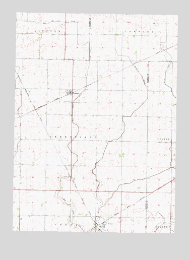
Knierim, IA USGS Topographic Map
Click on map above to begin viewing in our Map Viewer.

This topographic map contains these locations and features:
Feature Name Type Latitude Longitude GNIS ID View Map
Calvary ChurchChurchN42.4736°W94.3833°455095View Map
Calvary United Presbyterian CemeteryCemeteryN42.4741°W94.3837°1996851View Map
City of KnierimCivilN42.4561°W94.4559°2395554View Map
City of SomersCivilN42.3787°W94.4310°2395911View Map
Ditch Number 31CanalN42.4041°W94.4075°465711View Map
Farmers Co-op Company ElevatorLocaleN42.3783°W94.4300°1995790View Map
Greenfield Township CemeteryCemeteryN42.4494°W94.4568°2728644View Map
KnierimPopulated PlaceN42.4555°W94.4569°458131View Map
KnierimLocaleN42.4539°W94.4580°1995867View Map
Knierim Fire DepartmentBuildingN42.4548°W94.4574°1995866View Map
Knierim Post OfficePost OfficeN42.4554°W94.4573°1995864View Map
Prairie Valley Elementary West SchoolSchoolN42.3764°W94.4333°1995789View Map
Schilling SanctuaryParkN42.4119°W94.4564°1995733View Map
SomersLocaleN42.3811°W94.4300°1995795View Map
SomersPopulated PlaceN42.3783°W94.4300°461750View Map
Somers City HallBuildingN42.3783°W94.4300°1995791View Map
Somers City LibraryBuildingN42.3783°W94.4300°1995792View Map
Somers Post OfficePost OfficeN42.3779°W94.4301°1995793View Map
Township of GreenfieldCivilN42.4287°W94.4557°467973View Map
Trinity CemeteryCemeteryN42.4745°W94.4555°1995888View Map
Trinity ChurchChurchN42.4739°W94.4558°462313View Map
Trinity Lutheran ChurchChurchN42.4555°W94.4569°1995865View Map
United Methodist ChurchChurchN42.3783°W94.4300°1995794View Map
WadleighPopulated PlaceN42.4736°W94.4033°464129View Map
Welsh BridgeBridgeN42.3786°W94.4364°1995891View Map

Note: Coordinates in the location and feature list above are referenced to NAD83 datum.


Copyright (C) 2008-2025 Ryan Niemi / Sunset Dynamics ... All Rights Reserved