TopoQuest Logo
Do you find TopoQuest useful?
Help keep TopoQuest running and adding new maps/features by donating!
Bitcoin:  19c7KJd3qBynnjoSw5npx9KScwjBe4ifkT
Litecoin:  LXs6TkuXGGXo1vDsWCkWVdjQX94eUKd6ui
Home View Maps Find Maps Find Places Resources & Links


Richard, Iowa Topographic Map

USGS Map Title: Richard, IA
USGS Map MRC: 42094D5
DRG (GeoTIFF) Download: o42094d5.tif


Neighboring USGS Topographic Map Quads:


  Pomeroy, IA  
42094E6
 

  Manson, IA  
42094E5
 

  Gilmore City SW, IA  
42094E4
 

  Rockwell City, IA  
42094D6
 

  Richard, IA  
42094D5
 

  Knierim, IA  
42094D4
 

  Lake City, IA  
42094C6
 

  Lohrville, IA  
42094C5
 

  Farnhamville, IA  
42094C4


Map MRC Location:

N43°
W95°
N43°
W94°
H8 H7 H6 H5 H4 H3 H2 H1
G8 G7 G6 G5 G4 G3 G2 G1
F8 F7 F6 F5 F4 F3 F2 F1
E8 E7 E6 E5 E4 E3 E2 E1
D8 D7 D6 D5 D4 D3 D2 D1
C8 C7 C6 C5 C4 C3 C2 C1
B8 B7 B6 B5 B4 B3 B2 B1
A8 A7 A6 A5 A4 A3 A2 A1
N42°
W95°
N42°
W94°

Richard, IA USGS 1:24K Topographic Map Preview:
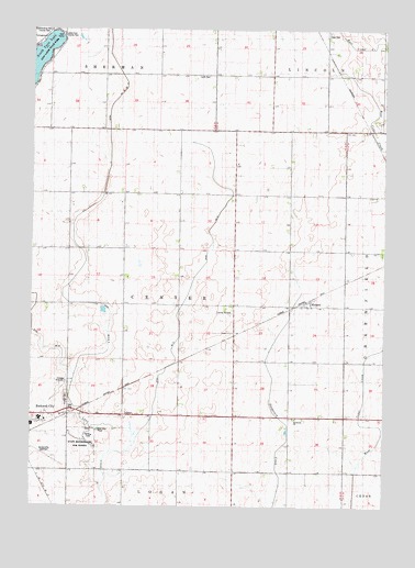
Richard, IA USGS Topographic Map
Click on map above to begin viewing in our Map Viewer.

This topographic map contains these locations and features:
Feature Name Type Latitude Longitude GNIS ID View Map
Calhoun County HomeBuildingN42.4261°W94.5547°463398View Map
Center Wildlife AreaParkN42.4278°W94.5739°1995727View Map
Drainage Ditch 13CanalN42.4269°W94.5728°455986View Map
Drainage Ditch 65CanalN42.4300°W94.6233°455999View Map
Greenwood CemeteryCemeteryN42.4666°W94.6169°1995885View Map
Highway Number Twenty Rest AreaLocaleN42.3997°W94.6114°1995734View Map
Hope CemeteryCemeteryN42.4993°W94.5202°457641View Map
Immanuel ChurchChurchN42.3980°W94.5314°457767View Map
Iowa State Reformatory for WomenLocaleN42.3911°W94.6058°1823183View Map
Lake End County ParkParkN42.4986°W94.6147°1823184View Map
Leith CemeteryCemeteryN42.4878°W94.5667°458284View Map
McFarland Clinic at RockwellHospitalN42.3978°W94.6225°1995784View Map
North Central Correctional FacilityBuildingN42.3924°W94.6056°1995764View Map
Physical Therapy Rost ClinicHospitalN42.3978°W94.6225°1995785View Map
Reformatory CemeteryCemeteryN42.3951°W94.6039°1995883View Map
RichardPopulated PlaceN42.4278°W94.5297°460609View Map
RichardsLocaleN42.4278°W94.5297°1995749View Map
Richards Post Office (historical)Post OfficeN42.4278°W94.5297°1995748View Map
Rockwell City BridgeBridgeN42.4000°W94.6072°1995889View Map
Rockwell City Municipal AirportAirportN42.3900°W94.6243°466930View Map
Rosehill CemeteryCemeteryN42.4038°W94.6126°460807View Map
Saint Francis CemeteryCemeteryN42.4014°W94.6125°1995884View Map
South Central Calhoun Elementary SchoolSchoolN42.3963°W94.6248°1995783View Map
Sunny Knoll Care CenterHospitalN42.3980°W94.6225°1995786View Map
Township of CenterCivilN42.4290°W94.5722°467570View Map
Twin Lakes State ParkParkN42.4928°W94.6186°462402View Map

Note: Coordinates in the location and feature list above are referenced to NAD83 datum.


Copyright (C) 2008-2024 Ryan Niemi / Sunset Dynamics ... All Rights Reserved