TopoQuest Logo
Do you find TopoQuest useful?
Help keep TopoQuest running and adding new maps/features by donating!
Bitcoin:  19c7KJd3qBynnjoSw5npx9KScwjBe4ifkT
Litecoin:  LXs6TkuXGGXo1vDsWCkWVdjQX94eUKd6ui
Home View Maps Find Maps Find Places Resources & Links


Knife River, Minnesota Topographic Map

USGS Map Title: Knife River, MN
USGS Map MRC: 46091H7
DRG (GeoTIFF) Download: o46091h7.tif


Neighboring USGS Topographic Map Quads:


  Barrs Lake, MN  
47091A8
 

  McCarthy Creek, MN  
47091A7
 

  Two Harbors, MN  
47091A6
 

  French River, MN  
46091H8
 

  Knife River, MN  
46091H7


  Lakewood, MN  
46091G8


Map MRC Location:

N47°
W92°
N47°
W91°
H8 H7 H6 H5 H4 H3 H2 H1
G8 G7 G6 G5 G4 G3 G2 G1
F8 F7 F6 F5 F4 F3 F2 F1
E8 E7 E6 E5 E4 E3 E2 E1
D8 D7 D6 D5 D4 D3 D2 D1
C8 C7 C6 C5 C4 C3 C2 C1
B8 B7 B6 B5 B4 B3 B2 B1
A8 A7 A6 A5 A4 A3 A2 A1
N46°
W92°
N46°
W91°

Knife River, MN USGS 1:24K Topographic Map Preview:
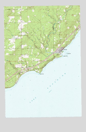
Knife River, MN USGS Topographic Map
Click on map above to begin viewing in our Map Viewer.

This topographic map contains these locations and features:
Feature Name Type Latitude Longitude GNIS ID View Map
Arthur V Rohweder Memorial Highway Historical MuseumParkN46.9508°W91.7875°2093502View Map
Big Blaze Campground and CabinsLocaleN46.9681°W91.7583°2094051View Map
Big Sucker CreekStreamN46.9216°W91.8480°660801View Map
Buchanan Historical MarkerParkN46.9472°W91.7806°2093500View Map
Clifton Fire Department Station 2BuildingN46.9523°W91.8467°2666620View Map
Community ChurchChurchN46.9930°W91.8466°661033View Map
Duluth Township Police DepartmentBuildingN46.9523°W91.8467°2758795View Map
Granite PointCapeN46.9435°W91.7802°644351View Map
Knife IslandIslandN46.9463°W91.7730°646203View Map
Knife RiverLocaleN46.9472°W91.7819°2093363View Map
Knife RiverStreamN46.9497°W91.7788°661653View Map
Knife RiverPopulated PlaceN46.9494°W91.7791°646206View Map
Knife River Lutheran ChurchChurchN46.9494°W91.7789°2093364View Map
Knife River Post OfficePost OfficeN46.9494°W91.7789°2093365View Map
Knife River Rest AreaLocaleN46.9508°W91.7875°2093501View Map
Lake View CemeteryCemeteryN46.9318°W91.8369°661677View Map
Little Knife RiverStreamN46.9452°W91.8091°661747View Map
Little Sucker RiverStreamN46.9272°W91.8346°661775View Map
PalmersPopulated PlaceN46.9247°W91.8507°662128View Map
Palmers Post Office (historical)Post OfficeN46.9247°W91.8506°2117805View Map
Palmers StationLocaleN46.9247°W91.8506°2117815View Map
Stanley CreekStreamN46.9802°W91.7913°662535View Map
Stony PointCapeN46.9241°W91.8174°662563View Map
Township of DuluthCivilN46.9620°W91.8625°664006View Map
WRSR-FM (Two Harbors)TowerN46.9974°W91.8371°663356View Map

Note: Coordinates in the location and feature list above are referenced to NAD83 datum.


Copyright (C) 2008-2025 Ryan Niemi / Sunset Dynamics ... All Rights Reserved