TopoQuest Logo
Do you find TopoQuest useful?
Help keep TopoQuest running and adding new maps/features by donating!
Bitcoin:  19c7KJd3qBynnjoSw5npx9KScwjBe4ifkT
Litecoin:  LXs6TkuXGGXo1vDsWCkWVdjQX94eUKd6ui
Home View Maps Find Maps Find Places Resources & Links


Knights Ferry, California Topographic Map

USGS Map Title: Knights Ferry, CA
USGS Map MRC: 37120G6
DRG (GeoTIFF) Download: o37120g6.tif


Neighboring USGS Topographic Map Quads:


  Bachelor Valley, CA  
37120H7
 

  Copperopolis, CA  
37120H6
 

  New Melones Dam, CA  
37120H5
 

  Oakdale, CA  
37120G7
 

  Knights Ferry, CA  
37120G6
 

  Keystone, CA  
37120G5
 

  Waterford, CA  
37120F7
 

  Paulsell, CA  
37120F6
 

  Cooperstown, CA  
37120F5


Map MRC Location:

N38°
W121°
N38°
W120°
H8 H7 H6 H5 H4 H3 H2 H1
G8 G7 G6 G5 G4 G3 G2 G1
F8 F7 F6 F5 F4 F3 F2 F1
E8 E7 E6 E5 E4 E3 E2 E1
D8 D7 D6 D5 D4 D3 D2 D1
C8 C7 C6 C5 C4 C3 C2 C1
B8 B7 B6 B5 B4 B3 B2 B1
A8 A7 A6 A5 A4 A3 A2 A1
N37°
W121°
N37°
W120°

Knights Ferry, CA USGS 1:24K Topographic Map Preview:
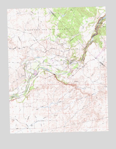
Knights Ferry, CA USGS Topographic Map
Click on map above to begin viewing in our Map Viewer.

This topographic map contains these locations and features:
Feature Name Type Latitude Longitude GNIS ID View Map
Arnold (historical)Populated PlaceN37.7630°W120.7419°1670460View Map
Cape Horn LateralCanalN37.8058°W120.7360°220575View Map
Cape Horn TunnelTunnelN37.8210°W120.7485°220578View Map
Cashman DamDamN37.7758°W120.7110°220672View Map
Goodwin DamDamN37.8627°W120.6302°224318View Map
Knights FerryPopulated PlaceN37.8196°W120.6721°1658915View Map
Knights Ferry Elementary SchoolSchoolN37.8209°W120.6730°1817217View Map
Knights Ferry Recreation AreaParkN37.8202°W120.6630°1817218View Map
Littlejohns DamDamN37.8467°W120.6865°227413View Map
Lovers LeapCliffN37.8077°W120.6924°227736View Map
Morrison Siphon LateralCanalN37.8210°W120.6935°229087View Map
North Fork Wildcat CreekStreamN37.8138°W120.6391°234379View Map
North San Joaquin Main CanalCanalN37.8419°W120.6966°229755View Map
Oakdale Rural Fire Protection District Station 3BuildingN37.8192°W120.6710°2624242View Map
Orange Blossom School (historical)SchoolN37.7910°W120.7402°1662148View Map
Owl CreekStreamN37.8508°W120.6380°230178View Map
Peachys CreekStreamN37.8452°W120.6913°230435View Map
Smith CreekStreamN37.8730°W120.6749°233324View Map
South Fork Wildcat CreekStreamN37.8138°W120.6391°235065View Map
Stanislaus County Sheriff's Office Knights FerryBuildingN37.8192°W120.6710°2755694View Map
Wildcat CreekStreamN37.8080°W120.6871°237788View Map
Wills LateralCanalN37.8202°W120.7219°237956View Map

Note: Coordinates in the location and feature list above are referenced to NAD83 datum.


Copyright (C) 2008-2025 Ryan Niemi / Sunset Dynamics ... All Rights Reserved