TopoQuest Logo
Do you find TopoQuest useful?
Help keep TopoQuest running and adding new maps/features by donating!
Bitcoin:  19c7KJd3qBynnjoSw5npx9KScwjBe4ifkT
Litecoin:  LXs6TkuXGGXo1vDsWCkWVdjQX94eUKd6ui
Home View Maps Find Maps Find Places Resources & Links


New Melones Dam, California Topographic Map

USGS Map Title: New Melones Dam, CA
USGS Map MRC: 37120H5
DRG (GeoTIFF) Download: o37120h5.tif


Neighboring USGS Topographic Map Quads:


  Salt Spring Valley, CA  
38120A6
 

  Angels Camp, CA  
38120A5
 

  Columbia, CA  
38120A4
 

  Copperopolis, CA  
37120H6
 

  New Melones Dam, CA  
37120H5
 

  Sonora, CA  
37120H4
 

  Knights Ferry, CA  
37120G6
 

  Keystone, CA  
37120G5
 

  Chinese Camp, CA  
37120G4


Map MRC Location:

N38°
W121°
N38°
W120°
H8 H7 H6 H5 H4 H3 H2 H1
G8 G7 G6 G5 G4 G3 G2 G1
F8 F7 F6 F5 F4 F3 F2 F1
E8 E7 E6 E5 E4 E3 E2 E1
D8 D7 D6 D5 D4 D3 D2 D1
C8 C7 C6 C5 C4 C3 C2 C1
B8 B7 B6 B5 B4 B3 B2 B1
A8 A7 A6 A5 A4 A3 A2 A1
N37°
W121°
N37°
W120°

New Melones Dam, CA USGS 1:24K Topographic Map Preview:
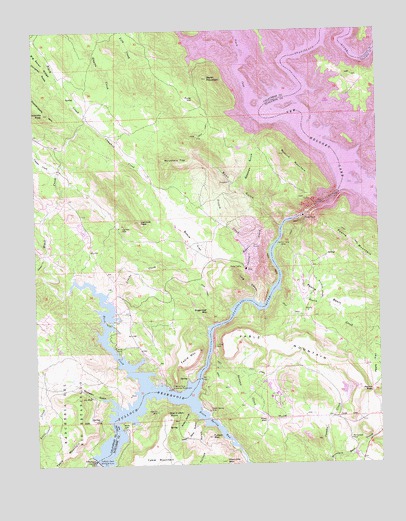
New Melones Dam, CA USGS Topographic Map
Click on map above to begin viewing in our Map Viewer.

This topographic map contains these locations and features:
Feature Name Type Latitude Longitude GNIS ID View Map
Abbotts PeakSummitN37.9763°W120.6224°217943View Map
Alto MineMineN37.8946°W120.6066°218192View Map
Andrew CreekStreamN37.8771°W120.5113°238616View Map
Angels CreekStreamN37.9760°W120.5433°266382View Map
Barth MountainSummitN37.9858°W120.5624°218708View Map
Bean GulchValleyN37.9430°W120.5369°218784View Map
Black CreekStreamN37.9966°W120.5613°219349View Map
Black CreekStreamN37.8969°W120.5852°219351View Map
Black Jack BluffsPopulated PlaceN37.8896°W120.5841°1785550View Map
Bostick BarBarN37.9755°W120.5291°1670427View Map
Bostick MountainSummitN37.9638°W120.5349°219668View Map
Bowie FlatFlatN37.9391°W120.5683°219718View Map
Bowman GulchValleyN37.9549°W120.5521°219723View Map
Campbell CreekStreamN37.9741°W120.6060°220502View Map
Casnau CreekStreamN37.8755°W120.5205°220675View Map
Central FerryLocaleN37.9377°W120.5377°220838View Map
Christian GulchValleyN37.9849°W120.6174°221088View Map
Copper CreekStreamN37.9583°W120.6169°221537View Map
Copperopolis QuarryMineN37.9367°W120.5467°2676105View Map
Empire CreekStreamN37.9749°W120.6069°233851View Map
French CreekStreamN37.9455°W120.5399°223900View Map
Funk HillSummitN37.9802°W120.5669°1658594View Map
Green Spring MineMineN37.8902°W120.5635°224566View Map
Green Spring RunStreamN37.8930°W120.5694°233956View Map
Hammils MountainSummitN37.8758°W120.5577°224854View Map
If I Can MineMineN37.9088°W120.5610°225829View Map
Iron CanyonValleyN37.9460°W120.5296°225973View Map
Jamestown Conservation CampLocaleN37.8933°W120.5383°1785558View Map
Lightner MineMineN37.9438°W120.5938°227083View Map
Lightner PeakSummitN37.9449°W120.5877°227084View Map
Long CanyonValleyN37.9227°W120.5469°227545View Map
Loucks CreekStreamN37.9241°W120.5999°227723View Map
McCormick MineMineN37.8816°W120.5121°228325View Map
Melones Dam (historical)DamN37.9535°W120.5149°228483View Map
Mormon CreekStreamN37.9641°W120.5088°267031View Map
Mountain TopSummitN37.9619°W120.5741°229202View Map
Negro Jack GulchValleyN37.8877°W120.5674°229454View Map
Negro Jack PointCliffN37.8896°W120.5791°229456View Map
New Melones DamDamN37.9481°W120.5252°1670429View Map
New Melones DamDamN37.9471°W120.5280°1664773View Map
New Melones LakeReservoirN37.9936°W120.5072°253643View Map
O Byrne Ferry Historical MonumentParkN37.8969°W120.5771°229821View Map
O'Byrnes Ferry (historical)CrossingN37.8949°W120.5710°1670430View Map
O'Byrnes School (historical)SchoolN37.9308°W120.6016°1670431View Map
Peoria AirportAirportN37.9215°W120.5190°2650948View Map
Peoria BasinBasinN37.9233°W120.5213°230504View Map
Peoria CreekStreamN37.9249°W120.5366°230506View Map
Peoria MountainSummitN37.9405°W120.5088°1659369View Map
Peoria PassGapN37.8955°W120.5041°230508View Map
Reynolds Ferry (historical)CrossingN37.9805°W120.5349°1670432View Map
Rocky GulchValleyN37.8896°W120.5705°231768View Map
Rogers CreekStreamN37.9430°W120.5444°231819View Map
Sawmill CreekStreamN37.9352°W120.6230°232615View Map
Scorpion GulchValleyN37.8908°W120.5969°232707View Map
Shotgun CreekStreamN37.9038°W120.5633°233058View Map
Sierra Conservation CenterBuildingN37.8934°W120.5382°2739958View Map
Sierra Conservation Center Fire DepartmentBuildingN37.8882°W120.5369°2624688View Map
South Shore Recreation AreaParkN37.8852°W120.5941°1785591View Map
Sugarloaf MineMineN37.9191°W120.5635°235664View Map
Texas Charley GulchValleyN37.9935°W120.5521°236134View Map
The Shores of Poker FlatPopulated PlaceN37.9030°W120.5821°1804965View Map
Tulloch DamDamN37.8764°W120.6049°236612View Map
Tulloch GulchValleyN37.8858°W120.5652°236613View Map
Tulloch MountainSummitN37.8824°W120.5627°255162View Map
Tulloch ReservoirReservoirN37.8966°W120.5884°255161View Map
Valencia MineMineN37.8896°W120.5821°236952View Map
Vermont BarBarN37.9688°W120.5249°1670462View Map
Wagner RanchLocaleN37.8880°W120.5424°237150View Map
York CreekStreamN37.9869°W120.5994°238271View Map

Note: Coordinates in the location and feature list above are referenced to NAD83 datum.


Copyright (C) 2008-2025 Ryan Niemi / Sunset Dynamics ... All Rights Reserved