TopoQuest Logo
Do you find TopoQuest useful?
Help keep TopoQuest running and adding new maps/features by donating!
Bitcoin:  19c7KJd3qBynnjoSw5npx9KScwjBe4ifkT
Litecoin:  LXs6TkuXGGXo1vDsWCkWVdjQX94eUKd6ui
Home View Maps Find Maps Find Places Resources & Links


Bargersville, Indiana Topographic Map

USGS Map Title: Bargersville, IN
USGS Map MRC: 39086E2
DRG (GeoTIFF) Download: o39086e2.tif


Neighboring USGS Topographic Map Quads:


  Bridgeport, IN  
39086F3
 

  Maywood, IN  
39086F2
 

  Beech Grove, IN  
39086F1
 

  Mooresville East, IN  
39086E3
 

  Bargersville, IN  
39086E2
 

  Greenwood, IN  
39086E1
 

  Cope, IN  
39086D3
 

  Trafalgar, IN  
39086D2
 

  Franklin, IN  
39086D1


Map MRC Location:

N40°
W87°
N40°
W86°
H8 H7 H6 H5 H4 H3 H2 H1
G8 G7 G6 G5 G4 G3 G2 G1
F8 F7 F6 F5 F4 F3 F2 F1
E8 E7 E6 E5 E4 E3 E2 E1
D8 D7 D6 D5 D4 D3 D2 D1
C8 C7 C6 C5 C4 C3 C2 C1
B8 B7 B6 B5 B4 B3 B2 B1
A8 A7 A6 A5 A4 A3 A2 A1
N39°
W87°
N39°
W86°

Bargersville, IN USGS 1:24K Topographic Map Preview:
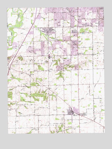
Bargersville, IN USGS Topographic Map
Click on map above to begin viewing in our Map Viewer.

This topographic map contains these locations and features:
Feature Name Type Latitude Longitude GNIS ID View Map
Al-MarPopulated PlaceN39.5447°W86.2050°2107801View Map
Alexander DitchCanalN39.5495°W86.1353°430064View Map
Auburn BranchStreamN39.5914°W86.1739°430335View Map
Auburn TracePopulated PlaceN39.5944°W86.1808°2107783View Map
Bargersvill Police DepartmentBuildingN39.5213°W86.1670°2758258View Map
BargersvillePopulated PlaceN39.5209°W86.1678°430487View Map
Bargersville CemeteryCemeteryN39.5192°W86.1535°430488View Map
Bargersville Christian ChurchChurchN39.5197°W86.1647°2096192View Map
Bargersville Community Fire Department Station 1BuildingN39.5200°W86.1669°2625790View Map
Bargersville Community Fire Department Station 2BuildingN39.5628°W86.2147°2626573View Map
Bargersville Community Fire Station 1BuildingN39.5199°W86.1669°2701444View Map
Bargersville Community Fire Station 2BuildingN39.5628°W86.2146°2701342View Map
Beck Airport (historical)AirportN39.5601°W86.2025°2677106View Map
Bluff AcresPopulated PlaceN39.6000°W86.2192°2107802View Map
Bluff CreekPopulated PlaceN39.5575°W86.2208°431260View Map
Bluff Creek Christian ChurchChurchN39.5586°W86.2222°2096193View Map
Boles CemeteryCemeteryN39.5187°W86.1529°431305View Map
BrentridgePopulated PlaceN39.5842°W86.1939°2107803View Map
BrentwoodPopulated PlaceN39.6028°W86.1828°2107784View Map
Brockton ManorPopulated PlaceN39.5900°W86.1856°2107804View Map
Cedar HillsPopulated PlaceN39.5678°W86.1797°2107805View Map
Center CreekStreamN39.5817°W86.1911°449555View Map
Center Grove High SchoolSchoolN39.5750°W86.1958°447482View Map
ClearviewPopulated PlaceN39.5833°W86.2117°2107806View Map
CritchfieldPopulated PlaceN39.6003°W86.1633°433136View Map
Crook BranchStreamN39.5406°W86.2333°433151View Map
DeerwoodPopulated PlaceN39.5833°W86.2194°2107807View Map
Doty RunStreamN39.5725°W86.1864°433650View Map
Doty Run Lake DamDamN39.5717°W86.1900°447891View Map
Eagle TracePopulated PlaceN39.5936°W86.1736°2107808View Map
El DoradoPopulated PlaceN39.5912°W86.1625°434058View Map
Elmer C Summit Lake DamDamN39.5517°W86.2100°447675View Map
Fair BrookStreamN39.6156°W86.1636°434282View Map
Fairview CreekStreamN39.6206°W86.1703°434346View Map
Forest Lawn Memory GardensCemeteryN39.5906°W86.1568°434659View Map
Foxberry TracePopulated PlaceN39.6036°W86.1758°2107809View Map
FrancesPopulated PlaceN39.6059°W86.1689°434748View Map
Frances CreekStreamN39.6125°W86.1889°434749View Map
Gilmore CemeteryCemeteryN39.5104°W86.1479°435079View Map
Gilmore CreekStreamN39.5223°W86.1286°435081View Map
Golden GrovePopulated PlaceN39.5714°W86.1822°2107810View Map
Green ValleyPopulated PlaceN39.6062°W86.1400°435416View Map
Greenwood Nursing HomeBuildingN39.6183°W86.1456°2107774View Map
Henderson CemeteryCemeteryN39.5041°W86.2141°436008View Map
HendricksPopulated PlaceN39.6081°W86.1483°436016View Map
Hickory Stick Golf ClubLocaleN39.5514°W86.1928°2096195View Map
Honey CreekStreamN39.6109°W86.2322°436382View Map
Honey Creek ChurchChurchN39.5775°W86.1403°436391View Map
Horizon EstatesPopulated PlaceN39.5800°W86.2056°2107811View Map
Hunters PointePopulated PlaceN39.5864°W86.1803°2107785View Map
KinderPopulated PlaceN39.5439°W86.1972°437313View Map
Kinder RunStreamN39.5389°W86.2044°437315View Map
Lake RunStreamN39.5839°W86.1919°437538View Map
Lowe CemeteryCemeteryN39.5820°W86.2201°438354View Map
Lowe CreekStreamN39.5875°W86.2258°438355View Map
Mallow CemeteryCemeteryN39.5473°W86.2345°438503View Map
Mallow RunStreamN39.5492°W86.2289°438504View Map
McCartyPopulated PlaceN39.6092°W86.1311°438785View Map
McColgin CemeteryCemeteryN39.5121°W86.2392°438805View Map
McColgin CreekStreamN39.5287°W86.2369°438806View Map
Meridian Place Shopping CenterLocaleN39.6119°W86.1575°2107775View Map
Messersmith CemeteryCemeteryN39.6127°W86.1772°439039View Map
Messersmith CreekStreamN39.6081°W86.2167°439040View Map
Miles Field Airport (historical)AirportN39.5629°W86.1351°2676949View Map
Miller CemeteryCemeteryN39.5495°W86.2100°439190View Map
Mount Auburn CemeteryCemeteryN39.5854°W86.1595°439791View Map
Mount Auburn United Methodist ChurchChurchN39.5775°W86.1605°439792View Map
Mount Pleasant Christian ChurchChurchN39.6186°W86.2081°2096197View Map
Old BargersvillePopulated PlaceN39.5175°W86.1558°440531View Map
Pebble HillsPopulated PlaceN39.6236°W86.1917°2107812View Map
Pebble RunPopulated PlaceN39.6214°W86.1997°2107813View Map
Pennington EstatesPopulated PlaceN39.5714°W86.1961°2107814View Map
Pleasant Run CreekStreamN39.6200°W86.2289°441314View Map
Roberts DitchCanalN39.5364°W86.1503°442157View Map
Royal Oak Country ClubLocaleN39.5878°W86.1633°2096194View Map
Salem BrookStreamN39.5564°W86.2425°442879View Map
Salem CemeteryCemeteryN39.5634°W86.2155°2107788View Map
Salem ChurchChurchN39.5628°W86.2158°442910View Map
Sally Doty HillSummitN39.5714°W86.1989°442937View Map
Scott DitchCanalN39.5398°W86.1467°449556View Map
Smith RunStreamN39.5975°W86.1983°443702View Map
Smith ValleyPopulated PlaceN39.6053°W86.1969°449732View Map
Smith Valley Baptist ChurchChurchN39.6056°W86.1911°2096196View Map
Stones CrossingPopulated PlaceN39.5778°W86.1592°444217View Map
The Centre At Smith Valley Shopping CenterLocaleN39.6047°W86.1578°2107780View Map
Thorn FieldAirportN39.5812°W86.1793°2676984View Map
Town of BargersvilleCivilN39.5412°W86.2004°2396585View Map
Township of White RiverCivilN39.5763°W86.1950°454055View Map
Travis CreekStreamN39.5842°W86.2414°444858View Map
Travis HillSummitN39.5725°W86.2367°444859View Map
TremontPopulated PlaceN39.5653°W86.1614°2107816View Map
Turkey Pen CreekStreamN39.5973°W86.2000°444975View Map
Utterback BranchStreamN39.5020°W86.1839°445183View Map
Utterback CemeteryCemeteryN39.5046°W86.1655°445184View Map
Walnut Ridge Golf CourseLocaleN39.5897°W86.1950°2107781View Map
WaterlooPopulated PlaceN39.5625°W86.1975°445540View Map
Waterloo RunStreamN39.5662°W86.1808°445543View Map
Waters EdgePopulated PlaceN39.5722°W86.1878°2107817View Map
White River Township Fire Department Station 51BuildingN39.5928°W86.1615°2625560View Map
White River Township Fire Department Station 52BuildingN39.6199°W86.1627°2626511View Map
White River Township Fire Department Station 53BuildingN39.6039°W86.2186°2626512View Map
Willow LakesPopulated PlaceN39.5808°W86.1756°2107818View Map
Woodland StreamPopulated PlaceN39.5647°W86.1831°2107925View Map

Note: Coordinates in the location and feature list above are referenced to NAD83 datum.


Copyright (C) 2008-2025 Ryan Niemi / Sunset Dynamics ... All Rights Reserved