TopoQuest Logo
Do you find TopoQuest useful?
Help keep TopoQuest running and adding new maps/features by donating!
Bitcoin:  19c7KJd3qBynnjoSw5npx9KScwjBe4ifkT
Litecoin:  LXs6TkuXGGXo1vDsWCkWVdjQX94eUKd6ui
Home View Maps Find Maps Find Places Resources & Links


Trafalgar, Indiana Topographic Map

USGS Map Title: Trafalgar, IN
USGS Map MRC: 39086D2
DRG (GeoTIFF) Download: o39086d2.tif


Neighboring USGS Topographic Map Quads:


  Mooresville East, IN  
39086E3
 

  Bargersville, IN  
39086E2
 

  Greenwood, IN  
39086E1
 

  Cope, IN  
39086D3
 

  Trafalgar, IN  
39086D2
 

  Franklin, IN  
39086D1
 

  Morgantown, IN  
39086C3
 

  Beanblossom, IN  
39086C2
 

  Nineveh, IN  
39086C1


Map MRC Location:

N40°
W87°
N40°
W86°
H8 H7 H6 H5 H4 H3 H2 H1
G8 G7 G6 G5 G4 G3 G2 G1
F8 F7 F6 F5 F4 F3 F2 F1
E8 E7 E6 E5 E4 E3 E2 E1
D8 D7 D6 D5 D4 D3 D2 D1
C8 C7 C6 C5 C4 C3 C2 C1
B8 B7 B6 B5 B4 B3 B2 B1
A8 A7 A6 A5 A4 A3 A2 A1
N39°
W87°
N39°
W86°

Trafalgar, IN USGS 1:24K Topographic Map Preview:
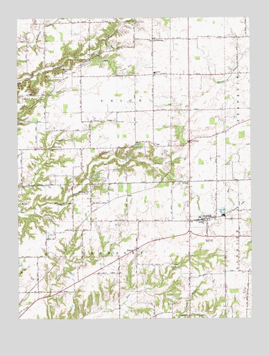
Trafalgar, IN USGS Topographic Map
Click on map above to begin viewing in our Map Viewer.

This topographic map contains these locations and features:
Feature Name Type Latitude Longitude GNIS ID View Map
AnitaPopulated PlaceN39.4259°W86.1914°430180View Map
Beech Grove ChurchChurchN39.4273°W86.2133°430726View Map
Bronson AirportAirportN39.4822°W86.2280°2677078View Map
BudPopulated PlaceN39.4470°W86.1758°431757View Map
Carmen CemeteryCemeteryN39.4950°W86.2058°432151View Map
Christian ChapelChurchN39.4459°W86.2317°432496View Map
Deer CemeteryCemeteryN39.4876°W86.1946°433417View Map
Dollings CemeteryCemeteryN39.4491°W86.1574°433620View Map
Fair Haven ChurchChurchN39.4314°W86.1586°434284View Map
Harris CemeteryCemeteryN39.4767°W86.1888°435779View Map
Kephart FieldAirportN39.4840°W86.1492°2717326View Map
Lick CreekStreamN39.3775°W86.1603°437862View Map
Moore HillSummitN39.4773°W86.2228°439401View Map
Murray LakeReservoirN39.4117°W86.1267°447794View Map
Murray Lake DamDamN39.4117°W86.1267°447793View Map
Pea RidgeRidgeN39.4773°W86.2203°440952View Map
ProvidencePopulated PlaceN39.4909°W86.1767°441616View Map
SamariaPopulated PlaceN39.4039°W86.1864°442947View Map
Shiloh CemeteryCemeteryN39.4569°W86.1969°443385View Map
Simpson CemeteryCemeteryN39.4982°W86.1865°443530View Map
Teeters LakeReservoirN39.4000°W86.1550°447229View Map
Teeters Lake DamDamN39.4000°W86.1550°447230View Map
Town of TrafalgarCivilN39.4132°W86.1496°2397699View Map
Township of HensleyCivilN39.3868°W86.1953°453408View Map
Township of UnionCivilN39.4748°W86.1950°453921View Map
TrafalgarPopulated PlaceN39.4162°W86.1508°444851View Map
Trafalgar Police DepartmentBuildingN39.4101°W86.1536°2758367View Map
Trafalgar Volunteer Fire DepartmentBuildingN39.4161°W86.1496°2626514View Map
Turkey HillSummitN39.4839°W86.1855°444974View Map
Union Elementary SchoolSchoolN39.4775°W86.1769°447486View Map
Watts CemeteryCemeteryN39.4992°W86.1880°445559View Map
WFCI-FM (Franklin)TowerN39.4073°W86.1478°449000View Map
WGTC-FM (Bloomington)TowerN39.4075°W86.1478°448939View Map
WTTV-TV (Bloomington)TowerN39.4073°W86.1478°447013View Map

Note: Coordinates in the location and feature list above are referenced to NAD83 datum.


Copyright (C) 2008-2025 Ryan Niemi / Sunset Dynamics ... All Rights Reserved