TopoQuest Logo
Do you find TopoQuest useful?
Help keep TopoQuest running and adding new maps/features by donating!
Bitcoin:  19c7KJd3qBynnjoSw5npx9KScwjBe4ifkT
Litecoin:  LXs6TkuXGGXo1vDsWCkWVdjQX94eUKd6ui
Home View Maps Find Maps Find Places Resources & Links


Ksanka Peak, Montana Topographic Map

USGS Map Title: Ksanka Peak, MT
USGS Map MRC: 48114H8
DRG (GeoTIFF) Download: o48114h8.tif


Neighboring USGS Topographic Map Quads:


  Eureka North, MT  
48115H1
 

  Ksanka Peak, MT  
48114H8
 

  Stahl Peak, MT  
48114H7
 

  Eureka South, MT  
48115G1
 

  Fortine, MT  
48114G8
 

  Mount Marston, MT  
48114G7


Map MRC Location:

N49°
W115°
N49°
W114°
H8 H7 H6 H5 H4 H3 H2 H1
G8 G7 G6 G5 G4 G3 G2 G1
F8 F7 F6 F5 F4 F3 F2 F1
E8 E7 E6 E5 E4 E3 E2 E1
D8 D7 D6 D5 D4 D3 D2 D1
C8 C7 C6 C5 C4 C3 C2 C1
B8 B7 B6 B5 B4 B3 B2 B1
A8 A7 A6 A5 A4 A3 A2 A1
N48°
W115°
N48°
W114°

Ksanka Peak, MT USGS 1:24K Topographic Map Preview:
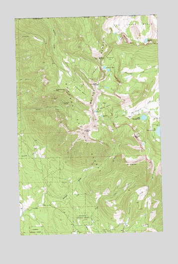
Ksanka Peak, MT USGS Topographic Map
Click on map above to begin viewing in our Map Viewer.

This topographic map contains these locations and features:
Feature Name Type Latitude Longitude GNIS ID View Map
Big Therriault CampgroundLocaleN48.9366°W114.8785°1782389View Map
Big Therriault LakeLakeN48.9328°W114.8764°779886View Map
Bluebird BasinBasinN48.9475°W114.9235°780167View Map
Bluebird CabinLocaleN48.9500°W114.9257°780168View Map
Bluebird LakeLakeN48.9454°W114.9324°780170View Map
Galton RangeRidgeN48.9702°W114.9271°783817View Map
Green MountainSummitN48.9611°W114.9341°784294View Map
Independence MineMineN48.9536°W114.9660°785236View Map
Independence MineMineN48.9536°W114.9652°804116View Map
Independence PeakSummitN48.9591°W114.9668°785240View Map
Ksanka PeakSummitN48.9344°W114.9410°785857View Map
Lemonade SpringsSpringN48.9508°W114.9602°773297View Map
Little Therriault LakeLakeN48.9412°W114.8901°786375View Map
Little Therriault Lake CampgroundLocaleN48.9439°W114.8904°794356View Map
Mount BarnabySummitN48.9144°W114.9038°779371View Map
Paradise LakeLakeN48.9428°W114.9267°788623View Map
Poorman BasinBasinN48.9580°W114.9435°789088View Map
Poorman MountainSummitN48.9764°W114.9291°789090View Map
Saint Clair PeakSummitN48.9302°W114.8979°789930View Map
Ten Lakes BasinBasinN48.9930°W114.8888°791951View Map
Ten Lakes Scenic AreaParkN48.9833°W114.9093°1782397View Map
Twin Peaks MineMineN48.9647°W114.8991°804117View Map
Twin Peaks MineMineN48.9644°W114.9327°792540View Map
Wolverine FlatFlatN48.9741°W114.9182°793471View Map
Wolverine LakesLakeN48.9694°W114.9218°793473View Map

Note: Coordinates in the location and feature list above are referenced to NAD83 datum.


Copyright (C) 2008-2024 Ryan Niemi / Sunset Dynamics ... All Rights Reserved