TopoQuest Logo
Do you find TopoQuest useful?
Help keep TopoQuest running and adding new maps/features by donating!
Bitcoin:  19c7KJd3qBynnjoSw5npx9KScwjBe4ifkT
Litecoin:  LXs6TkuXGGXo1vDsWCkWVdjQX94eUKd6ui
Home View Maps Find Maps Find Places Resources & Links


Stahl Peak, Montana Topographic Map

USGS Map Title: Stahl Peak, MT
USGS Map MRC: 48114H7
DRG (GeoTIFF) Download: o48114h7.tif


Neighboring USGS Topographic Map Quads:


  Ksanka Peak, MT  
48114H8
 

  Stahl Peak, MT  
48114H7
 

  Tuchuck Mountain, MT  
48114H6
 

  Fortine, MT  
48114G8
 

  Mount Marston, MT  
48114G7
 

  Mount Thompson-Seton, MT  
48114G6


Map MRC Location:

N49°
W115°
N49°
W114°
H8 H7 H6 H5 H4 H3 H2 H1
G8 G7 G6 G5 G4 G3 G2 G1
F8 F7 F6 F5 F4 F3 F2 F1
E8 E7 E6 E5 E4 E3 E2 E1
D8 D7 D6 D5 D4 D3 D2 D1
C8 C7 C6 C5 C4 C3 C2 C1
B8 B7 B6 B5 B4 B3 B2 B1
A8 A7 A6 A5 A4 A3 A2 A1
N48°
W115°
N48°
W114°

Stahl Peak, MT USGS 1:24K Topographic Map Preview:
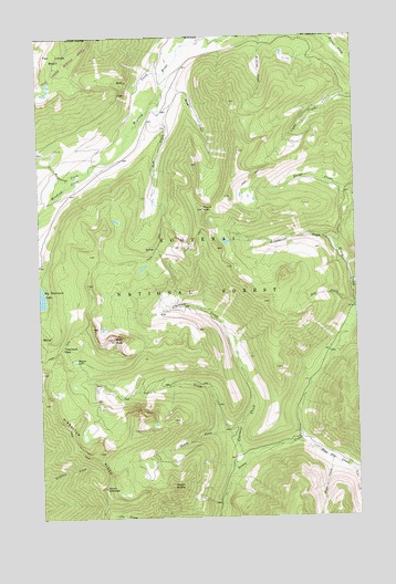
Stahl Peak, MT USGS Topographic Map
Click on map above to begin viewing in our Map Viewer.

This topographic map contains these locations and features:
Feature Name Type Latitude Longitude GNIS ID View Map
Baboon LakeLakeN48.9162°W114.8623°779223View Map
Blue Sky CreekStreamN48.8952°W114.7754°780163View Map
Bluebird CreekStreamN48.9652°W114.8554°780169View Map
Clarence CreekStreamN48.8894°W114.7990°781311View Map
Drip CreekStreamN48.9300°W114.7515°782534View Map
Foundation CreekStreamN48.9439°W114.7574°783636View Map
Grave Creek Snow GageLocaleN48.9122°W114.7679°794383View Map
Jiggs CreekStreamN48.8897°W114.7618°785480View Map
Kopsi CreekStreamN48.8866°W114.7529°785843View Map
Lewis CreekStreamN48.9272°W114.7504°786075View Map
Mount GibralterSummitN48.8827°W114.8510°783923View Map
Mount ScottySummitN48.8836°W114.8243°790163View Map
Mount WamSummitN48.9555°W114.8107°792793View Map
Rich CreekStreamN48.9839°W114.8277°789563View Map
Robin CreekStreamN48.9902°W114.8266°789645View Map
South Fork Clarence CreekStreamN48.8952°W114.7993°790927View Map
Stahl CreekStreamN48.8958°W114.8007°791417View Map
Stahl PeakSummitN48.9214°W114.8463°791418View Map
Stahl Peak Snow GageLocaleN48.9094°W114.8635°794391View Map
Therriault PassGapN48.9197°W114.8671°792060View Map
Wam CreekStreamN48.9883°W114.8271°792792View Map
Weasel Divide Snow GageLocaleN48.9564°W114.7563°794382View Map
Wolverine CreekStreamN48.9652°W114.8554°793469View Map

Note: Coordinates in the location and feature list above are referenced to NAD83 datum.


Copyright (C) 2008-2024 Ryan Niemi / Sunset Dynamics ... All Rights Reserved