TopoQuest Logo
Do you find TopoQuest useful?
Help keep TopoQuest running and adding new maps/features by donating!
Bitcoin:  19c7KJd3qBynnjoSw5npx9KScwjBe4ifkT
Litecoin:  LXs6TkuXGGXo1vDsWCkWVdjQX94eUKd6ui
Home View Maps Find Maps Find Places Resources & Links


Barker, Montana Topographic Map

USGS Map Title: Barker, MT
USGS Map MRC: 47110A6
DRG (GeoTIFF) Download: o47110a6.tif


Neighboring USGS Topographic Map Quads:


  Monarch NE, MT  
47110B7
 

  Limestone Butte, MT  
47110B6
 

  The Arch, MT  
47110B5
 

  Monarch, MT  
47110A7
 

  Barker, MT  
47110A6
 

  Mixes Baldy, MT  
47110A5
 

  Belt Park Butte, MT  
46110H7
 

  Neihart, MT  
46110H6
 

  Yogo Peak, MT  
46110H5


Map MRC Location:

N48°
W111°
N48°
W110°
H8 H7 H6 H5 H4 H3 H2 H1
G8 G7 G6 G5 G4 G3 G2 G1
F8 F7 F6 F5 F4 F3 F2 F1
E8 E7 E6 E5 E4 E3 E2 E1
D8 D7 D6 D5 D4 D3 D2 D1
C8 C7 C6 C5 C4 C3 C2 C1
B8 B7 B6 B5 B4 B3 B2 B1
A8 A7 A6 A5 A4 A3 A2 A1
N47°
W111°
N47°
W110°

Barker, MT USGS 1:24K Topographic Map Preview:
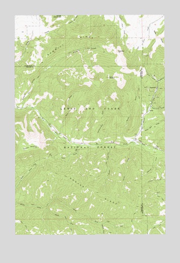
Barker, MT USGS Topographic Map
Click on map above to begin viewing in our Map Viewer.

This topographic map contains these locations and features:
Feature Name Type Latitude Longitude GNIS ID View Map
BarkerPopulated PlaceN47.0714°W110.6405°802011View Map
Barker CemeteryCemeteryN47.0522°W110.6458°779360View Map
Barker MineMineN47.0819°W110.6360°803636View Map
Barker MountainSummitN47.0894°W110.6730°779362View Map
Barker Post Office (historical)Post OfficeN47.0714°W110.6405°1762380View Map
Barker School (historical)SchoolN47.0714°W110.6405°1750683View Map
Belfont/Harrison MineMineN47.0883°W110.6263°803642View Map
Belt/Grace/Marcelline MineMineN47.0797°W110.6341°803617View Map
Bend Gulch CreekStreamN47.0725°W110.6380°779687View Map
Bender CreekStreamN47.0522°W110.6719°779689View Map
Block P Powder Magazine MineMineN47.0825°W110.6319°803626View Map
Block P TailingsMineN47.0555°W110.6497°802721View Map
Bon Ton MineMineN47.0827°W110.6485°802725View Map
Centerville (historical)Populated PlaceN47.0597°W110.6458°1762451View Map
Charcoal CreekStreamN47.0489°W110.6355°781160View Map
Daisy CreekStreamN47.0858°W110.6313°782048View Map
Edwards MineMineN47.0819°W110.6385°803628View Map
Fairplay MineMineN47.0841°W110.6480°802726View Map
Finn CreekStreamN47.0566°W110.7152°783395View Map
Galena (historical)LocaleN47.0777°W110.6341°1750762View Map
Galena CreekStreamN47.0530°W110.6544°783800View Map
Gold Run CreekStreamN47.0597°W110.6458°784069View Map
Green CreekStreamN47.0866°W110.6308°784274View Map
Grey Eagle MineMineN47.0833°W110.6299°803621View Map
Henn GulchValleyN47.0500°W110.6991°784778View Map
Hoover RidgeRidgeN47.0244°W110.6869°784998View Map
HughesvillePopulated PlaceN47.0833°W110.6324°802123View Map
Hughesville (historical)LocaleN47.0833°W110.6324°1750744View Map
Hughesville Post Office (historical)Post OfficeN47.0833°W110.6324°1750613View Map
Hughesville School (historical)SchoolN47.0833°W110.6324°1750681View Map
Irene PeakSummitN47.1041°W110.6652°785306View Map
Leadville (historical)LocaleN47.0777°W110.6369°1750740View Map
M T A MineMineN47.0819°W110.6305°803622View Map
Marcelline MineMineN47.0797°W110.6352°803604View Map
May MineMineN47.0905°W110.6433°803619View Map
McKay GulchValleyN47.0522°W110.6566°787075View Map
McKay MineMineN47.0761°W110.6455°802727View Map
Middle Fork Hoover CreekStreamN47.0064°W110.6794°787277View Map
MS 3048 MineMineN47.0602°W110.6444°803606View Map
Myrtle Navy MineMineN47.0739°W110.6374°803605View Map
NE NE Section 30 MineMineN47.0377°W110.6266°803634View Map
NE SE Section 7 MineMineN47.0744°W110.6341°803624View Map
Nebel CouleeValleyN47.1180°W110.6377°787918View Map
North Fork Hoover CreekStreamN47.0158°W110.7261°788184View Map
NW NE Section 31 MineMineN47.0233°W110.6285°803637View Map
NW SW Section 7 MineMineN47.0758°W110.6419°803613View Map
Otter MountainSummitN47.1239°W110.7113°788796View Map
Paragon MineMineN47.0944°W110.6402°803623View Map
Pride of the West MineMineN47.0705°W110.6435°803616View Map
Puzzler MineMineN47.0961°W110.6374°803620View Map
Sawmill CreekStreamN47.0719°W110.7452°790053View Map
Sawmill RidgeRidgeN47.1108°W110.7091°790079View Map
SE SE Section 1 MineMineN47.0822°W110.6499°802722View Map
Servoss MountainSummitN47.0500°W110.7344°790239View Map
Setter Post Office (historical)Post OfficeN47.0541°W110.6522°1762464View Map
Smelter MineMineN47.0911°W110.6405°803618View Map
Smoke-in-Hole CreekStreamN47.0519°W110.6785°790742View Map
South Fork Hoover CreekStreamN47.0158°W110.7261°790982View Map
Spruce CreekStreamN47.0525°W110.6513°791334View Map
Summit (historical)LocaleN47.1180°W110.7174°1750594View Map
SW NE Section 1 MineMineN47.0905°W110.6516°802708View Map
SW NW Section 06 MineMineN47.0902°W110.6441°803608View Map
SW SE Section 30 MineMineN47.0252°W110.6333°803633View Map
SW SE Section 7 MineMineN47.0722°W110.6310°803643View Map
Vista/NW NW Section 6 MineMineN47.0966°W110.6422°803625View Map
Wright Lode MineMineN47.0841°W110.6405°803627View Map

Note: Coordinates in the location and feature list above are referenced to NAD83 datum.


Copyright (C) 2008-2025 Ryan Niemi / Sunset Dynamics ... All Rights Reserved