TopoQuest Logo
Do you find TopoQuest useful?
Help keep TopoQuest running and adding new maps/features by donating!
Bitcoin:  19c7KJd3qBynnjoSw5npx9KScwjBe4ifkT
Litecoin:  LXs6TkuXGGXo1vDsWCkWVdjQX94eUKd6ui
Home View Maps Find Maps Find Places Resources & Links


Neihart, Montana Topographic Map

USGS Map Title: Neihart, MT
USGS Map MRC: 46110H6
DRG (GeoTIFF) Download: o46110h6.tif


Neighboring USGS Topographic Map Quads:


  Monarch, MT  
47110A7
 

  Barker, MT  
47110A6
 

  Mixes Baldy, MT  
47110A5
 

  Belt Park Butte, MT  
46110H7
 

  Neihart, MT  
46110H6
 

  Yogo Peak, MT  
46110H5
 

  Moose Mountain, MT  
46110G7
 

  Kings Hill, MT  
46110G6
 

  Sand Point, MT  
46110G5


Map MRC Location:

N47°
W111°
N47°
W110°
H8 H7 H6 H5 H4 H3 H2 H1
G8 G7 G6 G5 G4 G3 G2 G1
F8 F7 F6 F5 F4 F3 F2 F1
E8 E7 E6 E5 E4 E3 E2 E1
D8 D7 D6 D5 D4 D3 D2 D1
C8 C7 C6 C5 C4 C3 C2 C1
B8 B7 B6 B5 B4 B3 B2 B1
A8 A7 A6 A5 A4 A3 A2 A1
N46°
W111°
N46°
W110°

Neihart, MT USGS 1:24K Topographic Map Preview:
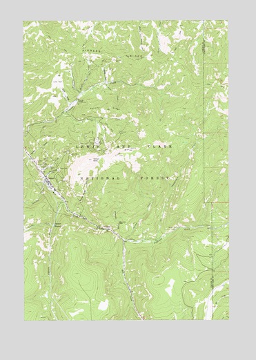
Neihart, MT USGS Topographic Map
Click on map above to begin viewing in our Map Viewer.

This topographic map contains these locations and features:
Feature Name Type Latitude Longitude GNIS ID View Map
14N48E29ADCA01 WellWellN46.9419°W110.6666°819531View Map
Atlantus MineMineN46.9372°W110.7297°802744View Map
Baker MineMineN46.9775°W110.7119°802811View Map
Big Seven MineMineN46.9486°W110.7049°802787View Map
Big Seven MineMineN46.9489°W110.7058°779869View Map
Big Seven Mine School (historical)SchoolN46.9486°W110.7077°1761929View Map
Big Snowy Number 4 MineMineN46.9444°W110.7002°802792View Map
Black Diamond Jay MineMineN46.9555°W110.6994°802777View Map
Blotter MineMineN46.9805°W110.7049°802767View Map
Broadwater MinesMineN46.9327°W110.7285°780422View Map
Bull of the Woods MineMineN46.9316°W110.7188°802753View Map
Burg CreekStreamN46.9739°W110.7008°780611View Map
Carpenter Creek TailingMineN46.9666°W110.7177°802734View Map
Chamberlain CreekStreamN46.9080°W110.6708°781149View Map
Compromise GulchValleyN46.9350°W110.7377°781553View Map
Compromise MineMineN46.9377°W110.7355°802731View Map
Concentrated MineMineN46.9422°W110.7444°802736View Map
Cornucopia MineMineN46.9547°W110.6916°802778View Map
Cornucopia MineMineN46.9539°W110.6919°781682View Map
Cowboy MineMineN46.9686°W110.7269°802735View Map
Cumberland MineMineN46.9402°W110.7363°802755View Map
Dacotah MineMineN46.9458°W110.7241°802752View Map
Dickens MineMineN46.9008°W110.7252°802730View Map
Emma MineMineN46.9786°W110.7019°802775View Map
Empire MineMineN46.9380°W110.7324°802759View Map
Evening Star MineMineN46.9441°W110.7469°802718View Map
Fairplay MineMineN46.9455°W110.7202°802743View Map
Florence MineMineN46.9414°W110.7422°783553View Map
Florence MineMineN46.9425°W110.7413°802712View Map
Florence Mine (historical)LocaleN46.9416°W110.7438°1762388View Map
Frisco Number 2 MineMineN46.9294°W110.7352°802745View Map
Graham and Hollowbush MineMineN46.9255°W110.7274°802748View Map
Hartley MineMineN46.9380°W110.7288°784599View Map
Haystack CreekStreamN46.9691°W110.7163°784669View Map
Haystack Creek MineMineN46.9783°W110.7205°802810View Map
Heganer (historical)LocaleN46.9791°W110.7091°1762368View Map
Hidden CanyonValleyN46.9114°W110.6949°794002View Map
Hidden Treasure MineMineN46.9344°W110.7297°802728View Map
Huchinson MineMineN46.9591°W110.7033°802808View Map
Hunter MineMineN46.9716°W110.7016°802774View Map
Jefferson CreekStreamN46.9086°W110.6897°785439View Map
Jennie Whipple MineMineN46.9455°W110.7041°802785View Map
Jennie Whipple Number 2 MineMineN46.9450°W110.7049°802790View Map
Jennie Whipple Number 3 MineMineN46.9433°W110.7049°802791View Map
Johnston CreekStreamN46.9327°W110.7380°785551View Map
Keegan MineMineN46.9336°W110.7352°802729View Map
Kings Hill CampLocaleN46.9133°W110.7049°785754View Map
Last Chance MineMineN46.9350°W110.7394°802763View Map
Lewis and Clark National Forest - Jefferson DivisionForestN46.9166°W110.6341°1851866View Map
Lexington Number 1 MineMineN46.9450°W110.7105°802795View Map
Lexington Number 2 MineMineN46.9458°W110.7105°802796View Map
Lexington Number 3 MineMineN46.9466°W110.7105°802797View Map
Lexington Number 4 MineMineN46.9472°W110.7105°802798View Map
Lizze MineMineN46.9450°W110.7283°802762View Map
Long MountainSummitN46.9436°W110.6922°786534View Map
Lower Big Snowy MineMineN46.9464°W110.7019°802783View Map
Lower Black Diamond MineMineN46.9550°W110.7008°802805View Map
Lower Champion MineMineN46.9452°W110.7269°802761View Map
Lower I X L MineMineN46.9522°W110.7127°802801View Map
Lower Rebellion MineMineN46.9500°W110.7008°802789View Map
Lower West Eureka MineMineN46.9519°W110.7141°802803View Map
Lucky Strike MineMineN46.9491°W110.7160°802800View Map
Lucy CreekStreamN46.9639°W110.7219°786708View Map
Lucy ParkFlatN46.9750°W110.7299°786709View Map
Mackay CreekStreamN46.9694°W110.7158°786753View Map
Many Pines CampgroundLocaleN46.8989°W110.6880°794003View Map
Mattie MineMineN46.9755°W110.6899°802770View Map
Maud S MineMineN46.9402°W110.7224°802760View Map
Memorial CreekStreamN46.9127°W110.6969°787182View Map
Memorial FallsFallsN46.9154°W110.6929°787183View Map
Middle Lexington Number 2 MineMineN46.9594°W110.7013°802807View Map
Molton MineMineN46.9391°W110.7341°802715View Map
Molton MineMineN46.9389°W110.7344°787546View Map
Monarch MineMineN46.9436°W110.7424°802740View Map
Montezuma (historical)LocaleN46.9605°W110.7258°1762340View Map
MS 3489 MineMineN46.9275°W110.7397°802724View Map
Narrow Gauge GulchValleyN46.9202°W110.7205°787912View Map
NeihartPopulated PlaceN46.9333°W110.7358°787933View Map
Neihart (historical)LocaleN46.9333°W110.7358°1762339View Map
Neihart BaldySummitN46.9419°W110.7088°787934View Map
Neihart Post OfficePost OfficeN46.9319°W110.7344°1762338View Map
Neihart ReservoirReservoirN46.9149°W110.7322°787936View Map
Neihart TailingsMineN46.9416°W110.7452°802765View Map
Neihart Volunteer Fire DepartmentBuildingN46.9330°W110.7357°2546753View Map
Nellie L MineMineN46.9269°W110.7305°802750View Map
NW NE Section 10 MineMineN46.9083°W110.6835°802707View Map
NW SW Section 29 MineMineN46.9450°W110.7358°802758View Map
O'Brien CreekStreamN46.9244°W110.7255°788358View Map
Old Crow MineMineN46.9736°W110.7133°802776View Map
Ontario MineMineN46.9500°W110.6930°802779View Map
Palisade CreekStreamN46.9086°W110.6888°788598View Map
Pioneer RidgeRidgeN46.9861°W110.6941°788940View Map
Poverty RidgeRidgeN46.9630°W110.7030°789152View Map
Queen of the Hills MineMineN46.9386°W110.7410°802716View Map
Queen of the Hills MineMineN46.9389°W110.7410°789288View Map
Queen of the Hills Mine Spur (historical)LocaleN46.9397°W110.7424°1762469View Map
Ripple MineMineN46.9464°W110.6994°802780View Map
Ripple Number 2 MineMineN46.9464°W110.6985°802786View Map
Ripple Number 3 MineMineN46.9452°W110.6985°802794View Map
Ripple Number 4 MineMineN46.9444°W110.6980°802793View Map
Rochester MineMineN46.9400°W110.7302°802741View Map
Rock CreekStreamN46.9372°W110.7408°789664View Map
Savage MineMineN46.9805°W110.7008°802772View Map
Sherman Number 2 MineMineN46.9741°W110.6985°802771View Map
Sherman Number 2 MineMineN46.9730°W110.6997°802773View Map
Shorty CreekStreamN46.9147°W110.7322°790451View Map
Sih-mem CreekStreamN46.9739°W110.7011°791372View Map
Silver Belt MineMineN46.9441°W110.7216°790494View Map
Silver Dyke (historical)LocaleN46.9833°W110.6952°1762429View Map
Silver Dyke Adit MineMineN46.9825°W110.6974°802766View Map
Silver Dyke MillsiteMineN46.9783°W110.6994°802769View Map
Silver Dyke MineMineN46.9833°W110.6955°790513View Map
Silver Dyke TailingsMineN46.9755°W110.6960°802768View Map
Silver King MineMineN46.9341°W110.7388°802723View Map
Silver Safe MineMineN46.9286°W110.7327°802749View Map
Snow CreekStreamN46.9616°W110.7266°790771View Map
Speculation MineMineN46.9322°W110.7380°802746View Map
Spokane MineMineN46.9469°W110.7024°802784View Map
Spotted MineMineN46.9480°W110.7160°802799View Map
Spring GulchValleyN46.9433°W110.7460°791294View Map
Stallabrass MineMineN46.9197°W110.7241°802751View Map
Star MineMineN46.9441°W110.7466°791446View Map
The Devils ChairLocaleN46.9139°W110.6980°792032View Map
Town of NeihartCivilN46.9352°W110.7361°2413038View Map
Turkey Mountain MineMineN46.9172°W110.7133°802764View Map
Upper Big Snowy MineMineN46.9455°W110.7016°802782View Map
Upper Blue Cloud MineMineN46.9472°W110.6994°802781View Map
Upper Champion MineMineN46.9466°W110.7258°802747View Map
Upper Lexington Number 2 MineMineN46.9589°W110.7022°802806View Map
Upper Rebellion MineMineN46.9480°W110.7044°802788View Map
Upper Snow Creek MineMineN46.9500°W110.7019°802804View Map
Upper West Eureka MineMineN46.9508°W110.7133°802802View Map
Vilipa MineMineN46.9752°W110.7119°802711View Map
White Elephant Number 1 MineMineN46.9597°W110.7094°802809View Map
Win-O-Ki CampLocaleN46.9136°W110.6572°793397View Map

Note: Coordinates in the location and feature list above are referenced to NAD83 datum.


Copyright (C) 2008-2025 Ryan Niemi / Sunset Dynamics ... All Rights Reserved