TopoQuest Logo
Do you find TopoQuest useful?
Help keep TopoQuest running and adding new maps/features by donating!
Bitcoin:  19c7KJd3qBynnjoSw5npx9KScwjBe4ifkT
Litecoin:  LXs6TkuXGGXo1vDsWCkWVdjQX94eUKd6ui
Home View Maps Find Maps Find Places Resources & Links


La Jara, Colorado Topographic Map

USGS Map Title: La Jara, CO
USGS Map MRC: 37105C8
DRG (GeoTIFF) Download: o37105c8.tif


Neighboring USGS Topographic Map Quads:


  Waverly, CO  
37106D1
 

  Alamosa West, CO  
37105D8
 

  Alamosa East, CO  
37105D7
 

  Capulin, CO  
37106C1
 

  La Jara, CO  
37105C8
 

  Pikes Stockade, CO  
37105C7
 

  Goshawk Dam, CO  
37106B1
 

  Manassa, CO  
37105B8
 

  Manassa NE, CO  
37105B7


Map MRC Location:

N38°
W106°
N38°
W105°
H8 H7 H6 H5 H4 H3 H2 H1
G8 G7 G6 G5 G4 G3 G2 G1
F8 F7 F6 F5 F4 F3 F2 F1
E8 E7 E6 E5 E4 E3 E2 E1
D8 D7 D6 D5 D4 D3 D2 D1
C8 C7 C6 C5 C4 C3 C2 C1
B8 B7 B6 B5 B4 B3 B2 B1
A8 A7 A6 A5 A4 A3 A2 A1
N37°
W106°
N37°
W105°

La Jara, CO USGS 1:24K Topographic Map Preview:
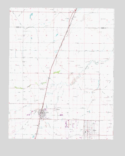
La Jara, CO USGS Topographic Map
Click on map above to begin viewing in our Map Viewer.

This topographic map contains these locations and features:
Feature Name Type Latitude Longitude GNIS ID View Map
Church of Jesus Christ of Latter - day SaintsChurchN37.2574°W105.9060°2696385View Map
Conejos County HospitalHospitalN37.2629°W105.9656°2025556View Map
Empire LateralCanalN37.3736°W105.9172°203622View Map
EstrellaPopulated PlaceN37.3661°W105.9245°192916View Map
First Presbyterian ChurchChurchN37.2718°W105.9596°2696370View Map
La JaraPopulated PlaceN37.2750°W105.9603°204783View Map
La Jara ArroyoStreamN37.3025°W105.9345°190793View Map
La Jara CemeteryCemeteryN37.2976°W105.9617°192915View Map
La Jara DivisionCivilN37.2890°W105.9275°1935502View Map
La Jara Elementary SchoolSchoolN37.2747°W105.9572°2025554View Map
La Jara Fire DepartmentBuildingN37.2704°W105.9613°2667019View Map
La Jara Police DepartmentBuildingN37.2737°W105.9604°2696613View Map
La Jara Post OfficePost OfficeN37.2748°W105.9581°2734572View Map
Lama Airfield (historical)AirportN37.2608°W105.9292°192913View Map
Lowland DitchCanalN37.3129°W105.9419°2723359View Map
Northwest Conejos Fire Protection DistrictBuildingN37.2568°W105.9052°2666958View Map
RichfieldPopulated PlaceN37.2778°W105.9450°192914View Map
San Luis DitchCanalN37.2647°W105.9172°203636View Map
SanfordPopulated PlaceN37.2583°W105.9047°203638View Map
Sanford DitchCanalN37.2583°W105.9097°203639View Map
Sanford Post OfficePost OfficeN37.2564°W105.9053°2734575View Map
Sanford School K - 12SchoolN37.2576°W105.9083°2035925View Map
Stout Creek LakesLakeN37.3520°W105.8900°191634View Map
Town of La JaraCivilN37.2736°W105.9598°2412855View Map
Town of SanfordCivilN37.2574°W105.9007°2413256View Map
Weist DitchCanalN37.2991°W105.9930°2724402View Map
West Branch Richfield CanalCanalN37.2722°W105.9572°192912View Map

Note: Coordinates in the location and feature list above are referenced to NAD83 datum.


Copyright (C) 2008-2025 Ryan Niemi / Sunset Dynamics ... All Rights Reserved