TopoQuest Logo
Do you find TopoQuest useful?
Help keep TopoQuest running and adding new maps/features by donating!
Bitcoin:  19c7KJd3qBynnjoSw5npx9KScwjBe4ifkT
Litecoin:  LXs6TkuXGGXo1vDsWCkWVdjQX94eUKd6ui
Home View Maps Find Maps Find Places Resources & Links


Capulin, Colorado Topographic Map

USGS Map Title: Capulin, CO
USGS Map MRC: 37106C1
DRG (GeoTIFF) Download: o37106c1.tif


Neighboring USGS Topographic Map Quads:


  Fulcher Gulch, CO  
37106D2
 

  Waverly, CO  
37106D1
 

  Alamosa West, CO  
37105D8
 

  Centro, CO  
37106C2
 

  Capulin, CO  
37106C1
 

  La Jara, CO  
37105C8
 

  Vicente Canyon, CO  
37106B2
 

  Goshawk Dam, CO  
37106B1
 

  Manassa, CO  
37105B8


Map MRC Location:

N38°
W107°
N38°
W106°
H8 H7 H6 H5 H4 H3 H2 H1
G8 G7 G6 G5 G4 G3 G2 G1
F8 F7 F6 F5 F4 F3 F2 F1
E8 E7 E6 E5 E4 E3 E2 E1
D8 D7 D6 D5 D4 D3 D2 D1
C8 C7 C6 C5 C4 C3 C2 C1
B8 B7 B6 B5 B4 B3 B2 B1
A8 A7 A6 A5 A4 A3 A2 A1
N37°
W107°
N37°
W106°

Capulin, CO USGS 1:24K Topographic Map Preview:
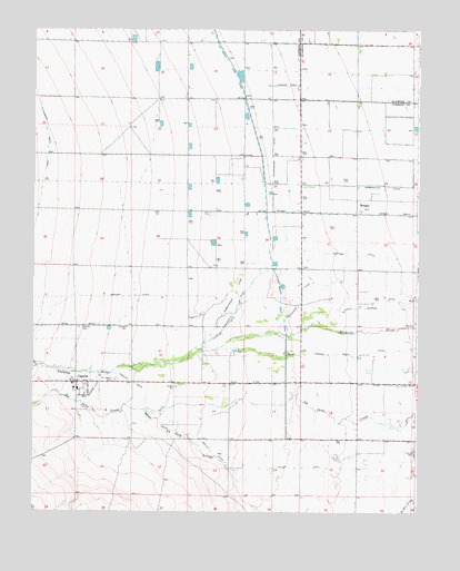
Capulin, CO USGS Topographic Map
Click on map above to begin viewing in our Map Viewer.

This topographic map contains these locations and features:
Feature Name Type Latitude Longitude GNIS ID View Map
CapulinPopulated PlaceN37.2839°W106.1114°190796View Map
Capulin CemeteryCemeteryN37.2977°W106.1106°190798View Map
Capulin Census Designated PlaceCensusN37.2819°W106.1049°2583218View Map
Capulin DitchCanalN37.2750°W106.0825°190794View Map
Capulin Post OfficePost OfficeN37.2837°W106.1115°2750996View Map
Carmel Fire DepartmentBuildingN37.3421°W106.0384°2667028View Map
Cottonwood DitchCanalN37.3008°W106.0422°190801View Map
Flintham DitchCanalN37.3128°W106.0478°190799View Map
L D Eskridge Irrigation DitchCanalN37.2524°W106.0022°2723095View Map
Miller DitchCanalN37.2611°W106.0589°190792View Map
MorganPopulated PlaceN37.3278°W106.0200°190802View Map
Morgan DrainCanalN37.3278°W106.0339°203483View Map
Morganville DitchCanalN37.3345°W106.0089°203484View Map
New Exchange DitchCanalN37.2806°W106.1067°190795View Map
Norland DitchCanalN37.3061°W106.1089°203481View Map
North Alamosa DitchCanalN37.3028°W106.0228°203485View Map
Northwest Conejos County Fire District Capulin Fire DepartmentBuildingN37.2828°W106.1108°2667027View Map
Saint Joseph Catholic Church CapulinChurchN37.2820°W106.1117°2696361View Map
Saint Joseph CemeteryCemeteryN37.2842°W106.0986°190797View Map
Scandinavian DitchCanalN37.3167°W106.0522°190800View Map
Spring Creek DitchCanalN37.2917°W106.0164°203486View Map
Union DitchCanalN37.2842°W106.0339°203482View Map
Viejo DitchCanalN37.2983°W106.1172°203480View Map

Note: Coordinates in the location and feature list above are referenced to NAD83 datum.


Copyright (C) 2008-2024 Ryan Niemi / Sunset Dynamics ... All Rights Reserved