TopoQuest Logo
Do you find TopoQuest useful?
Help keep TopoQuest running and adding new maps/features by donating!
Bitcoin:  19c7KJd3qBynnjoSw5npx9KScwjBe4ifkT
Litecoin:  LXs6TkuXGGXo1vDsWCkWVdjQX94eUKd6ui
Home View Maps Find Maps Find Places Resources & Links


Barkman, Texas Topographic Map

USGS Map Title: Barkman, TX
USGS Map MRC: 33094E2
DRG (GeoTIFF) Download: o33094e2.tif


Neighboring USGS Topographic Map Quads:


  Arden, AR  
33094F3
 

  Ashdown West, AR  
33094F2
 

  Ashdown East, AR  
33094F1
 

  Redbank, TX  
33094E3
 

  Barkman, TX  
33094E2
 

  Ogden, AR  
33094E1
 

  Hooks, TX  
33094D3
 

  Leary, TX  
33094D2
 

  Texarkana, TX  
33094D1


Map MRC Location:

N34°
W95°
N34°
W94°
H8 H7 H6 H5 H4 H3 H2 H1
G8 G7 G6 G5 G4 G3 G2 G1
F8 F7 F6 F5 F4 F3 F2 F1
E8 E7 E6 E5 E4 E3 E2 E1
D8 D7 D6 D5 D4 D3 D2 D1
C8 C7 C6 C5 C4 C3 C2 C1
B8 B7 B6 B5 B4 B3 B2 B1
A8 A7 A6 A5 A4 A3 A2 A1
N33°
W95°
N33°
W94°

Barkman, TX USGS 1:24K Topographic Map Preview:
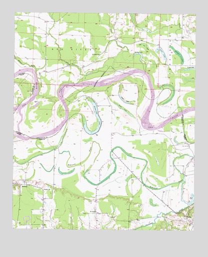
Barkman, TX USGS Topographic Map
Click on map above to begin viewing in our Map Viewer.

This topographic map contains these locations and features:
Feature Name Type Latitude Longitude GNIS ID View Map
Allen CreekStreamN33.5915°W94.1599°45833View Map
BarkmanPopulated PlaceN33.5254°W94.2444°1379390View Map
Barkman CreekStreamN33.5293°W94.1327°1372394View Map
Bull CreekStreamN33.5929°W94.1663°47167View Map
Clear Lake CemeteryCemeteryN33.5487°W94.1285°1354641View Map
Everett ChurchChurchN33.5226°W94.2288°1357112View Map
Grassy LakeSwampN33.6018°W94.1366°49575View Map
Jim Lee LakeSwampN33.6071°W94.1602°50651View Map
King LakeLakeN33.5164°W94.1254°1360664View Map
Mount Zion ChurchChurchN33.5101°W94.1927°1363366View Map
Murl BranchStreamN33.6162°W94.1366°52552View Map
Old River LakeLakeN33.6022°W94.1649°70365View Map
Pine PrairiePopulated PlaceN33.6071°W94.1502°60157View Map
Red BankPopulated PlaceN33.5254°W94.2427°2034796View Map
Roseborough LakeLakeN33.5560°W94.1958°70373View Map
Rush LakeLakeN33.5694°W94.1741°1367021View Map
Saint Luke Baptist ChurchChurchN33.6010°W94.1916°78250View Map
Saint Lukes CemeteryCemeteryN33.6012°W94.1916°60176View Map
Scott LakeLakeN33.6030°W94.1488°78305View Map
Smith LakeLakeN33.5739°W94.1730°1368493View Map
The Old SagSwampN33.6154°W94.1599°55515View Map
Township of Red RiverCivilN33.6138°W94.2346°66842View Map
Trailer LakeLakeN33.5934°W94.1286°70381View Map
Walnut BayouStreamN33.5898°W94.2349°73993View Map
WambaPopulated PlaceN33.5060°W94.1288°1370842View Map

Note: Coordinates in the location and feature list above are referenced to NAD83 datum.


Copyright (C) 2008-2024 Ryan Niemi / Sunset Dynamics ... All Rights Reserved