TopoQuest Logo
Do you find TopoQuest useful?
Help keep TopoQuest running and adding new maps/features by donating!
Bitcoin:  19c7KJd3qBynnjoSw5npx9KScwjBe4ifkT
Litecoin:  LXs6TkuXGGXo1vDsWCkWVdjQX94eUKd6ui
Home View Maps Find Maps Find Places Resources & Links


La Sal West, Utah Topographic Map

USGS Map Title: La Sal West, UT
USGS Map MRC: 38109C3
DRG (GeoTIFF) Download: o38109c3.tif


Neighboring USGS Topographic Map Quads:


  Kane Springs, UT  
38109D4
 

  Mount Tukuhnikivatz, UT  
38109D3
 

  Mount Peale, UT  
38109D2
 

  La Sal Junction, UT  
38109C4
 

  La Sal West, UT  
38109C3
 

  La Sal East, UT  
38109C2
 

  Hatch Rock, UT  
38109B4
 

  Sandstone Draw, UT  
38109B3
 

  Lisbon Valley, UT  
38109B2


Map MRC Location:

N39°
W110°
N39°
W109°
H8 H7 H6 H5 H4 H3 H2 H1
G8 G7 G6 G5 G4 G3 G2 G1
F8 F7 F6 F5 F4 F3 F2 F1
E8 E7 E6 E5 E4 E3 E2 E1
D8 D7 D6 D5 D4 D3 D2 D1
C8 C7 C6 C5 C4 C3 C2 C1
B8 B7 B6 B5 B4 B3 B2 B1
A8 A7 A6 A5 A4 A3 A2 A1
N38°
W110°
N38°
W109°

La Sal West, UT USGS 1:24K Topographic Map Preview:
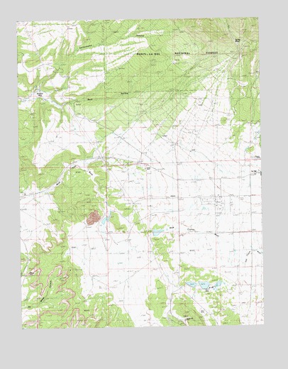
La Sal West, UT USGS Topographic Map
Click on map above to begin viewing in our Map Viewer.

This topographic map contains these locations and features:
Feature Name Type Latitude Longitude GNIS ID View Map
Alice MineMineN38.2553°W109.2809°1448060View Map
Beaver ShaftMineN38.3178°W109.2512°1448122View Map
Browns HoleBasinN38.3461°W109.3632°1439173View Map
Buck HollowValleyN38.3433°W109.3729°1439220View Map
Cottonwood CanyonValleyN38.3467°W109.3651°1439988View Map
Hecla ShaftMineN38.3144°W109.3104°1448461View Map
Homestake MineMineN38.2528°W109.2907°1448484View Map
La Sal CemeteryCemeteryN38.3091°W109.2610°1448561View Map
La Sal Census Designated PlaceCensusN38.3025°W109.2646°2408517View Map
La Sal Elementary SchoolSchoolN38.3129°W109.2522°1442381View Map
La Sal Post OfficePost OfficeN38.3126°W109.2501°1455359View Map
Lackey BasinValleyN38.3550°W109.2657°1442388View Map
Lisbon MineMineN38.2650°W109.2826°1448599View Map
Lower Bankhead DamDamN38.2950°W109.3298°1447695View Map
Lower Bankhead ReservoirReservoirN38.2937°W109.3318°1447694View Map
Rattlesnake Ranch Number Two DamDamN38.2883°W109.3071°1447693View Map
Rattlesnake Ranch Number Two ReservoirReservoirN38.2884°W109.3050°1447692View Map
Rio Algom Lower Tailings PondReservoirN38.2672°W109.2881°1447686View Map
Rio Algom Lower Tailings Pond DamDamN38.2667°W109.2890°1447687View Map
Rio Algom Upper Tailings PondReservoirN38.2664°W109.2818°1447684View Map
Rio Algom Upper Tailings Pond DamDamN38.2667°W109.2832°1447685View Map
San Juan Emergency Medical Services - La SalBuildingN38.3069°W109.2721°2768479View Map
San Juan Fire Department - La SalBuildingN38.3070°W109.2721°2627430View Map
The Church of Jesus Christ of Latter Day SaintsChurchN38.3125°W109.2548°1450788View Map
Upper Bankhead DamDamN38.2972°W109.3290°1447699View Map
Upper Bankhead ReservoirReservoirN38.2962°W109.3291°1447698View Map
Upper Rattlesnake Ranch Number One ReservoirReservoirN38.2895°W109.2999°1447690View Map
Wilson ArchArchN38.2725°W109.3712°1450554View Map

Note: Coordinates in the location and feature list above are referenced to NAD83 datum.


Copyright (C) 2008-2025 Ryan Niemi / Sunset Dynamics ... All Rights Reserved