TopoQuest Logo
Do you find TopoQuest useful?
Help keep TopoQuest running and adding new maps/features by donating!
Bitcoin:  19c7KJd3qBynnjoSw5npx9KScwjBe4ifkT
Litecoin:  LXs6TkuXGGXo1vDsWCkWVdjQX94eUKd6ui
Home View Maps Find Maps Find Places Resources & Links


Sandstone Draw, Utah Topographic Map

USGS Map Title: Sandstone Draw, UT
USGS Map MRC: 38109B3
DRG (GeoTIFF) Download: o38109b3.tif


Neighboring USGS Topographic Map Quads:


  La Sal Junction, UT  
38109C4
 

  La Sal West, UT  
38109C3
 

  La Sal East, UT  
38109C2
 

  Hatch Rock, UT  
38109B4
 

  Sandstone Draw, UT  
38109B3
 

  Lisbon Valley, UT  
38109B2
 

  Photograph Gap, UT  
38109A4
 

  Church Rock, UT  
38109A3
 

  Sop Canyon, UT  
38109A2


Map MRC Location:

N39°
W110°
N39°
W109°
H8 H7 H6 H5 H4 H3 H2 H1
G8 G7 G6 G5 G4 G3 G2 G1
F8 F7 F6 F5 F4 F3 F2 F1
E8 E7 E6 E5 E4 E3 E2 E1
D8 D7 D6 D5 D4 D3 D2 D1
C8 C7 C6 C5 C4 C3 C2 C1
B8 B7 B6 B5 B4 B3 B2 B1
A8 A7 A6 A5 A4 A3 A2 A1
N38°
W110°
N38°
W109°

Sandstone Draw, UT USGS 1:24K Topographic Map Preview:
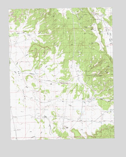
Sandstone Draw, UT USGS Topographic Map
Click on map above to begin viewing in our Map Viewer.

This topographic map contains these locations and features:
Feature Name Type Latitude Longitude GNIS ID View Map
Big Buck MineMineN38.1878°W109.2593°1425462View Map
Big Indian MineMineN38.2419°W109.2640°1425517View Map
Big Indian WashValleyN38.1542°W109.3357°1425520View Map
Casa Colorado RockPillarN38.1786°W109.3137°1426368View Map
Dry WashValleyN38.1522°W109.2559°1427594View Map
Homestake MineMineN38.2308°W109.2809°1428794View Map
La Sal Number 2 MineMineN38.2255°W109.2651°1435835View Map
Lightning DrawValleyN38.1380°W109.3287°1429609View Map
Lisbon Oil FieldOilfieldN38.1730°W109.2796°1435867View Map
Little Beaver MineMineN38.1855°W109.2679°1429675View Map
Lopez ArchArchN38.2414°W109.3743°1435896View Map
Lopez GulchValleyN38.1936°W109.3715°1429936View Map
McCormic MineMineN38.1928°W109.2548°1436018View Map
Mount Vida MineMineN38.1922°W109.2551°1430523View Map
Red RockPillarN38.1775°W109.3240°1431691View Map
San Juan Shaft MineMineN38.2297°W109.2732°1432173View Map
Sandstone DrawValleyN38.1942°W109.3684°1432225View Map
Small Fry MineMineN38.2347°W109.2698°1432557View Map
Spiller CanyonValleyN38.1589°W109.2848°1432794View Map
Standard MineMineN38.1875°W109.2590°1436422View Map
White RockPillarN38.1364°W109.3090°1434189View Map

Note: Coordinates in the location and feature list above are referenced to NAD83 datum.


Copyright (C) 2008-2025 Ryan Niemi / Sunset Dynamics ... All Rights Reserved