TopoQuest Logo
Do you find TopoQuest useful?
Help keep TopoQuest running and adding new maps/features by donating!
Bitcoin:  19c7KJd3qBynnjoSw5npx9KScwjBe4ifkT
Litecoin:  LXs6TkuXGGXo1vDsWCkWVdjQX94eUKd6ui
Home View Maps Find Maps Find Places Resources & Links


La Salle, Minnesota Topographic Map

USGS Map Title: La Salle, MN
USGS Map MRC: 44094A5
DRG (GeoTIFF) Download: o44094a5.tif


Neighboring USGS Topographic Map Quads:


  Lake Hanska West, MN  
44094B6
 

  Lake Hanska East, MN  
44094B5
 

  Hanska, MN  
44094B4
 

  Godahl, MN  
44094A6
 

  La Salle, MN  
44094A5
 

  Madelia, MN  
44094A4
 

  Saint James West, MN  
43094H6
 

  Saint James East, MN  
43094H5
 

  Lewisville, MN  
43094H4


Map MRC Location:

N45°
W95°
N45°
W94°
H8 H7 H6 H5 H4 H3 H2 H1
G8 G7 G6 G5 G4 G3 G2 G1
F8 F7 F6 F5 F4 F3 F2 F1
E8 E7 E6 E5 E4 E3 E2 E1
D8 D7 D6 D5 D4 D3 D2 D1
C8 C7 C6 C5 C4 C3 C2 C1
B8 B7 B6 B5 B4 B3 B2 B1
A8 A7 A6 A5 A4 A3 A2 A1
N44°
W95°
N44°
W94°

La Salle, MN USGS 1:24K Topographic Map Preview:
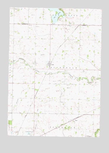
La Salle, MN USGS Topographic Map
Click on map above to begin viewing in our Map Viewer.

This topographic map contains these locations and features:
Feature Name Type Latitude Longitude GNIS ID View Map
Butterfield CreekStreamN44.0508°W94.5577°640705View Map
City of La SalleCivilN44.0710°W94.5713°2395574View Map
Fort HillSummitN44.1236°W94.5561°2063627View Map
GroganLocaleN44.0163°W94.5366°2050967View Map
GroganPopulated PlaceN44.0163°W94.5366°644488View Map
Grogan Post Office (historical)Post OfficeN44.0163°W94.5366°2050968View Map
Hanska - La Salle Lutheran ChurchChurchN44.0716°W94.5705°2050948View Map
Hanska Lake DamDamN44.1100°W94.5669°1776002View Map
La SallePopulated PlaceN44.0708°W94.5697°646294View Map
La Salle (historical)LocaleN44.0716°W94.5683°2050944View Map
La Salle City HallBuildingN44.0716°W94.5694°2050946View Map
La Salle LibraryBuildingN44.0716°W94.5694°2050947View Map
La Salle Lutheran CemeteryCemeteryN44.0688°W94.5736°2050982View Map
La Salle Lutheran ChurchChurchN44.0716°W94.5719°2050949View Map
La Salle Post OfficePost OfficeN44.0711°W94.5698°2050945View Map
Lake Hanska County ParkParkN44.1222°W94.5542°2063628View Map
Lake Hanska County Park CampgroundLocaleN44.1222°W94.5542°2063629View Map
LaSalle Volunteer Fire DepartmentBuildingN44.0697°W94.5732°2666581View Map
One Hundred Acre SloughGutN44.0027°W94.5966°648970View Map
Rosendale CemeteryCemeteryN44.0008°W94.5158°2050980View Map
Rosendale ChurchChurchN44.0005°W94.5155°650295View Map
Saint James CreekStreamN44.0575°W94.5414°650622View Map
Township of RiverdaleCivilN44.0654°W94.5542°665424View Map
Watonwan County Waterfowl Production AreaParkN44.0271°W94.5148°2765553View Map

Note: Coordinates in the location and feature list above are referenced to NAD83 datum.


Copyright (C) 2008-2025 Ryan Niemi / Sunset Dynamics ... All Rights Reserved