TopoQuest Logo
Do you find TopoQuest useful?
Help keep TopoQuest running and adding new maps/features by donating!
Bitcoin:  19c7KJd3qBynnjoSw5npx9KScwjBe4ifkT
Litecoin:  LXs6TkuXGGXo1vDsWCkWVdjQX94eUKd6ui
Home View Maps Find Maps Find Places Resources & Links


Saint James West, Minnesota Topographic Map

USGS Map Title: Saint James West, MN
USGS Map MRC: 43094H6
DRG (GeoTIFF) Download: o43094h6.tif


Neighboring USGS Topographic Map Quads:


  Darfur, MN  
44094A7
 

  Godahl, MN  
44094A6
 

  La Salle, MN  
44094A5
 

  Butterfield, MN  
43094H7
 

  Saint James West, MN  
43094H6
 

  Saint James East, MN  
43094H5
 

  Mountain Lake SE, MN  
43094G7
 

  Trimont, MN  
43094G6
 

  Saint James SE, MN  
43094G5


Map MRC Location:

N44°
W95°
N44°
W94°
H8 H7 H6 H5 H4 H3 H2 H1
G8 G7 G6 G5 G4 G3 G2 G1
F8 F7 F6 F5 F4 F3 F2 F1
E8 E7 E6 E5 E4 E3 E2 E1
D8 D7 D6 D5 D4 D3 D2 D1
C8 C7 C6 C5 C4 C3 C2 C1
B8 B7 B6 B5 B4 B3 B2 B1
A8 A7 A6 A5 A4 A3 A2 A1
N43°
W95°
N43°
W94°

Saint James West, MN USGS 1:24K Topographic Map Preview:
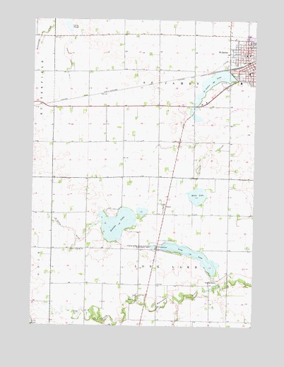
Saint James West, MN USGS Topographic Map
Click on map above to begin viewing in our Map Viewer.

This topographic map contains these locations and features:
Feature Name Type Latitude Longitude GNIS ID View Map
Armstrong SchoolSchoolN43.9891°W94.6286°639445View Map
Assembly of God ChurchChurchN43.9863°W94.6283°2050882View Map
Augustana Lutheran ChurchChurchN43.9863°W94.6300°2050881View Map
Curry SloughLakeN43.9972°W94.7307°642559View Map
Downtown-Eagles ParkParkN43.9825°W94.6283°2050899View Map
EcholsPopulated PlaceN43.9238°W94.6750°654684View Map
First Presbyterian ChurchChurchN43.9805°W94.6255°2050879View Map
Hosanna Free Lutheran ChurchChurchN43.9825°W94.6269°2050872View Map
Jaycee ParkParkN43.9843°W94.6324°2652125View Map
Judicial Ditch Number ThirteenCanalN43.9777°W94.7308°645802View Map
Kansas LakeLakeN43.9166°W94.7022°646036View Map
Kansas Lake CemeteryCemeteryN43.9061°W94.7255°2050987View Map
Kansas Lake ChurchChurchN43.9061°W94.7253°646037View Map
Kingdom Hall of Jehovahs WitnessesChurchN43.9877°W94.6372°2050878View Map
Long LakeLakeN43.9037°W94.6592°647031View Map
Long Lake ChurchChurchN43.8872°W94.6903°647126View Map
Long Lake Lutheran Church CemeteryCemeteryN43.8874°W94.6900°2050990View Map
Long Lake Wayside ParkParkN43.9061°W94.6780°2050978View Map
Malmrose ParkParkN43.9880°W94.6280°2050898View Map
Mary LakeReservoirN43.9250°W94.6519°1776076View Map
Mary LakeLakeN43.9282°W94.6570°647586View Map
Mary Lake DamDamN43.9250°W94.6519°1776075View Map
Memorial ParkParkN43.9777°W94.6366°2705761View Map
Pleasant View Good Samaritan CenterHospitalN43.9747°W94.6333°2050884View Map
Railroad MuseumBuildingN43.9738°W94.6405°2050895View Map
Saint JamesPopulated PlaceN43.9825°W94.6269°650613View Map
Saint JamesLocaleN43.9813°W94.6344°2050891View Map
Saint James Catholic ChurchChurchN43.9783°W94.6291°2050875View Map
Saint James Catholic SchoolSchoolN43.9783°W94.6286°2050888View Map
Saint James City HallBuildingN43.9813°W94.6280°2050867View Map
Saint James High SchoolSchoolN43.9911°W94.6255°2050890View Map
Saint James LakeReservoirN43.9747°W94.6480°650623View Map
Saint James PlacePopulated PlaceN43.9813°W94.6419°2050864View Map
Saint James Police DepartmentBuildingN43.9811°W94.6254°2050870View Map
Saint James Post OfficePost OfficeN43.9825°W94.6291°2050868View Map
Salutators ParkParkN43.9738°W94.6405°2050900View Map
Tiell ParkParkN43.9750°W94.6375°2050976View Map
Tiell Park CampgroundLocaleN43.9750°W94.6375°2050975View Map
Township of Long LakeCivilN43.8921°W94.6790°664819View Map
Township of Saint JamesCivilN43.9786°W94.6818°665514View Map
Turtle Marsh State Wildlife Management AreaParkN43.9069°W94.6816°653386View Map
United Methodist ChurchChurchN43.9969°W94.6269°2050880View Map
Watonwan County CourthouseBuildingN43.9813°W94.6255°2050869View Map
Watonwan County JailBuildingN43.9811°W94.6253°2758760View Map
Watonwan County LibraryBuildingN43.9811°W94.6280°2050866View Map
Watonwan County Sheriff's OfficeBuildingN43.9811°W94.6251°2050871View Map
Westside ParkParkN43.9851°W94.6371°2652124View Map
World of Pentecost ChurchChurchN43.9886°W94.6322°2050877View Map

Note: Coordinates in the location and feature list above are referenced to NAD83 datum.


Copyright (C) 2008-2025 Ryan Niemi / Sunset Dynamics ... All Rights Reserved