TopoQuest Logo
Do you find TopoQuest useful?
Help keep TopoQuest running and adding new maps/features by donating!
Bitcoin:  19c7KJd3qBynnjoSw5npx9KScwjBe4ifkT
Litecoin:  LXs6TkuXGGXo1vDsWCkWVdjQX94eUKd6ui
Home View Maps Find Maps Find Places Resources & Links


Lachine, Michigan Topographic Map

USGS Map Title: Lachine, MI
USGS Map MRC: 45083A6
DRG (GeoTIFF) Download: o45083a6.tif


Neighboring USGS Topographic Map Quads:


  Hillman NE, MI  
45083B7
 

  Polaski, MI  
45083B6
 

  Long Lake West, MI  
45083B5
 

  Jewett Creek, MI  
45083A7
 

  Lachine, MI  
45083A6
 

  Lake Winyah, MI  
45083A5
 

  Beaver Lake, MI  
44083H7
 

  Evans Creek, MI  
44083H6
 

  Big Ravine Creek, MI  
44083H5


Map MRC Location:

N46°
W84°
N46°
W83°
H8 H7 H6 H5 H4 H3 H2 H1
G8 G7 G6 G5 G4 G3 G2 G1
F8 F7 F6 F5 F4 F3 F2 F1
E8 E7 E6 E5 E4 E3 E2 E1
D8 D7 D6 D5 D4 D3 D2 D1
C8 C7 C6 C5 C4 C3 C2 C1
B8 B7 B6 B5 B4 B3 B2 B1
A8 A7 A6 A5 A4 A3 A2 A1
N45°
W84°
N45°
W83°

Lachine, MI USGS 1:24K Topographic Map Preview:
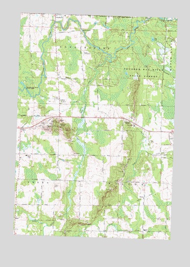
Lachine, MI USGS Topographic Map
Click on map above to begin viewing in our Map Viewer.

This topographic map contains these locations and features:
Feature Name Type Latitude Longitude GNIS ID View Map
Bean CreekStreamN45.1014°W83.6803°620817View Map
Blue LakeLakeN45.1124°W83.6441°621636View Map
Community of Christ ChurchChurchN45.0894°W83.7167°2492429View Map
Dafoe Post Office (historical)Post OfficeN45.0611°W83.6556°2492444View Map
Dafoe Station (historical)LocaleN45.0611°W83.6553°2492445View Map
Emerson StationPopulated PlaceN45.0642°W83.6542°625573View Map
FlandersPopulated PlaceN45.0600°W83.7467°1617560View Map
Flanders Post Office (historical)Post OfficeN45.0600°W83.7467°2492442View Map
Gaffney CreekStreamN45.1206°W83.7222°626584View Map
Greely Baptist ChurchChurchN45.0603°W83.7422°2492424View Map
Green CemeteryCemeteryN45.0572°W83.7478°2492462View Map
Green SchoolSchoolN45.0453°W83.7414°627334View Map
HerronPopulated PlaceN45.0231°W83.6469°628148View Map
Herron Post OfficePost OfficeN45.0658°W83.6597°2492451View Map
Herron Saint Rose's CemeteryCemeteryN45.0222°W83.6439°2492465View Map
LachinePopulated PlaceN45.0775°W83.7161°629930View Map
Lachine Post OfficePost OfficeN45.0786°W83.7167°2492423View Map
Liberty Baptist ChurchChurchN45.0456°W83.7331°2492425View Map
Long Rapids SchoolSchoolN45.1242°W83.7147°2492430View Map
Long Rapids Township Fire DepartmentBuildingN45.1222°W83.7229°2626760View Map
Manning HillSummitN45.0628°W83.7161°631407View Map
Manning Hill ParkParkN45.0667°W83.7250°2492407View Map
Morrison CreekStreamN45.0795°W83.6975°632721View Map
Orchard Hill BridgeBridgeN45.1245°W83.6344°1623546View Map
SprattPopulated PlaceN45.0086°W83.7480°1617860View Map
Spratt CreekStreamN45.0058°W83.7219°638531View Map
Spratt Post Office (historical)Post OfficeN45.0086°W83.7481°2492437View Map
WHSB-FM (Alpena)TowerN45.0611°W83.7180°1625337View Map
Wilson SchoolSchoolN45.0053°W83.6461°1616602View Map

Note: Coordinates in the location and feature list above are referenced to NAD83 datum.


Copyright (C) 2008-2024 Ryan Niemi / Sunset Dynamics ... All Rights Reserved