TopoQuest Logo
Do you find TopoQuest useful?
Help keep TopoQuest running and adding new maps/features by donating!
Bitcoin:  19c7KJd3qBynnjoSw5npx9KScwjBe4ifkT
Litecoin:  LXs6TkuXGGXo1vDsWCkWVdjQX94eUKd6ui
Home View Maps Find Maps Find Places Resources & Links


Lake Winyah, Michigan Topographic Map

USGS Map Title: Lake Winyah, MI
USGS Map MRC: 45083A5
DRG (GeoTIFF) Download: o45083a5.tif


Neighboring USGS Topographic Map Quads:


  Polaski, MI  
45083B6
 

  Long Lake West, MI  
45083B5
 

  Long Lake East, MI  
45083B4
 

  Lachine, MI  
45083A6
 

  Lake Winyah, MI  
45083A5
 

  Alpena, MI  
45083A4
 

  Evans Creek, MI  
44083H6
 

  Big Ravine Creek, MI  
44083H5
 

  Ossineke, MI  
44083H4


Map MRC Location:

N46°
W84°
N46°
W83°
H8 H7 H6 H5 H4 H3 H2 H1
G8 G7 G6 G5 G4 G3 G2 G1
F8 F7 F6 F5 F4 F3 F2 F1
E8 E7 E6 E5 E4 E3 E2 E1
D8 D7 D6 D5 D4 D3 D2 D1
C8 C7 C6 C5 C4 C3 C2 C1
B8 B7 B6 B5 B4 B3 B2 B1
A8 A7 A6 A5 A4 A3 A2 A1
N45°
W84°
N45°
W83°

Lake Winyah, MI USGS 1:24K Topographic Map Preview:
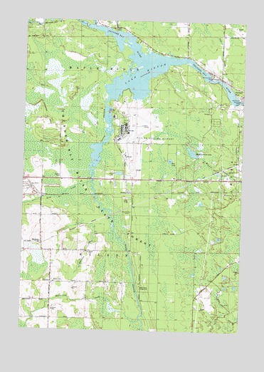
Lake Winyah, MI USGS Topographic Map
Click on map above to begin viewing in our Map Viewer.

This topographic map contains these locations and features:
Feature Name Type Latitude Longitude GNIS ID View Map
Alpena Army Air Field (historical)MilitaryN45.0825°W83.5614°2091533View Map
Alpena Combat Readiness Training Center Fire and Rescue ServicesBuildingN45.0776°W83.5691°2626961View Map
Alpena County Regional AirportAirportN45.0826°W83.5640°1623776View Map
Butterfield CreekStreamN45.0045°W83.5561°622380View Map
Campers Grove CampgroundLocaleN45.1139°W83.5583°2492411View Map
Devils Lake TrailTrailN45.0081°W83.5058°624609View Map
Fall CreekStreamN45.0997°W83.5089°625812View Map
Fourmile DamDamN45.0931°W83.5028°626338View Map
Fourmile PondReservoirN45.0931°W83.5025°626340View Map
Huron Shores Fellowship ChurchChurchN45.0611°W83.5256°2492068View Map
Kerston StationLocaleN45.0556°W83.5630°629624View Map
King CreekStreamN45.0603°W83.5861°629691View Map
Kingsbury CreekStreamN45.1208°W83.5719°629721View Map
Lake WinyahReservoirN45.1060°W83.5564°1616653View Map
Lower South Branch Thunder Bay RiverStreamN45.0939°W83.5766°631185View Map
McHargPopulated PlaceN45.0356°W83.6139°1617711View Map
Michigan Department of Natural Resources Alpena Field OfficeBuildingN45.0608°W83.5379°2626993View Map
Muskrat Farm LakeLakeN45.0720°W83.5288°633171View Map
North Branch Thunder Bay RiverStreamN45.1228°W83.5850°1624212View Map
Norway Point DamDamN45.1022°W83.5191°633761View Map
Norway Ridge TrailTrailN45.0395°W83.5358°633762View Map
PaxtonPopulated PlaceN45.0545°W83.6141°1617777View Map
Robinson CreekStreamN45.0364°W83.5828°636048View Map
Thunder Bay River State Forest CampgroundLocaleN45.0178°W83.5572°2492422View Map
Township of WilsonCivilN45.0107°W83.6125°1627277View Map
Wilson CemeteryCemeteryN45.0200°W83.6066°1616557View Map
Wilson Township Fire and RescueBuildingN45.0196°W83.6083°2627066View Map
Woodland CampLocaleN45.0481°W83.5628°1616754View Map
Zim LakeLakeN45.0687°W83.5413°1616930View Map

Note: Coordinates in the location and feature list above are referenced to NAD83 datum.


Copyright (C) 2008-2024 Ryan Niemi / Sunset Dynamics ... All Rights Reserved