TopoQuest Logo
Do you find TopoQuest useful?
Help keep TopoQuest running and adding new maps/features by donating!
Bitcoin:  19c7KJd3qBynnjoSw5npx9KScwjBe4ifkT
Litecoin:  LXs6TkuXGGXo1vDsWCkWVdjQX94eUKd6ui
Home View Maps Find Maps Find Places Resources & Links


Lake Alice, Nebraska Topographic Map

USGS Map Title: Lake Alice, NE
USGS Map MRC: 41103H5
DRG (GeoTIFF) Download: o41103h5.tif


Neighboring USGS Topographic Map Quads:


  University Lake, NE  
42103A6
 

  University Lake SE, NE  
42103A5
 

  Kilpatrick Lake SW, NE  
42103A4
 

  Scottsbluff North, NE  
41103H6
 

  Lake Alice, NE  
41103H5
 

  Lake Minatare, NE  
41103H4
 

  Scottsbluff South, NE  
41103G6
 

  Minatare, NE  
41103G5
 

  Bayard SW, NE  
41103G4


Map MRC Location:

N42°
W104°
N42°
W103°
H8 H7 H6 H5 H4 H3 H2 H1
G8 G7 G6 G5 G4 G3 G2 G1
F8 F7 F6 F5 F4 F3 F2 F1
E8 E7 E6 E5 E4 E3 E2 E1
D8 D7 D6 D5 D4 D3 D2 D1
C8 C7 C6 C5 C4 C3 C2 C1
B8 B7 B6 B5 B4 B3 B2 B1
A8 A7 A6 A5 A4 A3 A2 A1
N41°
W104°
N41°
W103°

Lake Alice, NE USGS 1:24K Topographic Map Preview:
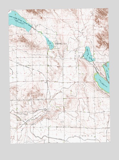
Lake Alice, NE USGS Topographic Map
Click on map above to begin viewing in our Map Viewer.

This topographic map contains these locations and features:
Feature Name Type Latitude Longitude GNIS ID View Map
Dewey Tabor Election PrecinctCivilN41.8974°W103.5169°1928818View Map
Dunham Andrews DrainCanalN41.8930°W103.6052°828889View Map
East Winters Creek Election PrecinctCivilN41.8782°W103.6155°1928842View Map
Gueck RanchLocaleN41.9877°W103.5388°829716View Map
Hillcrest School (historical)SchoolN41.8944°W103.5577°830009View Map
JamesPopulated PlaceN41.9319°W103.5788°835336View Map
Lake AliceReservoirN41.9890°W103.6137°826944View Map
Lake AliceReservoirN41.9816°W103.5955°1768805View Map
Lake Alice Lower DamDamN41.9816°W103.5955°1768804View Map
Lake Alice Number TwoReservoirN41.9686°W103.5752°836016View Map
Lake Alice SchoolSchoolN41.9475°W103.5769°1827945View Map
Lake Minatare State Recreation AreaParkN41.9416°W103.5088°1828124View Map
Lakeview Point CampgroundLocaleN41.9333°W103.5052°1828123View Map
Minatare DamDamN41.9166°W103.5005°1768812View Map
North Platte National Wildlife RefugeParkN41.9889°W103.6129°831722View Map
Scouts Rest CampgroundLocaleN41.9486°W103.5061°1828121View Map
Supply CanalCanalN41.9533°W103.5580°833955View Map
Tri-State CanalCanalN41.8805°W103.5488°834159View Map
TroutPopulated PlaceN41.8964°W103.6033°835468View Map
West Wind CampgroundLocaleN41.9400°W103.5180°1828122View Map
Winters Creek LakeLakeN41.9565°W103.5263°834830View Map

Note: Coordinates in the location and feature list above are referenced to NAD83 datum.


Copyright (C) 2008-2025 Ryan Niemi / Sunset Dynamics ... All Rights Reserved