TopoQuest Logo
Do you find TopoQuest useful?
Help keep TopoQuest running and adding new maps/features by donating!
Bitcoin:  19c7KJd3qBynnjoSw5npx9KScwjBe4ifkT
Litecoin:  LXs6TkuXGGXo1vDsWCkWVdjQX94eUKd6ui
Home View Maps Find Maps Find Places Resources & Links


Scottsbluff North, Nebraska Topographic Map

USGS Map Title: Scottsbluff North, NE
USGS Map MRC: 41103H6
DRG (GeoTIFF) Download: o41103h6.tif


Neighboring USGS Topographic Map Quads:


  Erdman Ranch, NE  
42103A7
 

  University Lake, NE  
42103A6
 

  University Lake SE, NE  
42103A5
 

  Mitchell, NE  
41103H7
 

  Scottsbluff North, NE  
41103H6
 

  Lake Alice, NE  
41103H5
 

  Roubadeau Pass, NE  
41103G7
 

  Scottsbluff South, NE  
41103G6
 

  Minatare, NE  
41103G5


Map MRC Location:

N42°
W104°
N42°
W103°
H8 H7 H6 H5 H4 H3 H2 H1
G8 G7 G6 G5 G4 G3 G2 G1
F8 F7 F6 F5 F4 F3 F2 F1
E8 E7 E6 E5 E4 E3 E2 E1
D8 D7 D6 D5 D4 D3 D2 D1
C8 C7 C6 C5 C4 C3 C2 C1
B8 B7 B6 B5 B4 B3 B2 B1
A8 A7 A6 A5 A4 A3 A2 A1
N41°
W104°
N41°
W103°

Scottsbluff North, NE USGS 1:24K Topographic Map Preview:
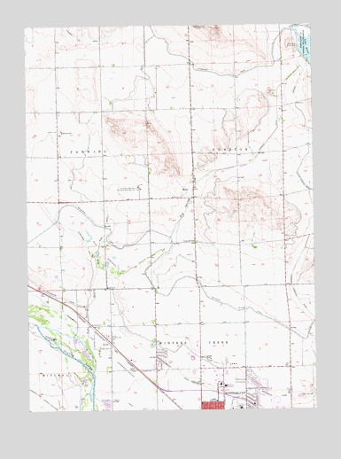
Scottsbluff North, NE USGS Topographic Map
Click on map above to begin viewing in our Map Viewer.

This topographic map contains these locations and features:
Feature Name Type Latitude Longitude GNIS ID View Map
Air Link Air Ambulance ServiceBuildingN41.8864°W103.6647°2553683View Map
Applied Technology AdditionBuildingN41.8764°W103.6436°1827938View Map
Babe Ruth Baseball FieldParkN41.8777°W103.6605°1828029View Map
Child Development CenterBuildingN41.8764°W103.6436°1827937View Map
Clark N Williams Multicultural Learning CenterBuildingN41.8764°W103.6436°1827936View Map
CovertPopulated PlaceN41.8969°W103.7155°835278View Map
Emmanuel Congregational ChurchChurchN41.8861°W103.6688°1827988View Map
Enterprise CanalCanalN41.8789°W103.6419°829140View Map
Fairview CemeteryCemeteryN41.8862°W103.6545°829233View Map
First Baptist ChurchChurchN41.8772°W103.6749°1827963View Map
Frank ParkParkN41.8755°W103.6605°1828033View Map
Funston Election PrecinctCivilN41.9590°W103.6377°1928885View Map
Grace ChapelChurchN41.8833°W103.6555°1827970View Map
HeldtPopulated PlaceN41.8877°W103.7055°835321View Map
Hiersche DrainCanalN41.9633°W103.6438°829957View Map
King of Kings Evangelical Lutheran ChurchChurchN41.8764°W103.6422°1827978View Map
Kingdom Hall of Jehovahs WitnessesChurchN41.8833°W103.6972°1827990View Map
KSTF-TV (Scottsbluff)TowerN41.9994°W103.6658°837461View Map
Lake AliceReservoirN41.9866°W103.6322°1768807View Map
Lake Alice Upper DamDamN41.9866°W103.6322°1768806View Map
Lateral 24CanalN41.9811°W103.6316°830631View Map
Medical Center Eye ClinicHospitalN41.8861°W103.6663°1828094View Map
MintlePopulated PlaceN41.9458°W103.6805°835383View Map
Monument Bible ChurchChurchN41.8872°W103.6758°1827964View Map
Nebraska State Highway Patrol Troop EBuildingN41.8919°W103.6790°2739920View Map
Northside Mobile Home RanchPopulated PlaceN41.8916°W103.6880°1828069View Map
Northwood ParkParkN41.8783°W103.6749°1828031View Map
Panhandle Mental Health CenterHospitalN41.8880°W103.6677°1828088View Map
Perry DrainCanalN41.9364°W103.7152°832042View Map
Pioneer Activity CenterBuildingN41.8764°W103.6436°1827935View Map
Platte Valley PediatricsHospitalN41.8880°W103.6663°1828090View Map
Plymouth Congregational ChurchChurchN41.8769°W103.6561°1827992View Map
Regional West Medical CenterHospitalN41.8867°W103.6647°1828089View Map
Regional West Medical Center Resource LibraryBuildingN41.8880°W103.6644°1828084View Map
Reisig Brothers AirportAirportN41.9056°W103.7000°837705View Map
Saint Marys HospitalHospitalN41.8825°W103.6647°833012View Map
Scottsbluff DrainCanalN41.8877°W103.6861°833319View Map
Scottsbluff Internal Medicine ClinicBuildingN41.8880°W103.6663°1828097View Map
Scottsbluff Nursing CenterHospitalN41.8827°W103.6649°1828093View Map
Scottsbluff/Chimney Rock KOA CampgroundLocaleN41.9080°W103.7283°1828126View Map
Seventh Day Adventist ChurchChurchN41.8777°W103.6686°1827959View Map
Splash ArenaParkN41.8772°W103.6566°1828028View Map
Sunflower DrainCanalN41.9319°W103.7269°833895View Map
Sunset Memorial ParkCemeteryN41.8990°W103.7159°833948View Map
Terry Carpenter Park and Recreation AreaParkN41.8772°W103.6566°1828027View Map
Tub SpringsSpringN41.9264°W103.7172°834195View Map
Tub Springs DrainCanalN41.9352°W103.6847°834196View Map
Twenty-three Club Baseball FieldsParkN41.8764°W103.6605°1828030View Map
University of Nebraska Medical Center College of Nursing - West Nebraska DivisionSchoolN41.8897°W103.6777°1827942View Map
Victory Hill School (historical)SchoolN41.9300°W103.6774°834386View Map
West Winters Creek Election PrecinctCivilN41.8918°W103.7099°1929385View Map
Western Hearing ClinicHospitalN41.8880°W103.6663°1828091View Map
Western Nebraska Community College - Scottsbluff CampusSchoolN41.8764°W103.6436°1827868View Map
Western Nebraska Community College LibraryBuildingN41.8764°W103.6436°1827939View Map
Western Nebraska Veterans HomeHospitalN41.8880°W103.6749°1828092View Map
Western Nebraska Veterans Home LibraryBuildingN41.8880°W103.6749°1828083View Map
Zion Evangelical ChurchChurchN41.8836°W103.6561°1827971View Map

Note: Coordinates in the location and feature list above are referenced to NAD83 datum.


Copyright (C) 2008-2024 Ryan Niemi / Sunset Dynamics ... All Rights Reserved