TopoQuest Logo
Do you find TopoQuest useful?
Help keep TopoQuest running and adding new maps/features by donating!
Bitcoin:  19c7KJd3qBynnjoSw5npx9KScwjBe4ifkT
Litecoin:  LXs6TkuXGGXo1vDsWCkWVdjQX94eUKd6ui
Home View Maps Find Maps Find Places Resources & Links


Lake Benton, Minnesota Topographic Map

USGS Map Title: Lake Benton, MN
USGS Map MRC: 44096C3
DRG (GeoTIFF) Download: o44096c3.tif


Neighboring USGS Topographic Map Quads:


  Lake Benton NW, MN  
44096D4
 

  Lake Benton NE, MN  
44096D3
 

  Arco, MN  
44096D2
 

  Lake Benton SW, MN  
44096C4
 

  Lake Benton, MN  
44096C3
 

  Tyler, MN  
44096C2
 

  Elkton, SD  
44096B4
 

  Verdi, MN  
44096B3
 

  Ruthton NW, MN  
44096B2


Map MRC Location:

N45°
W97°
N45°
W96°
H8 H7 H6 H5 H4 H3 H2 H1
G8 G7 G6 G5 G4 G3 G2 G1
F8 F7 F6 F5 F4 F3 F2 F1
E8 E7 E6 E5 E4 E3 E2 E1
D8 D7 D6 D5 D4 D3 D2 D1
C8 C7 C6 C5 C4 C3 C2 C1
B8 B7 B6 B5 B4 B3 B2 B1
A8 A7 A6 A5 A4 A3 A2 A1
N44°
W97°
N44°
W96°

Lake Benton, MN USGS 1:24K Topographic Map Preview:
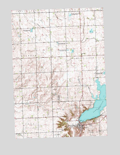
Lake Benton, MN USGS Topographic Map
Click on map above to begin viewing in our Map Viewer.

This topographic map contains these locations and features:
Feature Name Type Latitude Longitude GNIS ID View Map
Briffett Family CemeteryCemeteryN44.2622°W96.2514°2051778View Map
Church of Saint GenevieveChurchN44.2594°W96.2914°2051742View Map
City of Lake BentonCivilN44.2646°W96.2915°2395586View Map
Collinson State Wildlife Management AreaParkN44.3339°W96.2967°641403View Map
County Ditch Number ThirtyfiveCanalN44.3564°W96.2773°641987View Map
County Ditch Number ThirtyfourCanalN44.3725°W96.3137°641983View Map
County Ditch Number TwentyCanalN44.3133°W96.2623°641792View Map
Danish Evangelical CemeteryCemeteryN44.3294°W96.2814°2051780View Map
Diamond Lake ChurchChurchN44.3300°W96.2817°642805View Map
Emerald State Wildlife Management AreaParkN44.3677°W96.2959°643332View Map
First Baptist ChurchChurchN44.2611°W96.2875°2051739View Map
Grace Lutheran ChurchChurchN44.2605°W96.2914°2051741View Map
Horse State Wildlife Management AreaParkN44.3550°W96.3481°645197View Map
Immanuel CemeteryCemeteryN44.2541°W96.3737°2051777View Map
Immanuel ChurchChurchN44.2547°W96.3734°645370View Map
Kingdom Hall of Jehovahs WitnessesChurchN44.2619°W96.2811°2051740View Map
KKCK-FM (Marshall)TowerN44.2822°W96.3212°663072View Map
Lake BentonPopulated PlaceN44.2611°W96.2875°646331View Map
Lake BentonLocaleN44.2630°W96.2850°2051736View Map
Lake Benton Fire DepartmentBuildingN44.2613°W96.2890°2666226View Map
Lake Benton Health ClinicHospitalN44.2608°W96.2864°2051733View Map
Lake Benton LibraryBuildingN44.2614°W96.2867°2051734View Map
Lake Benton Police DepartmentBuildingN44.2612°W96.2889°2051737View Map
Lake Benton Post OfficePost OfficeN44.2614°W96.2870°2051735View Map
Lake Benton Public SchoolSchoolN44.2608°W96.2834°2051738View Map
Memorial Hill CemeteryCemeteryN44.2608°W96.2721°2051779View Map
Minnesota Noname Number 4 DamDamN44.3300°W96.3437°1776628View Map
Norwegian CreekStreamN44.2852°W96.2636°648761View Map
Saint John's Evangelical Lutheran ChurchChurchN44.2597°W96.2836°2051743View Map
Sioux Lookout State Wildlife Management AreaParkN44.2880°W96.3139°652085View Map
Township of Diamond LakeCivilN44.3302°W96.2636°663978View Map
Two Sloughs State Wildlife Management AreaParkN44.3411°W96.3134°653476View Map
United Methodist ChurchChurchN44.2594°W96.2878°2051744View Map

Note: Coordinates in the location and feature list above are referenced to NAD83 datum.


Copyright (C) 2008-2024 Ryan Niemi / Sunset Dynamics ... All Rights Reserved