TopoQuest Logo
Do you find TopoQuest useful?
Help keep TopoQuest running and adding new maps/features by donating!
Bitcoin:  19c7KJd3qBynnjoSw5npx9KScwjBe4ifkT
Litecoin:  LXs6TkuXGGXo1vDsWCkWVdjQX94eUKd6ui
Home View Maps Find Maps Find Places Resources & Links


Barnesville, Minnesota Topographic Map

USGS Map Title: Barnesville, MN
USGS Map MRC: 46096F4
DRG (GeoTIFF) Download: o46096f4.tif


Neighboring USGS Topographic Map Quads:


  Glyndon South, MN  
46096G5
 

  Downer, MN  
46096G4
 

  Hawley SE, MN  
46096G3
 

  Baker, MN  
46096F5
 

  Barnesville, MN  
46096F4
 

  Big Slough, MN  
46096F3
 

  Wolverton SE, MN  
46096E5
 

  Barnesville SW, MN  
46096E4
 

  Lawndale, MN  
46096E3


Map MRC Location:

N47°
W97°
N47°
W96°
H8 H7 H6 H5 H4 H3 H2 H1
G8 G7 G6 G5 G4 G3 G2 G1
F8 F7 F6 F5 F4 F3 F2 F1
E8 E7 E6 E5 E4 E3 E2 E1
D8 D7 D6 D5 D4 D3 D2 D1
C8 C7 C6 C5 C4 C3 C2 C1
B8 B7 B6 B5 B4 B3 B2 B1
A8 A7 A6 A5 A4 A3 A2 A1
N46°
W97°
N46°
W96°

Barnesville, MN USGS 1:24K Topographic Map Preview:
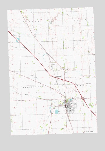
Barnesville, MN USGS Topographic Map
Click on map above to begin viewing in our Map Viewer.

This topographic map contains these locations and features:
Feature Name Type Latitude Longitude GNIS ID View Map
Assembly of God ChurchChurchN46.6492°W96.4153°2081076View Map
Assumption ChurchChurchN46.6394°W96.4200°2081072View Map
BarnesvilleLocaleN46.6522°W96.4211°2081071View Map
BarnesvillePopulated PlaceN46.6522°W96.4198°639637View Map
Barnesville Area ClinicHospitalN46.6522°W96.4181°2081082View Map
Barnesville City HallBuildingN46.6539°W96.4192°2081067View Map
Barnesville City LibraryBuildingN46.6539°W96.4192°2081068View Map
Barnesville City Police DepartmentBuildingN46.6532°W96.4205°2081070View Map
Barnesville Elementary SchoolSchoolN46.6506°W96.4128°2081084View Map
Barnesville Good Samaritan CenterHospitalN46.6481°W96.4117°2081083View Map
Barnesville High SchoolSchoolN46.6508°W96.4156°2081085View Map
Barnesville Lutheran Brethren ChurchChurchN46.6453°W96.4144°2081077View Map
Barnesville Municipal AirportAirportN46.6652°W96.4412°660048View Map
Barnesville Post OfficePost OfficeN46.6522°W96.4194°2081078View Map
Barnesville Volunteer Fire DepartmentBuildingN46.6516°W96.4190°2081066View Map
Blue Eagle LakeLakeN46.6589°W96.4127°640283View Map
Blue Eagle ParkParkN46.6583°W96.4125°2081080View Map
City of BarnesvilleCivilN46.6501°W96.4165°2394065View Map
Elkton CemeteryCemeteryN46.7344°W96.4526°643271View Map
Hosanna FellowshipChurchN46.6522°W96.4194°2081079View Map
Interchange 22CrossingN46.6783°W96.4200°2081101View Map
Interchange 24CrossingN46.6597°W96.3944°2081100View Map
Mathew Private FieldAirportN46.6736°W96.4515°660051View Map
McGrath ParkParkN46.6542°W96.4231°2081081View Map
Norwegian CemeteryCemeteryN46.6747°W96.3903°648757View Map
Old City Jail Tourist CenterBuildingN46.6539°W96.4192°2081069View Map
Our Saviour's Lutheran ChurchChurchN46.6558°W96.4164°2081075View Map
Rosemound CemeteryCemeteryN46.6536°W96.4417°1815085View Map
Saint James United ChurchChurchN46.6547°W96.4164°2081073View Map
Saint Johns Lutheran ChurchChurchN46.6553°W96.4169°2081074View Map
Saint Marys CemeteryCemeteryN46.6536°W96.4403°1815086View Map
School Number 110SchoolN46.6591°W96.3831°651346View Map
School Number 65SchoolN46.6888°W96.4409°651710View Map
School Number 67SchoolN46.7394°W96.3959°651713View Map
School Number 90SchoolN46.7391°W96.4515°651764View Map
Spring CreekStreamN46.7269°W96.4595°1815084View Map
Township of BarnesvilleCivilN46.6746°W96.4850°663507View Map

Note: Coordinates in the location and feature list above are referenced to NAD83 datum.


Copyright (C) 2008-2025 Ryan Niemi / Sunset Dynamics ... All Rights Reserved