TopoQuest Logo
Do you find TopoQuest useful?
Help keep TopoQuest running and adding new maps/features by donating!
Bitcoin:  19c7KJd3qBynnjoSw5npx9KScwjBe4ifkT
Litecoin:  LXs6TkuXGGXo1vDsWCkWVdjQX94eUKd6ui
Home View Maps Find Maps Find Places Resources & Links


Hawley SE, Minnesota Topographic Map

USGS Map Title: Hawley SE, MN
USGS Map MRC: 46096G3
DRG (GeoTIFF) Download: o46096g3.tif


Neighboring USGS Topographic Map Quads:


  Hawley NW, MN  
46096H4
 

  Hawley, MN  
46096H3
 

  Dale, MN  
46096H2
 

  Downer, MN  
46096G4
 

  Hawley SE, MN  
46096G3
 

  Lake Park SW, MN  
46096G2
 

  Barnesville, MN  
46096F4
 

  Big Slough, MN  
46096F3
 

  Rollag, MN  
46096F2


Map MRC Location:

N47°
W97°
N47°
W96°
H8 H7 H6 H5 H4 H3 H2 H1
G8 G7 G6 G5 G4 G3 G2 G1
F8 F7 F6 F5 F4 F3 F2 F1
E8 E7 E6 E5 E4 E3 E2 E1
D8 D7 D6 D5 D4 D3 D2 D1
C8 C7 C6 C5 C4 C3 C2 C1
B8 B7 B6 B5 B4 B3 B2 B1
A8 A7 A6 A5 A4 A3 A2 A1
N46°
W97°
N46°
W96°

Hawley SE, MN USGS 1:24K Topographic Map Preview:
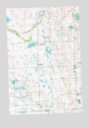
Hawley SE, MN USGS Topographic Map
Click on map above to begin viewing in our Map Viewer.

This topographic map contains these locations and features:
Feature Name Type Latitude Longitude GNIS ID View Map
Anfinson LakeLakeN46.8030°W96.2601°639370View Map
Bjornson State Wildlife Management AreaParkN46.7811°W96.3576°640200View Map
Clay County State Wildlife Management AreaParkN46.7525°W96.3515°641263View Map
Doran LakeLakeN46.8244°W96.3065°642892View Map
Hawley State Wildlife Management AreaParkN46.8086°W96.3292°644746View Map
Hegland CemeteryCemeteryN46.8347°W96.2708°2093845View Map
Hegland ChurchChurchN46.8341°W96.2712°644834View Map
Jegtvig LakeLakeN46.8085°W96.2503°645616View Map
Lee LakeLakeN46.8615°W96.2506°646573View Map
Maria LakeLakeN46.8623°W96.3740°647526View Map
Nelson LakeLakeN46.7641°W96.2555°648461View Map
Perch LakeLakeN46.8505°W96.2655°649291View Map
Rushfieldt LakeLakeN46.7877°W96.3664°650416View Map
Silver LakeLakeN46.8311°W96.3336°652057View Map
Silver Lake Pioneer CemeteryCemeteryN46.8338°W96.3506°652063View Map
Skree State Wildlife Management AreaParkN46.7536°W96.3156°652123View Map
Softing LakeLakeN46.7718°W96.2576°652223View Map
Township of HawleyCivilN46.8458°W96.3648°664420View Map
Township of SkreeCivilN46.7609°W96.3612°665628View Map
Zion CemeteryCemeteryN46.7722°W96.3659°654457View Map

Note: Coordinates in the location and feature list above are referenced to NAD83 datum.


Copyright (C) 2008-2024 Ryan Niemi / Sunset Dynamics ... All Rights Reserved