TopoQuest Logo
Do you find TopoQuest useful?
Help keep TopoQuest running and adding new maps/features by donating!
Bitcoin:  19c7KJd3qBynnjoSw5npx9KScwjBe4ifkT
Litecoin:  LXs6TkuXGGXo1vDsWCkWVdjQX94eUKd6ui
Home View Maps Find Maps Find Places Resources & Links


Lake Fremont, Minnesota Topographic Map

USGS Map Title: Lake Fremont, MN
USGS Map MRC: 45093D5
DRG (GeoTIFF) Download: o45093d5.tif


Neighboring USGS Topographic Map Quads:


  Princeton SW, MN  
45093E6
 

  Princeton, MN  
45093E5
 

  Wyanett, MN  
45093E4
 

  Orrock, MN  
45093D6
 

  Lake Fremont, MN  
45093D5
 

  Crown, MN  
45093D4
 

  Big Lake, MN  
45093C6
 

  Elk River, MN  
45093C5
 

  Nowthen, MN  
45093C4


Map MRC Location:

N46°
W94°
N46°
W93°
H8 H7 H6 H5 H4 H3 H2 H1
G8 G7 G6 G5 G4 G3 G2 G1
F8 F7 F6 F5 F4 F3 F2 F1
E8 E7 E6 E5 E4 E3 E2 E1
D8 D7 D6 D5 D4 D3 D2 D1
C8 C7 C6 C5 C4 C3 C2 C1
B8 B7 B6 B5 B4 B3 B2 B1
A8 A7 A6 A5 A4 A3 A2 A1
N45°
W94°
N45°
W93°

Lake Fremont, MN USGS 1:24K Topographic Map Preview:
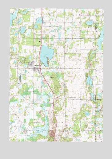
Lake Fremont, MN USGS Topographic Map
Click on map above to begin viewing in our Map Viewer.

This topographic map contains these locations and features:
Feature Name Type Latitude Longitude GNIS ID View Map
Blessed Cross ChurchChurchN45.4722°W93.6042°2069422View Map
Blue LakeLakeN45.4753°W93.5011°640291View Map
Cantlin LakeLakeN45.4868°W93.5871°640883View Map
Church of God ProphecyChurchN45.4436°W93.5872°2069427View Map
City of ZimmermanCivilN45.4415°W93.5977°2397401View Map
Diann LakeLakeN45.4790°W93.6080°642809View Map
East Hunter LakeLakeN45.4314°W93.5163°643081View Map
Fairview Northland ClinicHospitalN45.4425°W93.5847°2069428View Map
Fairview Northland Regional HospitalHospitalN45.4425°W93.5847°2069429View Map
Faith Community Lutheran ChurchChurchN45.4308°W93.5778°2069423View Map
Fremont Wildlife Management AreaParkN45.4344°W93.6091°643932View Map
Goose LakeLakeN45.4881°W93.6119°644259View Map
Helene LakeLakeN45.4753°W93.6168°644849View Map
Lake FremontLakeN45.4564°W93.5765°643933View Map
Lake Fremont Seaplane BaseAirportN45.4572°W93.5783°660484View Map
Little Diann LakeLakeN45.4783°W93.6216°646795View Map
Livonia CemeteryCemeteryN45.4138°W93.5286°646972View Map
Prairie Hill LakeLakeN45.4761°W93.5591°2014031View Map
Rice LakeLakeN45.3841°W93.5844°649991View Map
Saint John Lutheran ChurchChurchN45.4439°W93.6000°2069426View Map
Saint Pius X Catholic ChurchChurchN45.4414°W93.5939°2069430View Map
Saint Pius X CemeteryCemeteryN45.4500°W93.5750°2069526View Map
Sandy LakeLakeN45.4865°W93.5190°651185View Map
Stone LakeLakeN45.4013°W93.5211°652663View Map
Township of LivoniaCivilN45.4273°W93.5688°664808View Map
West Hunter LakeLakeN45.4316°W93.5186°653969View Map
Whitney CemeteryCemeteryN45.3927°W93.5533°654114View Map
ZimmermanPopulated PlaceN45.4433°W93.5900°646352View Map
Zimmerman - Livonia Fire DistrictBuildingN45.4430°W93.5997°2666334View Map
Zimmerman (historical)LocaleN45.4467°W93.5889°2069460View Map
Zimmerman City HallBuildingN45.4431°W93.5986°2069434View Map
Zimmerman Elementary SchoolSchoolN45.4408°W93.5919°2069432View Map
Zimmerman Evangelical Free ChurchChurchN45.4358°W93.5939°2069425View Map
Zimmerman Middle SchoolSchoolN45.4386°W93.5947°2069431View Map
Zimmerman Post OfficePost OfficeN45.4417°W93.5875°2069433View Map
Zimmerman Post OfficePost OfficeN45.4436°W93.5933°1669534View Map
Zimmerman TerracePopulated PlaceN45.4486°W93.5836°2069459View Map

Note: Coordinates in the location and feature list above are referenced to NAD83 datum.


Copyright (C) 2008-2025 Ryan Niemi / Sunset Dynamics ... All Rights Reserved