TopoQuest Logo
Do you find TopoQuest useful?
Help keep TopoQuest running and adding new maps/features by donating!
Bitcoin:  19c7KJd3qBynnjoSw5npx9KScwjBe4ifkT
Litecoin:  LXs6TkuXGGXo1vDsWCkWVdjQX94eUKd6ui
Home View Maps Find Maps Find Places Resources & Links


Wyanett, Minnesota Topographic Map

USGS Map Title: Wyanett, MN
USGS Map MRC: 45093E4
DRG (GeoTIFF) Download: o45093e4.tif


Neighboring USGS Topographic Map Quads:


  Princeton NE, MN  
45093F5
 

  Dalbo, MN  
45093F4
 

  Springvale, MN  
45093F3
 

  Princeton, MN  
45093E5
 

  Wyanett, MN  
45093E4
 

  Bradford, MN  
45093E3
 

  Lake Fremont, MN  
45093D5
 

  Crown, MN  
45093D4
 

  Saint Francis, MN  
45093D3


Map MRC Location:

N46°
W94°
N46°
W93°
H8 H7 H6 H5 H4 H3 H2 H1
G8 G7 G6 G5 G4 G3 G2 G1
F8 F7 F6 F5 F4 F3 F2 F1
E8 E7 E6 E5 E4 E3 E2 E1
D8 D7 D6 D5 D4 D3 D2 D1
C8 C7 C6 C5 C4 C3 C2 C1
B8 B7 B6 B5 B4 B3 B2 B1
A8 A7 A6 A5 A4 A3 A2 A1
N45°
W94°
N45°
W93°

Wyanett, MN USGS 1:24K Topographic Map Preview:
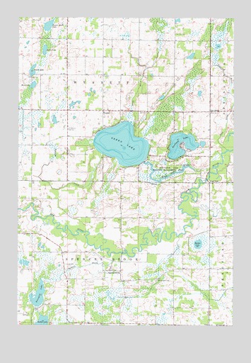
Wyanett, MN USGS Topographic Map
Click on map above to begin viewing in our Map Viewer.

This topographic map contains these locations and features:
Feature Name Type Latitude Longitude GNIS ID View Map
Barton LakeLakeN45.5330°W93.3955°639660View Map
Baxter LakeLakeN45.5007°W93.4859°639738View Map
Bear LakeLakeN45.5973°W93.4919°639768View Map
Cameron's AirportAirportN45.5501°W93.4755°2676846View Map
Clough CemeteryCemeteryN45.5244°W93.4727°641347View Map
Green LakeReservoirN45.5666°W93.4269°1776561View Map
Green LakeLakeN45.5733°W93.4398°644412View Map
Green Lake BrookStreamN45.5639°W93.3872°644419View Map
Green Lake DamDamN45.5666°W93.4269°1776560View Map
Isanti Fire District Station 2BuildingN45.5004°W93.3911°2666107View Map
King CemeteryCemeteryN45.5400°W93.4402°646154View Map
Lesure Heath LakeLakeN45.6217°W93.4830°646616View Map
Methodist ChurchChurchN45.5222°W93.4433°2069205View Map
Neighbors to Nations ChurchChurchN45.5875°W93.4875°2069196View Map
North BrookStreamN45.5825°W93.4350°648623View Map
Oak Knoll CemeteryCemeteryN45.6183°W93.4088°648829View Map
Old Wyanett Free CemeteryCemeteryN45.5797°W93.4711°648940View Map
OxlipPopulated PlaceN45.5002°W93.3888°654867View Map
Oxlip Post Office (historical)Post OfficeN45.5003°W93.3886°2069208View Map
Pine BrookStreamN45.5714°W93.3786°649443View Map
Pine BrookPopulated PlaceN45.5869°W93.3886°654880View Map
Pinebrook Post Office (historical)Post OfficeN45.5869°W93.3883°2069207View Map
Princeton Baptist FellowshipChurchN45.5875°W93.4722°2069197View Map
Radke LakeLakeN45.6119°W93.4849°649790View Map
Sandy LakeLakeN45.6032°W93.4921°651186View Map
Sandy Lake CemeteryCemeteryN45.6011°W93.4941°651192View Map
Spectacle LakeLakeN45.5704°W93.4042°652369View Map
Spectacle Lake Wildlife Management AreaParkN45.5647°W93.4138°652371View Map
Spencer BrookStreamN45.5289°W93.4394°652375View Map
Spencer BrookPopulated PlaceN45.5219°W93.4405°654954View Map
Spencer Brook CemeteryCemeteryN45.5183°W93.4191°652376View Map
Spencer Brook Post Office (historical)Post OfficeN45.5219°W93.4403°2069206View Map
Tennyson LakeLakeN45.5120°W93.4881°653087View Map
Township of Spencer BrookCivilN45.5150°W93.4497°665662View Map
Township of WyanettCivilN45.6018°W93.4504°666060View Map
Victory SchoolSchoolN45.5002°W93.3841°653653View Map
West PointPopulated PlaceN45.5577°W93.3891°655005View Map
WyanettPopulated PlaceN45.5869°W93.4508°655023View Map
Wyanett CreekStreamN45.5694°W93.4513°654399View Map
Wyanett Free Church CemeteryCemeteryN45.5853°W93.4505°2069282View Map
Wyanett Post Office (historical)Post OfficeN45.5869°W93.4506°2069195View Map

Note: Coordinates in the location and feature list above are referenced to NAD83 datum.


Copyright (C) 2008-2025 Ryan Niemi / Sunset Dynamics ... All Rights Reserved