TopoQuest Logo
Do you find TopoQuest useful?
Help keep TopoQuest running and adding new maps/features by donating!
Bitcoin:  19c7KJd3qBynnjoSw5npx9KScwjBe4ifkT
Litecoin:  LXs6TkuXGGXo1vDsWCkWVdjQX94eUKd6ui
Home View Maps Find Maps Find Places Resources & Links


Lake Norden, South Dakota Topographic Map

USGS Map Title: Lake Norden, SD
USGS Map MRC: 44097E2
DRG (GeoTIFF) Download: o44097e2.tif


Neighboring USGS Topographic Map Quads:


  Bryant NE, SD  
44097F3
 

  Hayti, SD  
44097F2
 

  Castlewood, SD  
44097F1
 

  Gertson Slough, SD  
44097E3
 

  Lake Norden, SD  
44097E2
 

  Lake Poinsett, SD  
44097E1
 

  Lake Preston NE, SD  
44097D3
 

  Badger, SD  
44097D2
 

  Arlington NE, SD  
44097D1


Map MRC Location:

N45°
W98°
N45°
W97°
H8 H7 H6 H5 H4 H3 H2 H1
G8 G7 G6 G5 G4 G3 G2 G1
F8 F7 F6 F5 F4 F3 F2 F1
E8 E7 E6 E5 E4 E3 E2 E1
D8 D7 D6 D5 D4 D3 D2 D1
C8 C7 C6 C5 C4 C3 C2 C1
B8 B7 B6 B5 B4 B3 B2 B1
A8 A7 A6 A5 A4 A3 A2 A1
N44°
W98°
N44°
W97°

Lake Norden, SD USGS 1:24K Topographic Map Preview:
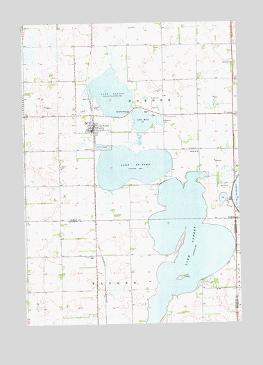
Lake Norden, SD USGS Topographic Map
Click on map above to begin viewing in our Map Viewer.

This topographic map contains these locations and features:
Feature Name Type Latitude Longitude GNIS ID View Map
AlsvillePopulated PlaceN44.5866°W97.1281°1260974View Map
Apostolic CemeteryCemeteryN44.5655°W97.2287°1253674View Map
City of Lake NordenCivilN44.5798°W97.2108°1267451View Map
Danish Lutheran Church (historical)ChurchN44.5289°W97.2301°1263796View Map
Denmark Post Office (historical)Post OfficeN44.5216°W97.2301°1267140View Map
Dolph CreekStreamN44.5972°W97.2112°1266798View Map
East Norden CemeteryCemeteryN44.6073°W97.1285°2560288View Map
East Norden ChurchChurchN44.6077°W97.1284°1265196View Map
Lake AlbertLakeN44.5333°W97.1574°1253603View Map
Lake MaryLakeN44.5843°W97.1811°1256344View Map
Lake NordenPopulated PlaceN44.5805°W97.2092°1256026View Map
Lake NordenLakeN44.5954°W97.1985°1256722View Map
Lake Norden Ambulance ServiceBuildingN44.5808°W97.2089°2658983View Map
Lake Norden Baptist CemeteryCemeteryN44.5881°W97.1800°2773715View Map
Lake Norden City OfficeBuildingN44.5807°W97.2099°2725084View Map
Lake Norden Community CenterBuildingN44.5808°W97.2094°2727738View Map
Lake Norden Fire DepartmentBuildingN44.5808°W97.2085°2580680View Map
Lake Norden Post OfficePost OfficeN44.5807°W97.2106°1267073View Map
Lake Saint JohnLakeN44.5653°W97.1878°1265345View Map
Nora (historical)LocaleN44.5916°W97.2212°1263377View Map
Olivet CemeteryCemeteryN44.5727°W97.2098°1256881View Map
Poinsett (historical)LocaleN44.5644°W97.1259°1263376View Map
Poinsett CemeteryCemeteryN44.5427°W97.1289°1257161View Map
School Number 16 (historical)SchoolN44.5200°W97.2092°1263795View Map
South Trinity CemeteryCemeteryN44.5281°W97.2098°1258222View Map
Township of NordenCivilN44.5866°W97.1575°1268153View Map
Township of Norden (historical)CivilN44.6089°W97.1787°1268140View Map
Trinity Lutheran CemeteryCemeteryN44.5860°W97.1670°2773711View Map

Note: Coordinates in the location and feature list above are referenced to NAD83 datum.


Copyright (C) 2008-2025 Ryan Niemi / Sunset Dynamics ... All Rights Reserved