TopoQuest Logo
Do you find TopoQuest useful?
Help keep TopoQuest running and adding new maps/features by donating!
Bitcoin:  19c7KJd3qBynnjoSw5npx9KScwjBe4ifkT
Litecoin:  LXs6TkuXGGXo1vDsWCkWVdjQX94eUKd6ui
Home View Maps Find Maps Find Places Resources & Links


Lake Park SW, Minnesota Topographic Map

USGS Map Title: Lake Park SW, MN
USGS Map MRC: 46096G2
DRG (GeoTIFF) Download: o46096g2.tif


Neighboring USGS Topographic Map Quads:


  Hawley, MN  
46096H3
 

  Dale, MN  
46096H2
 

  Lake Park, MN  
46096H1
 

  Hawley SE, MN  
46096G3
 

  Lake Park SW, MN  
46096G2
 

  Big Cormorant Lake, MN  
46096G1
 

  Big Slough, MN  
46096F3
 

  Rollag, MN  
46096F2
 

  Cormorant, MN  
46096F1


Map MRC Location:

N47°
W97°
N47°
W96°
H8 H7 H6 H5 H4 H3 H2 H1
G8 G7 G6 G5 G4 G3 G2 G1
F8 F7 F6 F5 F4 F3 F2 F1
E8 E7 E6 E5 E4 E3 E2 E1
D8 D7 D6 D5 D4 D3 D2 D1
C8 C7 C6 C5 C4 C3 C2 C1
B8 B7 B6 B5 B4 B3 B2 B1
A8 A7 A6 A5 A4 A3 A2 A1
N46°
W97°
N46°
W96°

Lake Park SW, MN USGS 1:24K Topographic Map Preview:
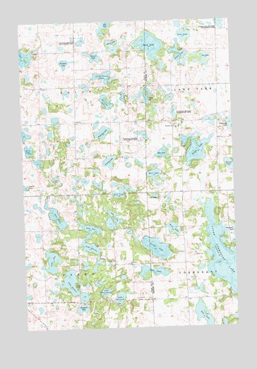
Lake Park SW, MN USGS Topographic Map
Click on map above to begin viewing in our Map Viewer.

This topographic map contains these locations and features:
Feature Name Type Latitude Longitude GNIS ID View Map
Axberg LakeLakeN46.8442°W96.1754°639542View Map
Bijou LakeLakeN46.8227°W96.1478°640151View Map
Boot LakeLakeN46.8127°W96.1723°640375View Map
Burk LakeLakeN46.8232°W96.2466°640656View Map
Camp GeorgeLocaleN46.7666°W96.2195°640801View Map
Christ Olson LakeLakeN46.8525°W96.2007°641189View Map
Cuba LakeLakeN46.8037°W96.1723°642542View Map
Erickson LakeLakeN46.8424°W96.1998°643397View Map
Houglum CemeteryCemeteryN46.8316°W96.1600°2108264View Map
Houglum ChurchChurchN46.8316°W96.1598°645250View Map
Jergenson LakeLakeN46.8299°W96.2024°645632View Map
Johnston AirportAirportN46.8590°W96.2421°660208View Map
Knudson LakeLakeN46.8584°W96.2240°646219View Map
Lake ElevenLakeN46.7830°W96.2116°643240View Map
Lake FifteenLakeN46.7690°W96.2244°643622View Map
Lake FourteenLakeN46.7646°W96.2031°643853View Map
Lake OneLakeN46.7936°W96.1951°648971View Map
Lake TenLakeN46.7777°W96.2349°653079View Map
Lake ThirteenLakeN46.7624°W96.1946°653142View Map
Lake ThreeLakeN46.7957°W96.2312°653183View Map
Lake TwoLakeN46.7903°W96.2111°653477View Map
Lee LakeLakeN46.8597°W96.1407°646571View Map
Lee Lake CampgroundLocaleN46.8653°W96.2389°2081005View Map
Long LakeLakeN46.7726°W96.1748°647094View Map
Lunde State Wildlife Management AreaParkN46.8736°W96.1292°647297View Map
Mansfield LakeLakeN46.7582°W96.2173°647451View Map
Moe LakeLakeN46.8747°W96.1981°648010View Map
Ness LakeLakeN46.8050°W96.1935°648489View Map
Old Yankee CemeteryCemeteryN46.7528°W96.2153°2093796View Map
Overson LakeLakeN46.8180°W96.1990°649093View Map
Park Lutheran Church CemeteryCemeteryN46.7761°W96.1872°2093800View Map
Parke ChurchChurchN46.7761°W96.1873°649156View Map
Prestrude LakeLakeN46.8328°W96.1260°649733View Map
Rose LakeLakeN46.7901°W96.1620°650269View Map
Round LakeLakeN46.8157°W96.1277°650363View Map
Sand LakeLakeN46.8650°W96.1728°651158View Map
Shoe LakeLakeN46.8209°W96.1673°651992View Map
Solem CemeteryCemeteryN46.8347°W96.2183°2093846View Map
Solem ChurchChurchN46.8344°W96.2184°652239View Map
Solum LakeLakeN46.8664°W96.1959°652245View Map
Talac LakeLakeN46.8590°W96.1560°652983View Map
Thorson LakeLakeN46.8610°W96.2066°653178View Map
Township of EglonCivilN46.8485°W96.2390°664055View Map
Township of ParkeCivilN46.7614°W96.2388°665254View Map
Tub LakeLakeN46.7548°W96.1458°653358View Map
Turtle LakeLakeN46.7824°W96.1727°653381View Map
Upper Cormorant LakeLakeN46.7786°W96.1319°653542View Map
York LakeLakeN46.8688°W96.1524°654418View Map

Note: Coordinates in the location and feature list above are referenced to NAD83 datum.


Copyright (C) 2008-2025 Ryan Niemi / Sunset Dynamics ... All Rights Reserved