TopoQuest Logo
Do you find TopoQuest useful?
Help keep TopoQuest running and adding new maps/features by donating!
Bitcoin:  19c7KJd3qBynnjoSw5npx9KScwjBe4ifkT
Litecoin:  LXs6TkuXGGXo1vDsWCkWVdjQX94eUKd6ui
Home View Maps Find Maps Find Places Resources & Links


Lake Tahkodah, Wisconsin Topographic Map

USGS Map Title: Lake Tahkodah, WI
USGS Map MRC: 46091B2
DRG (GeoTIFF) Download: o46091b2.tif


Neighboring USGS Topographic Map Quads:


  Drummond, WI  
46091C3
 

  Diamond Lake, WI  
46091C2
 

  Grand View, WI  
46091C1
 

  Cable, WI  
46091B3
 

  Lake Tahkodah, WI  
46091B2
 

  Namekagon Lake, WI  
46091B1
 

  Seeley, WI  
46091A3
 

  Spider Lake, WI  
46091A2
 

  Moose Lake, WI  
46091A1


Map MRC Location:

N47°
W92°
N47°
W91°
H8 H7 H6 H5 H4 H3 H2 H1
G8 G7 G6 G5 G4 G3 G2 G1
F8 F7 F6 F5 F4 F3 F2 F1
E8 E7 E6 E5 E4 E3 E2 E1
D8 D7 D6 D5 D4 D3 D2 D1
C8 C7 C6 C5 C4 C3 C2 C1
B8 B7 B6 B5 B4 B3 B2 B1
A8 A7 A6 A5 A4 A3 A2 A1
N46°
W92°
N46°
W91°

Lake Tahkodah, WI USGS 1:24K Topographic Map Preview:
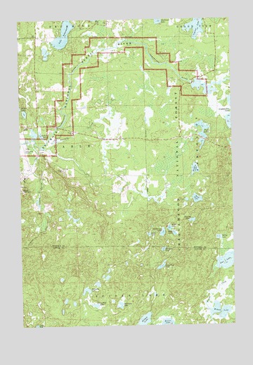
Lake Tahkodah, WI USGS Topographic Map
Click on map above to begin viewing in our Map Viewer.

This topographic map contains these locations and features:
Feature Name Type Latitude Longitude GNIS ID View Map
Beaver LakeLakeN46.1253°W91.1652°1578742View Map
Birch LakeLakeN46.1627°W91.1601°1578794View Map
Cable Union AirportAirportN46.1980°W91.2468°1580896View Map
Camp Four LakeLakeN46.1493°W91.1677°1578921View Map
Cap CreekStreamN46.1983°W91.2371°1578948View Map
Crystal LakeLakeN46.2469°W91.1444°1579072View Map
Emerson LakeLakeN46.1677°W91.1488°1579207View Map
Filing Shed LakeLakeN46.1334°W91.2069°1579238View Map
Fivemile CreekStreamN46.1994°W91.2349°1579251View Map
Frels LakeLakeN46.1647°W91.1627°1579294View Map
Hidden LakeLakeN46.1887°W91.1471°1579444View Map
Hildebrand LakeLakeN46.1629°W91.1669°1579447View Map
Holmes LakeLakeN46.1271°W91.1782°1579474View Map
Horseshoe LakeLakeN46.1326°W91.1926°1579483View Map
Horseshoe LakeLakeN46.1401°W91.2122°1579484View Map
Jo Ann LakeLakeN46.2032°W91.2377°1579534View Map
Johnson LakeLakeN46.1441°W91.2267°2771902View Map
Lake TahkodahLakeN46.2439°W91.2231°1580575View Map
McClaine LakeLakeN46.1561°W91.1665°1579840View Map
Namekagon 41 ReservoirReservoirN46.2233°W91.1469°1792754View Map
Namekgon WP320 DamDamN46.2233°W91.1469°1792753View Map
Rock LakeLakeN46.1765°W91.1463°1580276View Map
Rock Lake National Recreation TrailTrailN46.1758°W91.1421°1580895View Map
Southwest LakeLakeN46.2499°W91.1671°1580466View Map
Spring CreekStreamN46.2002°W91.2410°1580488View Map
Spring LakeLakeN46.1607°W91.1339°1580501View Map
Star LakeLakeN46.1507°W91.1299°1580525View Map
Tahkodah Hills Golf CourseLocaleN46.2450°W91.2316°1834268View Map
Trail LakeLakeN46.1622°W91.1741°1580642View Map
Twin LakesLakeN46.2050°W91.1424°1580676View Map
Wilson LakeLakeN46.1305°W91.1341°1580800View Map

Note: Coordinates in the location and feature list above are referenced to NAD83 datum.


Copyright (C) 2008-2024 Ryan Niemi / Sunset Dynamics ... All Rights Reserved