TopoQuest Logo
Do you find TopoQuest useful?
Help keep TopoQuest running and adding new maps/features by donating!
Bitcoin:  19c7KJd3qBynnjoSw5npx9KScwjBe4ifkT
Litecoin:  LXs6TkuXGGXo1vDsWCkWVdjQX94eUKd6ui
Home View Maps Find Maps Find Places Resources & Links


Spider Lake, Wisconsin Topographic Map

USGS Map Title: Spider Lake, WI
USGS Map MRC: 46091A2
DRG (GeoTIFF) Download: o46091a2.tif


Neighboring USGS Topographic Map Quads:


  Cable, WI  
46091B3
 

  Lake Tahkodah, WI  
46091B2
 

  Namekagon Lake, WI  
46091B1
 

  Seeley, WI  
46091A3
 

  Spider Lake, WI  
46091A2
 

  Moose Lake, WI  
46091A1
 

  Chief Lake, WI  
45091H3
 

  New Post, WI  
45091H2
 

  Barker Lake, WI  
45091H1


Map MRC Location:

N47°
W92°
N47°
W91°
H8 H7 H6 H5 H4 H3 H2 H1
G8 G7 G6 G5 G4 G3 G2 G1
F8 F7 F6 F5 F4 F3 F2 F1
E8 E7 E6 E5 E4 E3 E2 E1
D8 D7 D6 D5 D4 D3 D2 D1
C8 C7 C6 C5 C4 C3 C2 C1
B8 B7 B6 B5 B4 B3 B2 B1
A8 A7 A6 A5 A4 A3 A2 A1
N46°
W92°
N46°
W91°

Spider Lake, WI USGS 1:24K Topographic Map Preview:
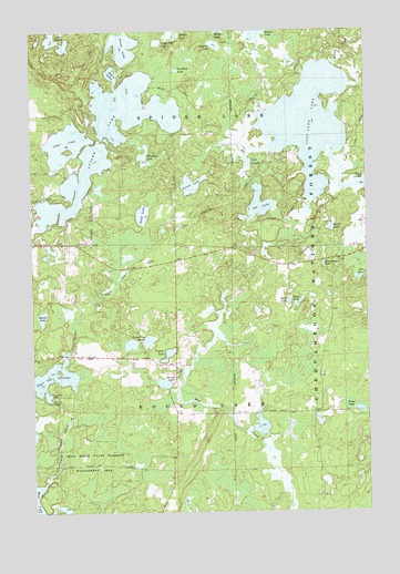
Spider Lake, WI USGS Topographic Map
Click on map above to begin viewing in our Map Viewer.

This topographic map contains these locations and features:
Feature Name Type Latitude Longitude GNIS ID View Map
Byrd LakeLakeN46.0541°W91.1545°1578906View Map
Camp Four LakesLakeN46.0445°W91.2070°1578922View Map
Chief River State Wildlife Management AreaParkN46.0127°W91.2302°1578990View Map
Clear LakeLakeN46.0963°W91.2377°1579017View Map
Currier LakeLakeN46.0409°W91.1998°1579075View Map
Davies LakeLakeN46.0507°W91.2465°1579084View Map
Davis LakeLakeN46.0736°W91.1386°1579085View Map
Dead CreekStreamN46.0491°W91.2346°1579090View Map
Dead Creek SpringSpringN46.0652°W91.2132°1577346View Map
Dead LakeLakeN46.0772°W91.2087°1579092View Map
Eagle Nest LakeLakeN46.1220°W91.2025°1579165View Map
Fawn LakeLakeN46.1138°W91.2196°1579231View Map
Foo LakeLakeN46.0607°W91.1287°1579267View Map
Lake HelaneLakeN46.1224°W91.2401°1579424View Map
Lake SchoolSchoolN46.0366°W91.1963°1579616View Map
Larson LakeLakeN46.0644°W91.1413°1580926View Map
Lewis LakeLakeN46.0849°W91.1904°1579652View Map
Little Ole LakeLakeN46.0906°W91.1693°1579694View Map
Lost Land LakeLakeN46.1019°W91.1468°1579770View Map
Lost Land Lake ClubLocaleN46.1063°W91.1402°1833773View Map
Mukwonago LakeLakeN46.0641°W91.1414°1579968View Map
North LakeLakeN46.1207°W91.2150°1580037View Map
Ole CreekStreamN46.0844°W91.1674°1580052View Map
Ole LakeLakeN46.0800°W91.1648°1580053View Map
One Shoe LakeLakeN46.1148°W91.1954°1580057View Map
Rush LakeLakeN46.0541°W91.1505°1580300View Map
Sickles LakeLakeN46.1236°W91.1952°1580403View Map
Spider CreekStreamN46.0422°W91.2355°1580470View Map
Spider LakeLakeN46.0974°W91.2233°1580472View Map
Spider Lake Fire Department Station 1BuildingN46.0702°W91.2332°2696916View Map
Spider Lake Fire Department Station 2BuildingN46.0985°W91.1267°2696846View Map
Spider Lake School (historical)SchoolN46.0700°W91.2330°1833802View Map
Spider Lake TownhallBuildingN46.0700°W91.2330°1833803View Map
Spring LakeLakeN46.0334°W91.2015°1580499View Map
Stearns LakeLakeN46.1213°W91.1808°1580527View Map
Tiger Cat 2WP255 DamDamN46.0300°W91.2418°1792036View Map
Tiger Cat DamDamN46.0297°W91.2430°1580615View Map
Tiger Cat Flowage 47ReservoirN46.0300°W91.2418°1792037View Map
Town of Round LakeCivilN46.0275°W91.1311°1584069View Map
Town of Round Lake Fire Department - Station 2BuildingN46.0156°W91.1984°2696856View Map
Trout LakeLakeN46.0263°W91.1283°1580652View Map
Whiplash LakeLakeN46.0926°W91.2079°1580767View Map
Wilson CreekStreamN46.1163°W91.1371°1580798View Map

Note: Coordinates in the location and feature list above are referenced to NAD83 datum.


Copyright (C) 2008-2025 Ryan Niemi / Sunset Dynamics ... All Rights Reserved