TopoQuest Logo
Do you find TopoQuest useful?
Help keep TopoQuest running and adding new maps/features by donating!
Bitcoin:  19c7KJd3qBynnjoSw5npx9KScwjBe4ifkT
Litecoin:  LXs6TkuXGGXo1vDsWCkWVdjQX94eUKd6ui
Home View Maps Find Maps Find Places Resources & Links


Lake Upsilon, North Dakota Topographic Map

USGS Map Title: Lake Upsilon, ND
USGS Map MRC: 48099H7
DRG (GeoTIFF) Download: o48099h7.tif


Neighboring USGS Topographic Map Quads:


  Carpenter Lake, ND  
48099H8
 

  Lake Upsilon, ND  
48099H7
 

  Saint John, ND  
48099H6
 

  Lake Upsilon SW, ND  
48099G8
 

  Lake Upsilon SE, ND  
48099G7
 

  Belcourt, ND  
48099G6


Map MRC Location:

N49°
W100°
N49°
W99°
H8 H7 H6 H5 H4 H3 H2 H1
G8 G7 G6 G5 G4 G3 G2 G1
F8 F7 F6 F5 F4 F3 F2 F1
E8 E7 E6 E5 E4 E3 E2 E1
D8 D7 D6 D5 D4 D3 D2 D1
C8 C7 C6 C5 C4 C3 C2 C1
B8 B7 B6 B5 B4 B3 B2 B1
A8 A7 A6 A5 A4 A3 A2 A1
N48°
W100°
N48°
W99°

Lake Upsilon, ND USGS 1:24K Topographic Map Preview:
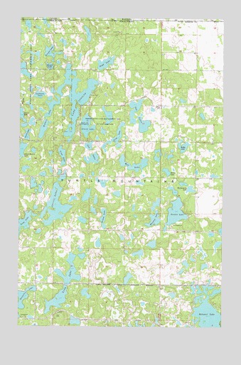
Lake Upsilon, ND USGS Topographic Map
Click on map above to begin viewing in our Map Viewer.

This topographic map contains these locations and features:
Feature Name Type Latitude Longitude GNIS ID View Map
Belcourt LakeLakeN48.8775°W99.7591°1027874View Map
Boyd LakeLakeN48.9818°W99.8232°1028106View Map
Broom LakeLakeN48.9805°W99.8574°1028147View Map
Cool LakesLakeN48.9430°W99.8304°1028445View Map
Crow LakeLakeN48.9443°W99.8489°1028552View Map
Desjarlis LakeLakeN48.8858°W99.8741°1028669View Map
Fiestel LakeLakeN48.9861°W99.8565°1028954View Map
Gordon LakeLakeN48.9225°W99.7790°1029185View Map
Gravel LakeLakeN48.9565°W99.8340°1029230View Map
Gravel Lake CampgroundLocaleN48.9570°W99.8385°1029231View Map
Grimm LakeLakeN48.9190°W99.8233°1029245View Map
Hufty LakeLakeN48.9483°W99.7747°1029569View Map
Jarvis LakeLakeN48.9211°W99.8528°1029652View Map
Laird LakeLakeN48.9527°W99.8708°1029796View Map
Lake UpsilonLakeN48.9662°W99.8446°1032614View Map
Lashman LakeLakeN48.9688°W99.8632°1029844View Map
Long LakeLakeN48.8973°W99.8439°1029990View Map
Long LakeLakeN48.9533°W99.8146°1029993View Map
Long LakeLakeN48.9159°W99.8733°1029999View Map
Mill LakeLakeN48.9409°W99.8052°1030226View Map
Mill Lake CemeteryCemeteryN48.9499°W99.8330°1030227View Map
Montgomery LakeLakeN48.9309°W99.7701°1030273View Map
Mullet LakeLakeN48.9380°W99.7847°1030337View Map
Oak LakesLakeN48.9629°W99.8047°1030527View Map
Rames LakeLakeN48.9593°W99.8734°1030836View Map
Saint Benedicts ChurchChurchN48.8783°W99.8710°1031100View Map
Turtle Mountain Community CollegeSchoolN48.8838°W99.7509°2745416View Map
Walker LakeLakeN48.9611°W99.8575°1032669View Map
Wheaton LakeLakeN48.9185°W99.7923°1032762View Map
Wilfreds LakeLakeN48.9987°W99.8601°1035872View Map

Note: Coordinates in the location and feature list above are referenced to NAD83 datum.


Copyright (C) 2008-2024 Ryan Niemi / Sunset Dynamics ... All Rights Reserved