TopoQuest Logo
Do you find TopoQuest useful?
Help keep TopoQuest running and adding new maps/features by donating!
Bitcoin:  19c7KJd3qBynnjoSw5npx9KScwjBe4ifkT
Litecoin:  LXs6TkuXGGXo1vDsWCkWVdjQX94eUKd6ui
Home View Maps Find Maps Find Places Resources & Links


Carpenter Lake, North Dakota Topographic Map

USGS Map Title: Carpenter Lake, ND
USGS Map MRC: 48099H8
DRG (GeoTIFF) Download: o48099h8.tif


Neighboring USGS Topographic Map Quads:


  International Peace Garden, ND  
48100H1
 

  Carpenter Lake, ND  
48099H8
 

  Lake Upsilon, ND  
48099H7
 

  Dunseith, ND  
48100G1
 

  Lake Upsilon SW, ND  
48099G8
 

  Lake Upsilon SE, ND  
48099G7


Map MRC Location:

N49°
W100°
N49°
W99°
H8 H7 H6 H5 H4 H3 H2 H1
G8 G7 G6 G5 G4 G3 G2 G1
F8 F7 F6 F5 F4 F3 F2 F1
E8 E7 E6 E5 E4 E3 E2 E1
D8 D7 D6 D5 D4 D3 D2 D1
C8 C7 C6 C5 C4 C3 C2 C1
B8 B7 B6 B5 B4 B3 B2 B1
A8 A7 A6 A5 A4 A3 A2 A1
N48°
W100°
N48°
W99°

Carpenter Lake, ND USGS 1:24K Topographic Map Preview:
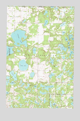
Carpenter Lake, ND USGS Topographic Map
Click on map above to begin viewing in our Map Viewer.

This topographic map contains these locations and features:
Feature Name Type Latitude Longitude GNIS ID View Map
Belle LakeLakeN48.8938°W99.9994°1027879View Map
Ben Waters LakeLakeN48.9676°W99.8950°1027884View Map
Bu LakeLakeN48.9149°W99.9011°1028165View Map
Cain LakeLakeN48.9156°W99.9159°1028231View Map
Carpenter LakeLakeN48.9609°W99.9769°1028282View Map
Cassidy LakeLakeN48.8759°W99.9059°1028295View Map
Coon LakeLakeN48.9970°W99.9088°1028448View Map
Dion LakeLakeN48.9778°W99.8960°1028686View Map
Donald LakeLakeN48.9264°W99.9075°1028702View Map
Gravel Bottom LakeLakeN48.9016°W99.9607°1029229View Map
Hooker LakeLakeN48.9598°W99.8896°1029522View Map
Horseshoe LakeLakeN48.9124°W99.9869°1029551View Map
Huff LakeLakeN48.9311°W99.9160°1029568View Map
Island LakeLakeN48.9621°W99.8819°1029633View Map
Jay LakeLakeN48.9453°W99.9486°1029653View Map
Little Horseshoe LakeLakeN48.9124°W99.9869°1029940View Map
Long LakeLakeN48.9036°W99.9974°1029998View Map
Magog LakeLakeN48.8824°W99.9451°1030065View Map
Olson LakeLakeN48.9497°W99.8844°1030567View Map
Purdy LakeLakeN48.9420°W99.8986°1030821View Map
Rolette County Waterfowl Production AreaParkN48.9033°W99.9801°2765483View Map
School Section LakeLakeN48.9010°W99.9254°1031988View Map
School Section LakeLakeN48.9442°W99.8776°1031990View Map
School Section LakeLakeN48.9447°W99.9968°1031991View Map
School Section Lake National Wildlife RefugeParkN48.9428°W99.9962°1031992View Map
Streitzel LakeLakeN48.9800°W99.9277°1032373View Map
Sucker LakeLakeN48.9272°W99.9693°1032378View Map
Unorganized Territory of North RoletteCivilN48.9021°W99.9692°1036198View Map
Villneauve LakeLakeN48.8803°W99.9107°1032647View Map
Wakopa DamDamN48.9800°W99.8771°1033184View Map
Wakopa State Game Management AreaParkN48.9778°W99.8754°1032662View Map
Warner LakeLakeN48.9549°W99.8854°1032684View Map
Wendland LakeLakeN48.9016°W99.9460°1032720View Map
Ziegler LakeLakeN48.9813°W99.9684°1032907View Map

Note: Coordinates in the location and feature list above are referenced to NAD83 datum.


Copyright (C) 2008-2024 Ryan Niemi / Sunset Dynamics ... All Rights Reserved