TopoQuest Logo
Do you find TopoQuest useful?
Help keep TopoQuest running and adding new maps/features by donating!
Bitcoin:  19c7KJd3qBynnjoSw5npx9KScwjBe4ifkT
Litecoin:  LXs6TkuXGGXo1vDsWCkWVdjQX94eUKd6ui
Home View Maps Find Maps Find Places Resources & Links


Lancaster East, California Topographic Map

USGS Map Title: Lancaster East, CA
USGS Map MRC: 34118F1
DRG (GeoTIFF) Download: o34118f1.tif


Neighboring USGS Topographic Map Quads:


  Rosamond, CA  
34118G2
 

  Rosamond Lake, CA  
34118G1
 

  Redman, CA  
34117G8
 

  Lancaster West, CA  
34118F2
 

  Lancaster East, CA  
34118F1
 

  Alpine Butte, CA  
34117F8
 

  Ritter Ridge, CA  
34118E2
 

  Palmdale, CA  
34118E1
 

  Littlerock, CA  
34117E8


Map MRC Location:

N35°
W119°
N35°
W118°
H8 H7 H6 H5 H4 H3 H2 H1
G8 G7 G6 G5 G4 G3 G2 G1
F8 F7 F6 F5 F4 F3 F2 F1
E8 E7 E6 E5 E4 E3 E2 E1
D8 D7 D6 D5 D4 D3 D2 D1
C8 C7 C6 C5 C4 C3 C2 C1
B8 B7 B6 B5 B4 B3 B2 B1
A8 A7 A6 A5 A4 A3 A2 A1
N34°
W119°
N34°
W118°

Lancaster East, CA USGS 1:24K Topographic Map Preview:
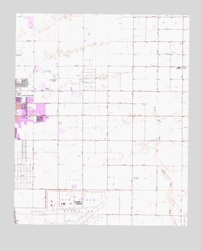
Lancaster East, CA USGS Topographic Map
Click on map above to begin viewing in our Map Viewer.

This topographic map contains these locations and features:
Feature Name Type Latitude Longitude GNIS ID View Map
Airport Terminal PoliceBuildingN34.6372°W118.0897°2756345View Map
Antelope Ambulance ServiceBuildingN34.6561°W118.1183°2665578View Map
Desert Haven SchoolSchoolN34.7114°W118.0984°241433View Map
East Lancaster Plaza Shopping CenterLocaleN34.6889°W118.1120°1733580View Map
East Side Elementary SchoolSchoolN34.7187°W118.0080°1669906View Map
Eastside ParkParkN34.7022°W118.1226°1733581View Map
El Dorado Elementary SchoolSchoolN34.6909°W118.1244°1733583View Map
El Dorado ParkParkN34.6911°W118.1220°1733584View Map
Joshua Memorial ParkCemeteryN34.6958°W118.1151°244145View Map
KUTY-AM (Palmdale)TowerN34.6653°W118.0120°1662684View Map
Linda Verde Elementary SchoolSchoolN34.6995°W118.1208°1733610View Map
Little Rock WashStreamN34.7047°W118.0276°272117View Map
Los Angeles County Fire Department Station 117BuildingN34.6987°W118.0775°2665215View Map
Los Angeles County Fire Department Station 135BuildingN34.6712°W118.0952°2665219View Map
New Vista Elementary SchoolSchoolN34.6730°W118.1140°1733620View Map
Piute Middle SchoolSchoolN34.7091°W118.1229°1733630View Map
Rancho Sierra Golf ClubLocaleN34.7436°W118.0262°1733635View Map
RooseveltPopulated PlaceN34.7194°W118.0056°248347View Map
Sheriffs HeliportAirportN34.6997°W118.0601°1653594View Map
Skytower ParkParkN34.6714°W118.0723°1733643View Map
Sterks Ranch Airport (historical)AirportN34.7155°W118.1023°1733644View Map
Tierra Bonita ParkParkN34.7000°W118.0792°1733647View Map
Tierra Bonita School (historical)SchoolN34.6894°W118.0595°1666869View Map
United States Air Force Plant 42 Fire Department Station 2BuildingN34.6356°W118.0921°2665024View Map

Note: Coordinates in the location and feature list above are referenced to NAD83 datum.


Copyright (C) 2008-2024 Ryan Niemi / Sunset Dynamics ... All Rights Reserved