TopoQuest Logo
Do you find TopoQuest useful?
Help keep TopoQuest running and adding new maps/features by donating!
Bitcoin:  19c7KJd3qBynnjoSw5npx9KScwjBe4ifkT
Litecoin:  LXs6TkuXGGXo1vDsWCkWVdjQX94eUKd6ui
Home View Maps Find Maps Find Places Resources & Links


Lance Canyon, Utah Topographic Map

USGS Map Title: Lance Canyon, UT
USGS Map MRC: 39110H5
DRG (GeoTIFF) Download: o39110h5.tif


Neighboring USGS Topographic Map Quads:


  Sams Canyon, UT  
40110A6
 

  Buck Knoll, UT  
40110A5
 

  Duchesne SW, UT  
40110A4
 

  Jones Hollow, UT  
39110H6
 

  Lance Canyon, UT  
39110H5
 

  Anthro Mountain, UT  
39110H4
 

  Minnie Maud Creek West, UT  
39110G6
 

  Minnie Maud Creek East, UT  
39110G5
 

  Wood Canyon, UT  
39110G4


Map MRC Location:

N40°
W111°
N40°
W110°
H8 H7 H6 H5 H4 H3 H2 H1
G8 G7 G6 G5 G4 G3 G2 G1
F8 F7 F6 F5 F4 F3 F2 F1
E8 E7 E6 E5 E4 E3 E2 E1
D8 D7 D6 D5 D4 D3 D2 D1
C8 C7 C6 C5 C4 C3 C2 C1
B8 B7 B6 B5 B4 B3 B2 B1
A8 A7 A6 A5 A4 A3 A2 A1
N39°
W111°
N39°
W110°

Lance Canyon, UT USGS 1:24K Topographic Map Preview:
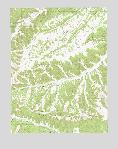
Lance Canyon, UT USGS Topographic Map
Click on map above to begin viewing in our Map Viewer.

This topographic map contains these locations and features:
Feature Name Type Latitude Longitude GNIS ID View Map
Big Piney CanyonValleyN39.8864°W110.6029°1438715View Map
Big Trough CreekStreamN39.9764°W110.5749°1438753View Map
Broad HollowValleyN39.9272°W110.5674°1439137View Map
Corral HollowValleyN39.9230°W110.5646°1439974View Map
Cottonwood RidgeRidgeN39.9827°W110.5374°1440034View Map
Deathtrap CanyonValleyN39.9189°W110.6174°1440333View Map
Fivemile CreekStreamN39.9852°W110.6029°1441100View Map
Garder CanyonValleyN39.8875°W110.6096°1441267View Map
Jenson CanyonValleyN39.8786°W110.5718°1442126View Map
Jolie HollowValleyN39.9386°W110.5265°1442197View Map
K P CreekStreamN39.9972°W110.5810°1442259View Map
Lance CanyonValleyN39.9322°W110.5313°1442435View Map
Mill CanyonValleyN39.8902°W110.6229°1443411View Map
North Twin HollowValleyN39.9394°W110.5149°1443985View Map
Road HollowValleyN39.9319°W110.5302°1445002View Map
Sorens CoveValleyN39.8811°W110.5796°1445785View Map
South Twin HollowValleyN39.9355°W110.5235°1445928View Map
Spring HollowValleyN39.9233°W110.5657°1454910View Map
Trail HollowValleyN39.9208°W110.5918°1446678View Map
Trapper CanyonValleyN39.9302°W110.5524°1446704View Map
West Lance SpringSpringN39.9102°W110.5427°2786334View Map
Wild Horse RidgeRidgeN39.9702°W110.5327°1447350View Map
Y CanyonValleyN39.9227°W110.5993°1447542View Map

Note: Coordinates in the location and feature list above are referenced to NAD83 datum.


Copyright (C) 2008-2025 Ryan Niemi / Sunset Dynamics ... All Rights Reserved