TopoQuest Logo
Do you find TopoQuest useful?
Help keep TopoQuest running and adding new maps/features by donating!
Bitcoin:  19c7KJd3qBynnjoSw5npx9KScwjBe4ifkT
Litecoin:  LXs6TkuXGGXo1vDsWCkWVdjQX94eUKd6ui
Home View Maps Find Maps Find Places Resources & Links


Landes, Illinois Topographic Map

USGS Map Title: Landes, IL
USGS Map MRC: 38087G8
DRG (GeoTIFF) Download: o38087g8.tif


Neighboring USGS Topographic Map Quads:


  Sainte Marie, IL  
38088H1
 

  Oblong South, IL  
38087H8
 

  Stoy, IL  
38087H7
 

  Dundas, IL  
38088G1
 

  Landes, IL  
38087G8
 

  Chauncey, IL  
38087G7
 

  Olney, IL  
38088F1
 

  Claremont, IL  
38087F8
 

  Sumner, IL  
38087F7


Map MRC Location:

N39°
W88°
N39°
W87°
H8 H7 H6 H5 H4 H3 H2 H1
G8 G7 G6 G5 G4 G3 G2 G1
F8 F7 F6 F5 F4 F3 F2 F1
E8 E7 E6 E5 E4 E3 E2 E1
D8 D7 D6 D5 D4 D3 D2 D1
C8 C7 C6 C5 C4 C3 C2 C1
B8 B7 B6 B5 B4 B3 B2 B1
A8 A7 A6 A5 A4 A3 A2 A1
N38°
W88°
N38°
W87°

Landes, IL USGS 1:24K Topographic Map Preview:
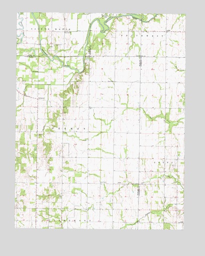
Landes, IL USGS Topographic Map
Click on map above to begin viewing in our Map Viewer.

This topographic map contains these locations and features:
Feature Name Type Latitude Longitude GNIS ID View Map
AmityPopulated PlaceN38.7764°W87.9242°422408View Map
Amity CemeteryCemeteryN38.7767°W87.9361°1820887View Map
Amity ChapelChurchN38.7770°W87.9364°403490View Map
Amity School (historical)SchoolN38.7762°W87.9270°1736778View Map
Asbury ChurchChurchN38.8203°W87.9453°403653View Map
Calfkiller CreekStreamN38.8403°W87.9539°405353View Map
Cotterell School (historical)SchoolN38.8059°W87.9648°1736792View Map
Cow Ford Ferry (historical)LocaleN38.8462°W87.9500°1736793View Map
Crum School (historical)SchoolN38.7764°W87.9648°1736794View Map
Dark Bend CemeteryCemeteryN38.8561°W87.9706°418716View Map
Douglas CreekStreamN38.8439°W87.9656°407334View Map
Fyffe School (historical)SchoolN38.7542°W87.8903°1764766View Map
Goss CemeteryCemeteryN38.7687°W87.9650°409208View Map
LandesPopulated PlaceN38.8648°W87.8892°422895View Map
Leech CemeteryCemeteryN38.7873°W87.8820°411915View Map
Leech School (historical)SchoolN38.7978°W87.8806°1764782View Map
Mount North SchoolSchoolN38.8281°W87.9592°1736815View Map
Murphy CreekStreamN38.8334°W87.9753°414247View Map
Newlight Church (historical)ChurchN38.8642°W87.9261°1736280View Map
Old Saint Josephs CemeteryCemeteryN38.8053°W87.9828°1820905View Map
Prairie ChapelChurchN38.7542°W87.8773°416101View Map
Prairie Hall ChurchChurchN38.8356°W87.9273°416144View Map
Prairie Hall School (historical)SchoolN38.8350°W87.9273°1736826View Map
Prairie School (historical)SchoolN38.7542°W87.8778°1764797View Map
Roney School (historical)SchoolN38.8056°W87.9275°1736832View Map
Saint Joseph Church (historical)ChurchN38.8034°W87.9834°1736833View Map
Saint Joseph SchoolSchoolN38.8042°W87.9828°417459View Map
South Bend ChurchChurchN38.8637°W87.9642°418717View Map
Stoltz CemeteryCemeteryN38.8175°W87.9648°419160View Map
StringtownPopulated PlaceN38.8250°W87.9836°423214View Map
Township of GermanCivilN38.8058°W87.9659°429049View Map
Union School (historical)SchoolN38.7987°W87.8889°1764805View Map

Note: Coordinates in the location and feature list above are referenced to NAD83 datum.


Copyright (C) 2008-2025 Ryan Niemi / Sunset Dynamics ... All Rights Reserved