TopoQuest Logo
Do you find TopoQuest useful?
Help keep TopoQuest running and adding new maps/features by donating!
Bitcoin:  19c7KJd3qBynnjoSw5npx9KScwjBe4ifkT
Litecoin:  LXs6TkuXGGXo1vDsWCkWVdjQX94eUKd6ui
Home View Maps Find Maps Find Places Resources & Links


Lane, Idaho Topographic Map

USGS Map Title: Lane, ID
USGS Map MRC: 47116E5
DRG (GeoTIFF) Download: o47116e5.tif


Neighboring USGS Topographic Map Quads:


  Fernan Lake, ID  
47116F6
 

  Wolf Lodge, ID  
47116F5
 

  Skitwish Peak, ID  
47116F4
 

  Mount Coeur D'Alene, ID  
47116E6
 

  Lane, ID  
47116E5
 

  Rose Lake, ID  
47116E4
 

  Black Lake, ID  
47116D6
 

  Medimont, ID  
47116D5
 

  Rochat Peak, ID  
47116D4


Map MRC Location:

N48°
W117°
N48°
W116°
H8 H7 H6 H5 H4 H3 H2 H1
G8 G7 G6 G5 G4 G3 G2 G1
F8 F7 F6 F5 F4 F3 F2 F1
E8 E7 E6 E5 E4 E3 E2 E1
D8 D7 D6 D5 D4 D3 D2 D1
C8 C7 C6 C5 C4 C3 C2 C1
B8 B7 B6 B5 B4 B3 B2 B1
A8 A7 A6 A5 A4 A3 A2 A1
N47°
W117°
N47°
W116°

Lane, ID USGS 1:24K Topographic Map Preview:
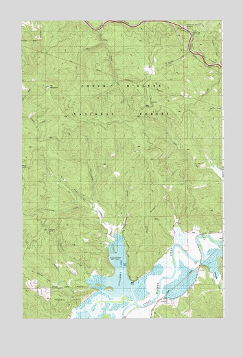
Lane, ID USGS Topographic Map
Click on map above to begin viewing in our Map Viewer.

This topographic map contains these locations and features:
Feature Name Type Latitude Longitude GNIS ID View Map
Armstrong CreekStreamN47.5455°W116.5818°376715View Map
Beauty SaddleGapN47.5632°W116.6221°395081View Map
Blackrock GulchValleyN47.5244°W116.5088°377817View Map
Chatfield CreekStreamN47.5169°W116.5843°379210View Map
Chatfield SaddleGapN47.5374°W116.6096°395200View Map
Elk MountainSummitN47.5971°W116.6099°381390View Map
Fortier CreekStreamN47.5307°W116.5685°381942View Map
Harrison DivisionCivilN47.6210°W116.5306°1936728View Map
Hogback RidgeRidgeN47.5085°W116.6016°383241View Map
Killarney CreekStreamN47.5057°W116.5563°384216View Map
Killarney LakeLakeN47.5187°W116.5648°373410View Map
Killarney Lake Picnic AreaLocaleN47.5227°W116.5602°394290View Map
Killarney MountainSummitN47.5899°W116.5480°396739View Map
LanePopulated PlaceN47.5069°W116.5363°399113View Map
Lane CemeteryCemeteryN47.5066°W116.5332°384415View Map
Lane CreekStreamN47.5141°W116.5827°384416View Map
McGinnis CreekStreamN47.5146°W116.6021°386618View Map
Mountain Tree Historic SiteLocaleN47.6188°W116.5193°387298View Map
Popcorn IslandIslandN47.5255°W116.5685°394936View Map
Reserve CreekStreamN47.6110°W116.5221°389304View Map
Rodney DrawValleyN47.6071°W116.5018°374761View Map
South Fork Cedar CreekStreamN47.6210°W116.5793°390902View Map
Ward RidgeRidgeN47.5394°W116.5521°392829View Map
West Fork Fortier CreekStreamN47.5488°W116.5835°393107View Map

Note: Coordinates in the location and feature list above are referenced to NAD83 datum.


Copyright (C) 2008-2025 Ryan Niemi / Sunset Dynamics ... All Rights Reserved