TopoQuest Logo
Do you find TopoQuest useful?
Help keep TopoQuest running and adding new maps/features by donating!
Bitcoin:  19c7KJd3qBynnjoSw5npx9KScwjBe4ifkT
Litecoin:  LXs6TkuXGGXo1vDsWCkWVdjQX94eUKd6ui
Home View Maps Find Maps Find Places Resources & Links


Mount Coeur D'Alene, Idaho Topographic Map

USGS Map Title: Mount Coeur D'Alene, ID
USGS Map MRC: 47116E6
DRG (GeoTIFF) Download: o47116e6.tif


Neighboring USGS Topographic Map Quads:


  Coeur D'Alene, ID  
47116F7
 

  Fernan Lake, ID  
47116F6
 

  Wolf Lodge, ID  
47116F5
 

  Mica Bay, ID  
47116E7
 

  Mount Coeur D'Alene, ID  
47116E6
 

  Lane, ID  
47116E5
 

  Harrison, ID  
47116D7
 

  Black Lake, ID  
47116D6
 

  Medimont, ID  
47116D5


Map MRC Location:

N48°
W117°
N48°
W116°
H8 H7 H6 H5 H4 H3 H2 H1
G8 G7 G6 G5 G4 G3 G2 G1
F8 F7 F6 F5 F4 F3 F2 F1
E8 E7 E6 E5 E4 E3 E2 E1
D8 D7 D6 D5 D4 D3 D2 D1
C8 C7 C6 C5 C4 C3 C2 C1
B8 B7 B6 B5 B4 B3 B2 B1
A8 A7 A6 A5 A4 A3 A2 A1
N47°
W117°
N47°
W116°

Mount Coeur D'Alene, ID USGS 1:24K Topographic Map Preview:
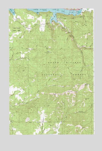
Mount Coeur D'Alene, ID USGS Topographic Map
Click on map above to begin viewing in our Map Viewer.

This topographic map contains these locations and features:
Feature Name Type Latitude Longitude GNIS ID View Map
Beauty BayBayN47.6166°W116.6838°377228View Map
Beauty Bay Picnic AreaLocaleN47.6113°W116.6899°395340View Map
Beauty CreekStreamN47.6119°W116.6802°377229View Map
Beauty Creek CampgroundLocaleN47.6066°W116.6688°395341View Map
Caribou CreekStreamN47.6013°W116.6613°378915View Map
Caribou MineMineN47.6010°W116.6635°378925View Map
Caribou Ridge National Recreation TrailTrailN47.5946°W116.6791°393942View Map
Carill PeakSummitN47.5405°W116.6821°378930View Map
Carrill CreekStreamN47.5480°W116.6971°378954View Map
Cottonwood CreekStreamN47.5202°W116.6649°379836View Map
Cottonwood PeakSummitN47.5346°W116.6405°379862View Map
EddyvillePopulated PlaceN47.6160°W116.7316°396442View Map
Elk Patrol LookoutLocaleN47.5999°W116.6257°396455View Map
Gray Wolf MineMineN47.5977°W116.6577°396585View Map
Hageman DrawValleyN47.5860°W116.6316°395592View Map
KVNI-AM (Coeur D'Alene)TowerN47.6157°W116.7196°401725View Map
Lost Man CreekStreamN47.5866°W116.6374°395655View Map
Mineral RidgeRidgeN47.6091°W116.6443°394776View Map
Mineral Ridge Boat RampLocaleN47.6185°W116.6610°393940View Map
Mineral Ridge Picnic AreaLocaleN47.6152°W116.6771°393941View Map
Moscow BayBayN47.6224°W116.7088°387248View Map
Mount Coeur D Alene LookoutLocaleN47.5813°W116.6893°393944View Map
Mount Coeur D Alene Picnic AreaLocaleN47.5855°W116.6932°393943View Map
Mount Coeur d'AleneSummitN47.5813°W116.6910°396315View Map
Murphys DrawValleyN47.6191°W116.6432°394814View Map
Neachen BayBayN47.6235°W116.7474°391276View Map
North CreekStreamN47.5519°W116.6924°387632View Map
Pleasant CreekStreamN47.5466°W116.7032°388600View Map
Red Horse MineMineN47.5421°W116.6491°394992View Map
Red Horse MountainSummitN47.5491°W116.6343°397090View Map
Silver Tip MineMineN47.5871°W116.6399°395948View Map
South Fork Beauty CreekStreamN47.5685°W116.6385°395967View Map
Steamchet CreekStreamN47.6182°W116.7432°391281View Map
Swan PeakSummitN47.5063°W116.6410°391730View Map
Swan SaddleGapN47.5216°W116.6280°393945View Map
Turner PeakSummitN47.5619°W116.7332°397278View Map
Varnum CreekStreamN47.5849°W116.6480°392707View Map
Wolf Lodge BayBayN47.6227°W116.6735°393632View Map
Wolf Lodge CreekStreamN47.6216°W116.6432°393633View Map

Note: Coordinates in the location and feature list above are referenced to NAD83 datum.


Copyright (C) 2008-2024 Ryan Niemi / Sunset Dynamics ... All Rights Reserved