TopoQuest Logo
Do you find TopoQuest useful?
Help keep TopoQuest running and adding new maps/features by donating!
Bitcoin:  19c7KJd3qBynnjoSw5npx9KScwjBe4ifkT
Litecoin:  LXs6TkuXGGXo1vDsWCkWVdjQX94eUKd6ui
Home View Maps Find Maps Find Places Resources & Links


Laramie, Wyoming Topographic Map

USGS Map Title: Laramie, WY
USGS Map MRC: 41105C5
DRG (GeoTIFF) Download: o41105c5.tif


Neighboring USGS Topographic Map Quads:


  Bamforth Lake, WY  
41105D6
 

  Howell, WY  
41105D5
 

  King Mountain, WY  
41105D4
 

  Laramie SW, WY  
41105C6
 

  Laramie, WY  
41105C5
 

  Pilot Hill, WY  
41105C4
 

  Hutton Lake, WY  
41105B6
 

  Red Buttes, WY  
41105B5
 

  Sherman Mountains West, WY  
41105B4


Map MRC Location:

N42°
W106°
N42°
W105°
H8 H7 H6 H5 H4 H3 H2 H1
G8 G7 G6 G5 G4 G3 G2 G1
F8 F7 F6 F5 F4 F3 F2 F1
E8 E7 E6 E5 E4 E3 E2 E1
D8 D7 D6 D5 D4 D3 D2 D1
C8 C7 C6 C5 C4 C3 C2 C1
B8 B7 B6 B5 B4 B3 B2 B1
A8 A7 A6 A5 A4 A3 A2 A1
N41°
W106°
N41°
W105°

Laramie, WY USGS 1:24K Topographic Map Preview:
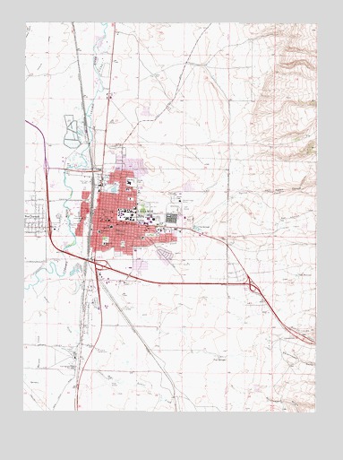
Laramie, WY USGS Topographic Map
Click on map above to begin viewing in our Map Viewer.

This topographic map contains these locations and features:
Feature Name Type Latitude Longitude GNIS ID View Map
Albany County SheriffBuildingN41.3111°W105.5904°2752674View Map
Beitel SchoolSchoolN41.3058°W105.5755°1585360View Map
Campus MallLocaleN41.3103°W105.5744°1764040View Map
Carroll PitMineN41.3136°W105.5675°1726213View Map
Chris Klein DamDamN41.2550°W105.5672°1605670View Map
Chris Klein ReservoirReservoirN41.2543°W105.5653°1608855View Map
City of LaramieCivilN41.3097°W105.6085°2411625View Map
City SpringsSpringN41.3089°W105.5525°1586729View Map
Easterling PitMineN41.3142°W105.5878°1726214View Map
Evans Airport (historical)AirportN41.2586°W105.5894°1605611View Map
Fort Sanders (historical)LocaleN41.2711°W105.5986°1609091View Map
Government GulchValleyN41.2589°W105.5383°1599996View Map
Government GullyValleyN41.2711°W105.5197°1599997View Map
Green Hill CemeteryCemeteryN41.3149°W105.5742°1589117View Map
Harney CreekStreamN41.2828°W105.6197°1596831View Map
Ivinson Memorial HospitalHospitalN41.3122°W105.5567°2673176View Map
Jack Rabbit CanyonValleyN41.3211°W105.5350°1600569View Map
Justin PitMineN41.2847°W105.5242°1726215View Map
Kay PitMineN41.2839°W105.5672°1726217View Map
KLDI-AM (Laramie)TowerN41.2553°W105.5508°1608807View Map
KOWB-AM (Laramie)TowerN41.2839°W105.5814°1608808View Map
LaramiePopulated PlaceN41.3114°W105.5911°1590526View Map
Laramie Country ClubLocaleN41.2697°W105.5933°1590527View Map
Laramie Fire Department Station 1BuildingN41.3115°W105.5919°2673451View Map
Laramie Fire Department Station 2BuildingN41.3253°W105.5664°2673498View Map
Laramie PlazaLocaleN41.3069°W105.5497°1764045View Map
Laramie Police DepartmentBuildingN41.2931°W105.5906°2752602View Map
Laramie Post OfficePost OfficeN41.3132°W105.5910°2767893View Map
Leah ReservoirReservoirN41.2944°W105.5083°1590610View Map
Lincoln SchoolSchoolN41.3119°W105.6011°1590697View Map
Nellie Iles SchoolSchoolN41.3039°W105.5917°1592000View Map
Odd Fellows Shopping CenterLocaleN41.3094°W105.5658°1764046View Map
Optimist ParkFlatN41.3094°W105.6044°1592455View Map
Pope SpringsSpringN41.2672°W105.5417°1592954View Map
Rock & A Hard Place Ranch AirportAirportN41.2840°W105.5089°2770559View Map
Saint Lawrence SchoolSchoolN41.3078°W105.5939°1593789View Map
Saint Mathews Church ColumbariumCemeteryN41.3126°W105.5929°2774560View Map
Slade SchoolSchoolN41.3214°W105.5828°1594437View Map
Soldier CreekStreamN41.2933°W105.6103°1594556View Map
Spring CreekStreamN41.3041°W105.6033°1603252View Map
Stanton SchoolSchoolN41.3141°W105.5883°1594979View Map
Sterling Limestone QuarryMineN41.2508°W105.5297°1726212View Map
Telephone CanyonValleyN41.2741°W105.5169°1603548View Map
Undine ParkFlatN41.3053°W105.5908°1595841View Map
University of WyomingSchoolN41.3119°W105.5764°1595843View Map
Washington ParkFlatN41.3066°W105.5703°1596064View Map
Washington SchoolSchoolN41.3100°W105.5864°1596066View Map
West LaramiePopulated PlaceN41.3089°W105.6205°1596225View Map
Whiting SchoolSchoolN41.3083°W105.5867°1596342View Map
Woodhouse DamDamN41.2766°W105.5589°1605686View Map
Woodhouse ReservoirReservoirN41.2762°W105.5570°1608994View Map
Wyoming Highway Patrol District 1 Division JBuildingN41.2832°W105.5895°2752608View Map

Note: Coordinates in the location and feature list above are referenced to NAD83 datum.


Copyright (C) 2008-2025 Ryan Niemi / Sunset Dynamics ... All Rights Reserved