TopoQuest Logo
Do you find TopoQuest useful?
Help keep TopoQuest running and adding new maps/features by donating!
Bitcoin:  19c7KJd3qBynnjoSw5npx9KScwjBe4ifkT
Litecoin:  LXs6TkuXGGXo1vDsWCkWVdjQX94eUKd6ui
Home View Maps Find Maps Find Places Resources & Links


Red Buttes, Wyoming Topographic Map

USGS Map Title: Red Buttes, WY
USGS Map MRC: 41105B5
DRG (GeoTIFF) Download: o41105b5.tif


Neighboring USGS Topographic Map Quads:


  Laramie SW, WY  
41105C6
 

  Laramie, WY  
41105C5
 

  Pilot Hill, WY  
41105C4
 

  Hutton Lake, WY  
41105B6
 

  Red Buttes, WY  
41105B5
 

  Sherman Mountains West, WY  
41105B4
 

  Johnson Ranch, WY  
41105A6
 

  Best Ranch, WY  
41105A5
 

  Dale Creek, WY  
41105A4


Map MRC Location:

N42°
W106°
N42°
W105°
H8 H7 H6 H5 H4 H3 H2 H1
G8 G7 G6 G5 G4 G3 G2 G1
F8 F7 F6 F5 F4 F3 F2 F1
E8 E7 E6 E5 E4 E3 E2 E1
D8 D7 D6 D5 D4 D3 D2 D1
C8 C7 C6 C5 C4 C3 C2 C1
B8 B7 B6 B5 B4 B3 B2 B1
A8 A7 A6 A5 A4 A3 A2 A1
N41°
W106°
N41°
W105°

Red Buttes, WY USGS 1:24K Topographic Map Preview:
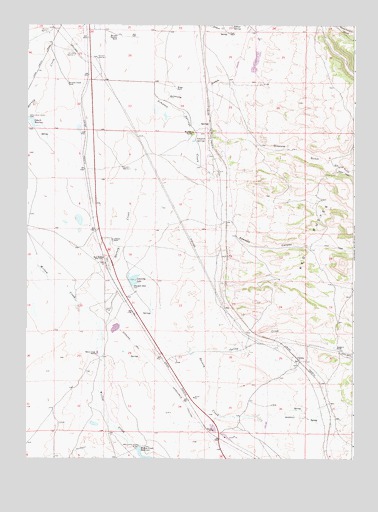
Red Buttes, WY USGS Topographic Map
Click on map above to begin viewing in our Map Viewer.

This topographic map contains these locations and features:
Feature Name Type Latitude Longitude GNIS ID View Map
ColoresLocaleN41.1544°W105.5222°1597263View Map
Columbus ReservoirReservoirN41.2220°W105.6234°1608996View Map
Double X RanchLocaleN41.1566°W105.5064°1587746View Map
Dry GulchValleyN41.2105°W105.5105°1599362View Map
Gilmore GulchValleyN41.2308°W105.6047°1599938View Map
Goforth ReservoirReservoirN41.2220°W105.6234°1605563View Map
Harney Creek DamDamN41.1550°W105.5639°1605699View Map
Harney Creek ReservoirReservoirN41.1557°W105.5621°1605700View Map
Harney Creek Valley MineMineN41.1725°W105.5803°1726222View Map
Hundred Springs DamDamN41.1766°W105.5855°1605671View Map
Hundred Springs ReservoirReservoirN41.1767°W105.5846°1608856View Map
Leazenby LakeLakeN41.1750°W105.5855°1590616View Map
Lembcke RanchLocaleN41.1880°W105.5928°1590639View Map
Monolith Goforth RanchLocaleN41.2330°W105.6100°1591688View Map
Monolith Hunziker RanchLocaleN41.2472°W105.5922°1591690View Map
Monolith RanchLocaleN41.2191°W105.5628°1591691View Map
Monolith Well Number 1WellN41.2478°W105.6172°1605385View Map
Monolith Well Number 3WellN41.2089°W105.5892°1605386View Map
Monolith Well Number 5WellN41.2419°W105.6075°1605387View Map
Monolith Well Number 7WellN41.2405°W105.5992°1605388View Map
Piper RanchLocaleN41.2478°W105.5494°1592852View Map
Red ButtesPopulated PlaceN41.1825°W105.5947°1593244View Map
Red ButtesSummitN41.1853°W105.5169°1593245View Map
Sawmill CanyonValleyN41.1894°W105.5455°1602739View Map
Simpson SpringsSpringN41.2160°W105.5605°1594368View Map
Simpson Springs CreekStreamN41.2308°W105.6047°1594369View Map
Soldier SpringSpringN41.2494°W105.5480°1594558View Map
Spring CreekStreamN41.1564°W105.5625°1603251View Map
The ButtesPopulated PlaceN41.1725°W105.5675°1853214View Map
The Buttes Census Designated PlaceCensusN41.1709°W105.5677°2410074View Map
Willow Creek RanchLocaleN41.1550°W105.5986°1596452View Map
Wright RanchLocaleN41.2319°W105.5697°1596637View Map

Note: Coordinates in the location and feature list above are referenced to NAD83 datum.


Copyright (C) 2008-2025 Ryan Niemi / Sunset Dynamics ... All Rights Reserved