TopoQuest Logo
Do you find TopoQuest useful?
Help keep TopoQuest running and adding new maps/features by donating!
Bitcoin:  19c7KJd3qBynnjoSw5npx9KScwjBe4ifkT
Litecoin:  LXs6TkuXGGXo1vDsWCkWVdjQX94eUKd6ui
Home View Maps Find Maps Find Places Resources & Links


Latimer, Iowa Topographic Map

USGS Map Title: Latimer, IA
USGS Map MRC: 42093G3
DRG (GeoTIFF) Download: o42093g3.tif


Neighboring USGS Topographic Map Quads:


  Thornton, IA  
42093H4
 

  Swaledale, IA  
42093H3
 

  Sheffield, IA  
42093H2
 

  Alexander, IA  
42093G4
 

  Latimer, IA  
42093G3
 

  Hampton North, IA  
42093G2
 

  Dows East, IA  
42093F4
 

  Coulter, IA  
42093F3
 

  Hampton South, IA  
42093F2


Map MRC Location:

N43°
W94°
N43°
W93°
H8 H7 H6 H5 H4 H3 H2 H1
G8 G7 G6 G5 G4 G3 G2 G1
F8 F7 F6 F5 F4 F3 F2 F1
E8 E7 E6 E5 E4 E3 E2 E1
D8 D7 D6 D5 D4 D3 D2 D1
C8 C7 C6 C5 C4 C3 C2 C1
B8 B7 B6 B5 B4 B3 B2 B1
A8 A7 A6 A5 A4 A3 A2 A1
N42°
W94°
N42°
W93°

Latimer, IA USGS 1:24K Topographic Map Preview:
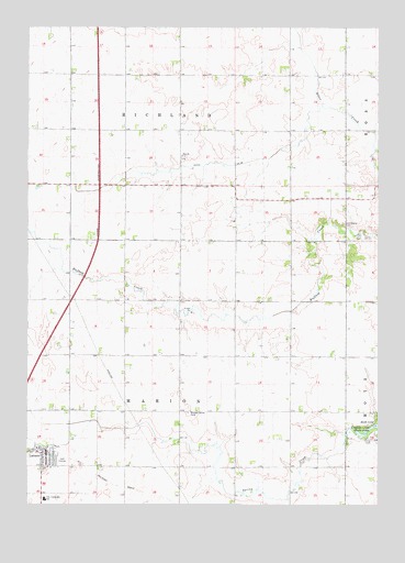
Latimer, IA USGS Topographic Map
Click on map above to begin viewing in our Map Viewer.

This topographic map contains these locations and features:
Feature Name Type Latitude Longitude GNIS ID View Map
CAL Community Junior High School / High SchoolSchoolN42.7513°W93.3688°455039View Map
CAL Elementary SchoolSchoolN42.7517°W93.3690°2719814View Map
City of LatimerCivilN42.7629°W93.3656°2395640View Map
Ditch Number 55CanalN42.8391°W93.3116°465729View Map
Farmers Co-op ElevatorLocaleN42.7650°W93.3671°1944769View Map
Franklin Medical CenterHospitalN42.7639°W93.3683°1944764View Map
Immanuel United Church of ChristChurchN42.7597°W93.3669°1944770View Map
Interchange 170CrossingN42.8036°W93.3599°1944814View Map
LatimerPopulated PlaceN42.7633°W93.3683°458237View Map
Latimer (historical)LocaleN42.7650°W93.3685°1944768View Map
Latimer Golf ClubLocaleN42.7611°W93.3627°1944773View Map
Latimer Post OfficePost OfficeN42.7639°W93.3683°1944766View Map
Latimer Rural Fire DepartmentBuildingN42.7631°W93.3692°1944767View Map
Latimer Town HallBuildingN42.7639°W93.3683°1944765View Map
Longdpun Habitat Area - Lukes WetlandParkN42.7541°W93.2808°1944774View Map
Marion Center CemeteryCemeteryN42.7741°W93.3177°458806View Map
Old Chapin CemeteryCemeteryN42.8237°W93.2626°459824View Map
Saint Paul Lutheran ChurchChurchN42.7647°W93.3708°1944771View Map
Saint Paul's Lutheran SchoolSchoolN42.7648°W93.3718°1944772View Map
Saint Pauls Evangelical Lutheran CemeteryCemeteryN42.7652°W93.3721°1944776View Map
Site of 1857 Hotel Historical MarkerParkN42.8305°W93.2613°1944703View Map
Spring Creek Wildlife AreaParkN42.7561°W93.3058°1944775View Map
Township of MarionCivilN42.7751°W93.3208°468351View Map
Township of RichlandCivilN42.8634°W93.3208°468604View Map
Trinity CemeteryCemeteryN42.7669°W93.2520°462307View Map
West Franklin Emergency Medical Services IncorporatedBuildingN42.7631°W93.3686°2599743View Map
Zion ChurchChurchN42.8414°W93.3205°463276View Map
Zion Reformed CemeteryCemeteryN42.8413°W93.3191°1944777View Map

Note: Coordinates in the location and feature list above are referenced to NAD83 datum.


Copyright (C) 2008-2024 Ryan Niemi / Sunset Dynamics ... All Rights Reserved