TopoQuest Logo
Do you find TopoQuest useful?
Help keep TopoQuest running and adding new maps/features by donating!
Bitcoin:  19c7KJd3qBynnjoSw5npx9KScwjBe4ifkT
Litecoin:  LXs6TkuXGGXo1vDsWCkWVdjQX94eUKd6ui
Home View Maps Find Maps Find Places Resources & Links


Latimer, Mississippi Topographic Map

USGS Map Title: Latimer, MS
USGS Map MRC: 30088E7
DRG (GeoTIFF) Download: o30088e7.tif


Neighboring USGS Topographic Map Quads:


  Beatrice, MS  
30088F8
 

  Vestry, MS  
30088F7
 

  Easen Hill, MS  
30088F6
 

  White Plains, MS  
30088E8
 

  Latimer, MS  
30088E7
 

  Vancleave, MS  
30088E6
 

  Biloxi, MS  
30088D8
 

  Ocean Springs, MS  
30088D7
 

  Gautier North, MS  
30088D6


Map MRC Location:

N31°
W89°
N31°
W88°
H8 H7 H6 H5 H4 H3 H2 H1
G8 G7 G6 G5 G4 G3 G2 G1
F8 F7 F6 F5 F4 F3 F2 F1
E8 E7 E6 E5 E4 E3 E2 E1
D8 D7 D6 D5 D4 D3 D2 D1
C8 C7 C6 C5 C4 C3 C2 C1
B8 B7 B6 B5 B4 B3 B2 B1
A8 A7 A6 A5 A4 A3 A2 A1
N30°
W89°
N30°
W88°

Latimer, MS USGS 1:24K Topographic Map Preview:
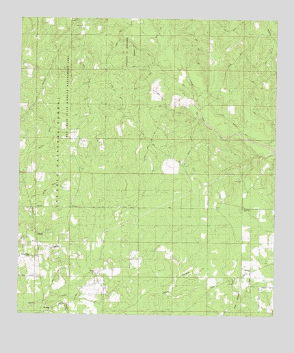
Latimer, MS USGS Topographic Map
Click on map above to begin viewing in our Map Viewer.

This topographic map contains these locations and features:
Feature Name Type Latitude Longitude GNIS ID View Map
Bethel Hill ChurchChurchN30.5283°W88.8589°692566View Map
Fort Bayou ChurchChurchN30.5196°W88.7614°693248View Map
Good Hope CemeteryCemeteryN30.5569°W88.7667°693316View Map
Good Hope ChurchChurchN30.5455°W88.7650°693318View Map
House of Prayer Tabernacle ChurchChurchN30.5241°W88.8698°705436View Map
LaruePopulated PlaceN30.6244°W88.8484°693689View Map
Larue Baptist ChurchChurchN30.6246°W88.8489°2596583View Map
LatimerPopulated PlaceN30.5346°W88.8667°705437View Map
Latimer ChurchChurchN30.5358°W88.8678°693691View Map
Latimer Community CenterBuildingN30.5004°W88.8636°2596973View Map
Latimer Lookout TowerTowerN30.5344°W88.8600°711259View Map
Latimer Volunteer Fire Company Station 7BuildingN30.5001°W88.8637°2332782View Map
Latimer Volunteer Fire Company Station 7ABuildingN30.5450°W88.8145°2332820View Map
New Fayard ChurchChurchN30.5027°W88.8592°705440View Map
New Light Church (historical)ChurchN30.5446°W88.7767°705441View Map
Perigal CreekStreamN30.5060°W88.8556°675613View Map
Seymour CemeteryCemeteryN30.5185°W88.8372°705443View Map
Supervisor District 4CivilN30.5634°W88.8336°711903View Map
Wilkerson CemeteryCemeteryN30.6207°W88.8459°705444View Map
Wolf BranchStreamN30.6141°W88.8084°695202View Map
Woodrow Wilson School (historical)SchoolN30.5905°W88.8678°705446View Map

Note: Coordinates in the location and feature list above are referenced to NAD83 datum.


Copyright (C) 2008-2025 Ryan Niemi / Sunset Dynamics ... All Rights Reserved